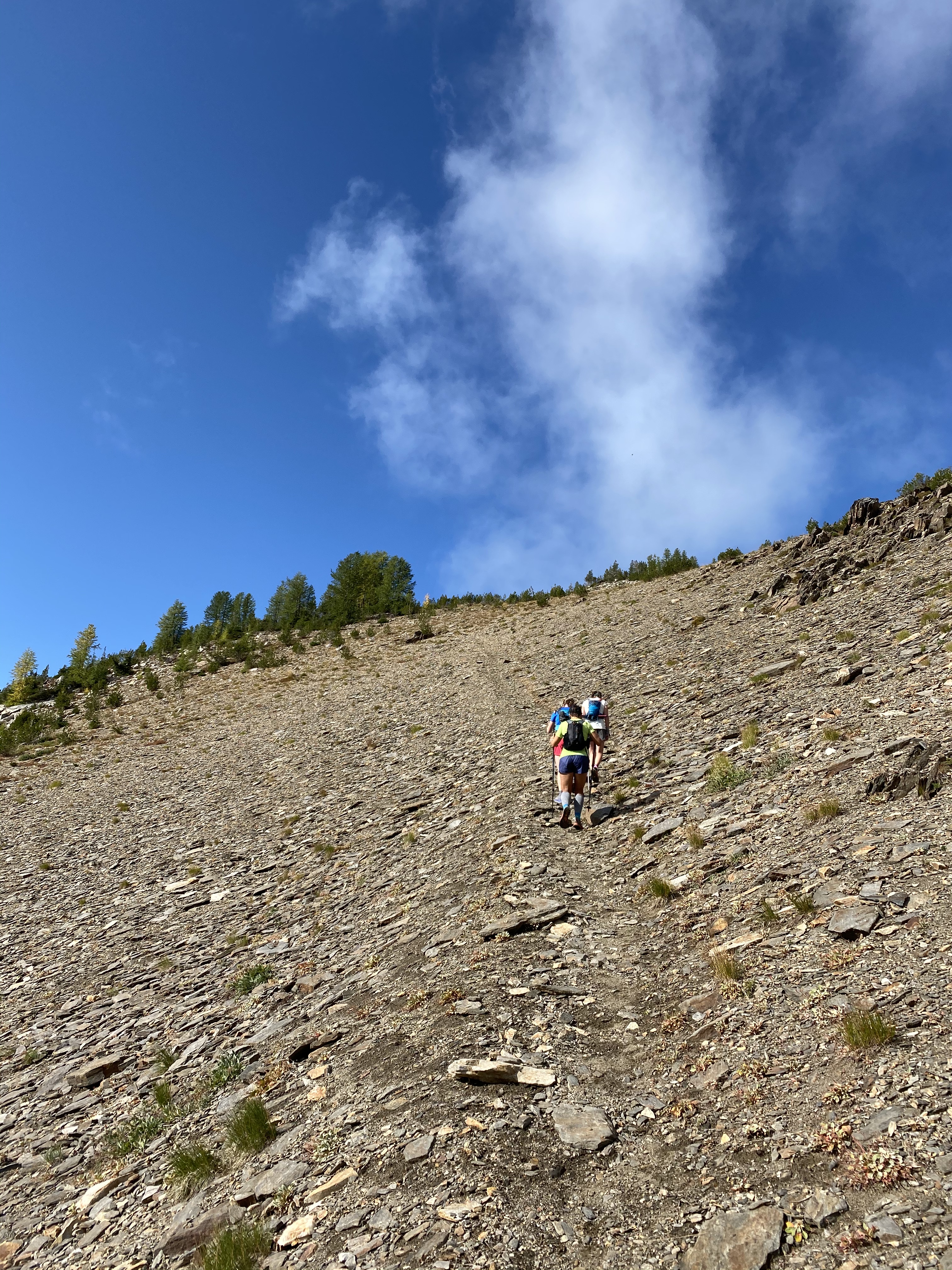
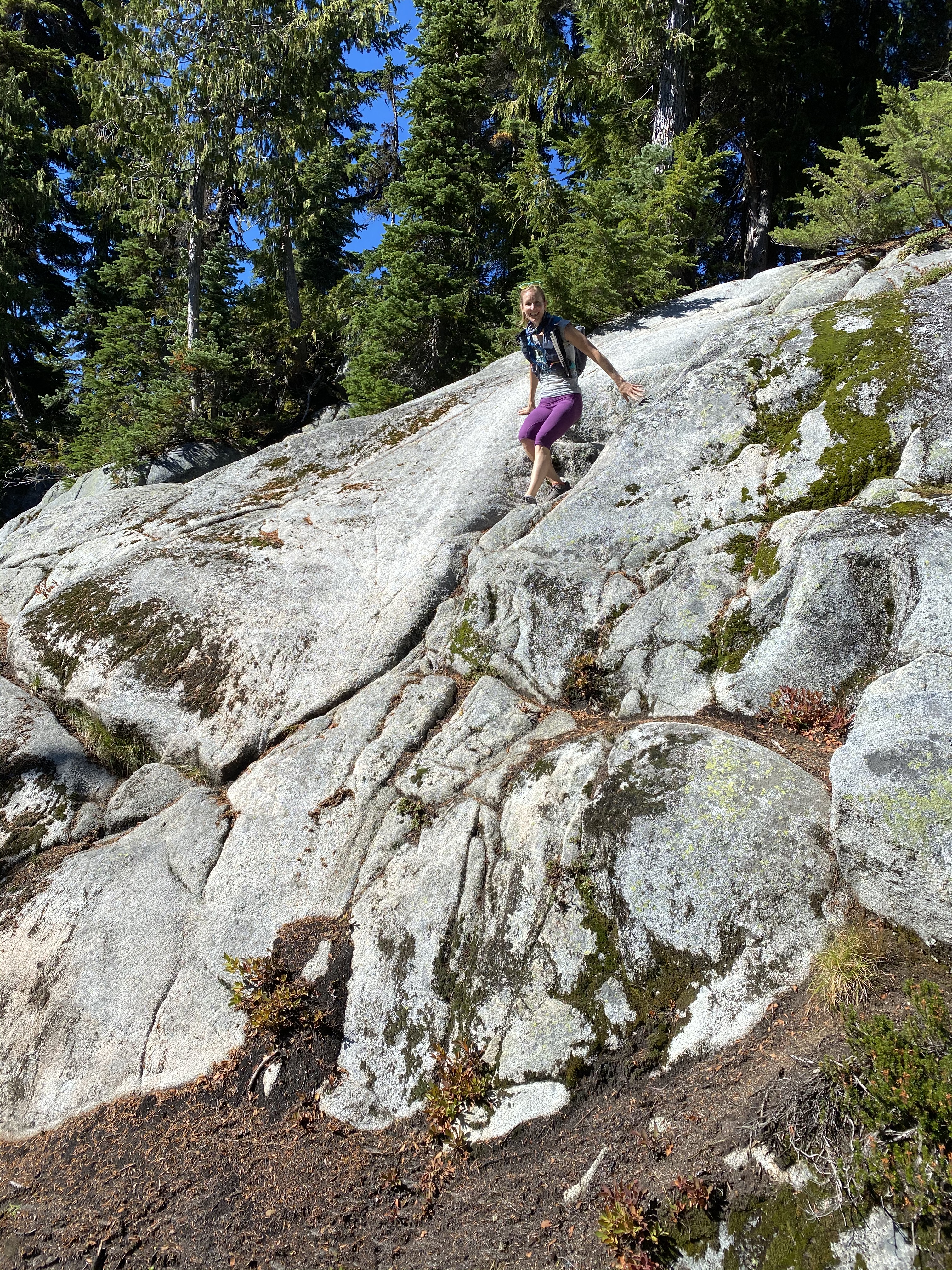
The understatement of the year is that 2020 has been a really weird year. You’re all living it, so you know what I’m talking about it. At first, it was about disappointments and inconveniences—kids home from school and in the house with me as I tried to work, races and travel plans canceled, parks and trails closed.
My little blog slowly seemed irrelevant simply because there didn’t seem to be much to write about. Life was on hold. At first it just seemed ridiculous.
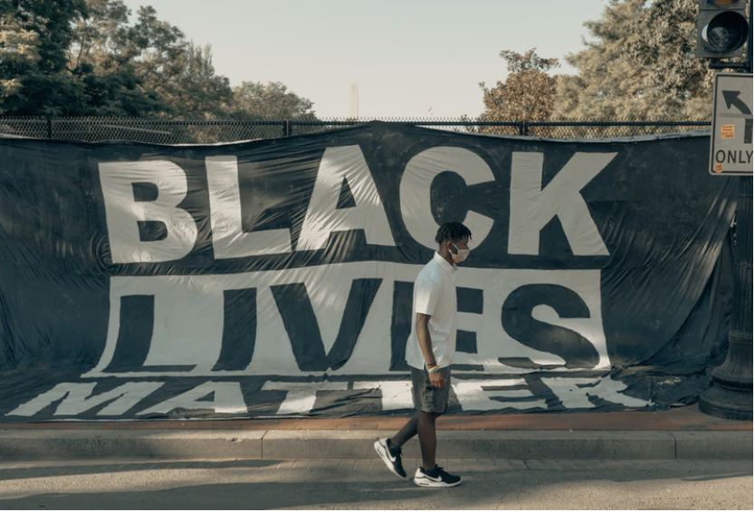
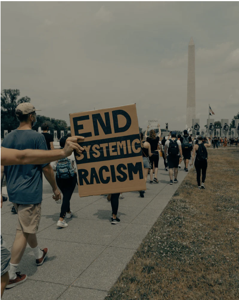
Then the world turned upside down again after George Floyd’s death, and with it a growing awareness of privilege, the depths and facets of racism, and some intense one-on-one conversations with family, neighbors, and friends. I wished I could back in time and change each person’s pain. I felt guilty for my privilege. Frankly, it all made writing about trail running seem trivial—no, not just trivial. It felt wrong to write about trail running while the country wrestled with topics like slavery, incarceration, and discrimination.
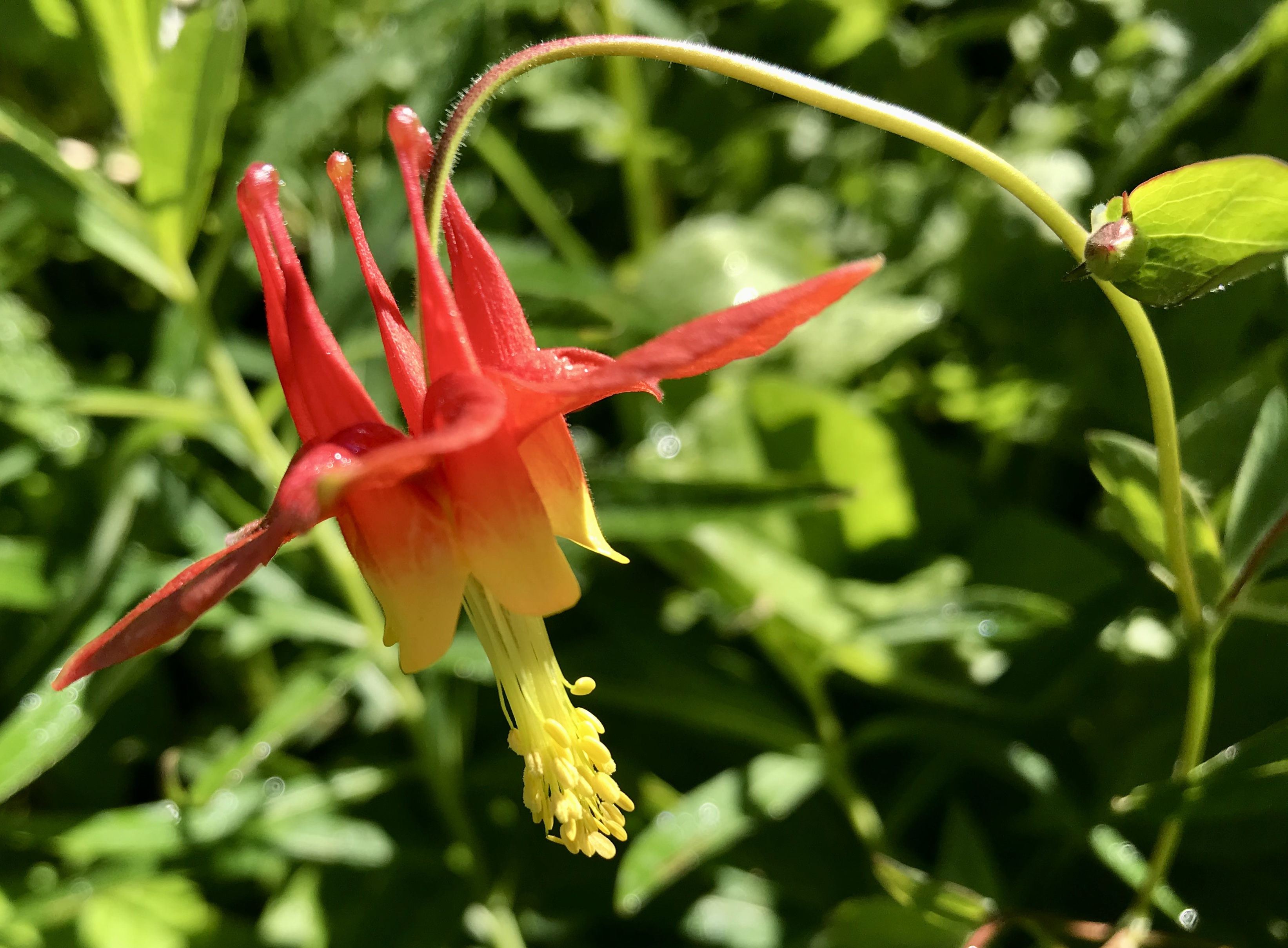
All photos credit Unsplash.com.
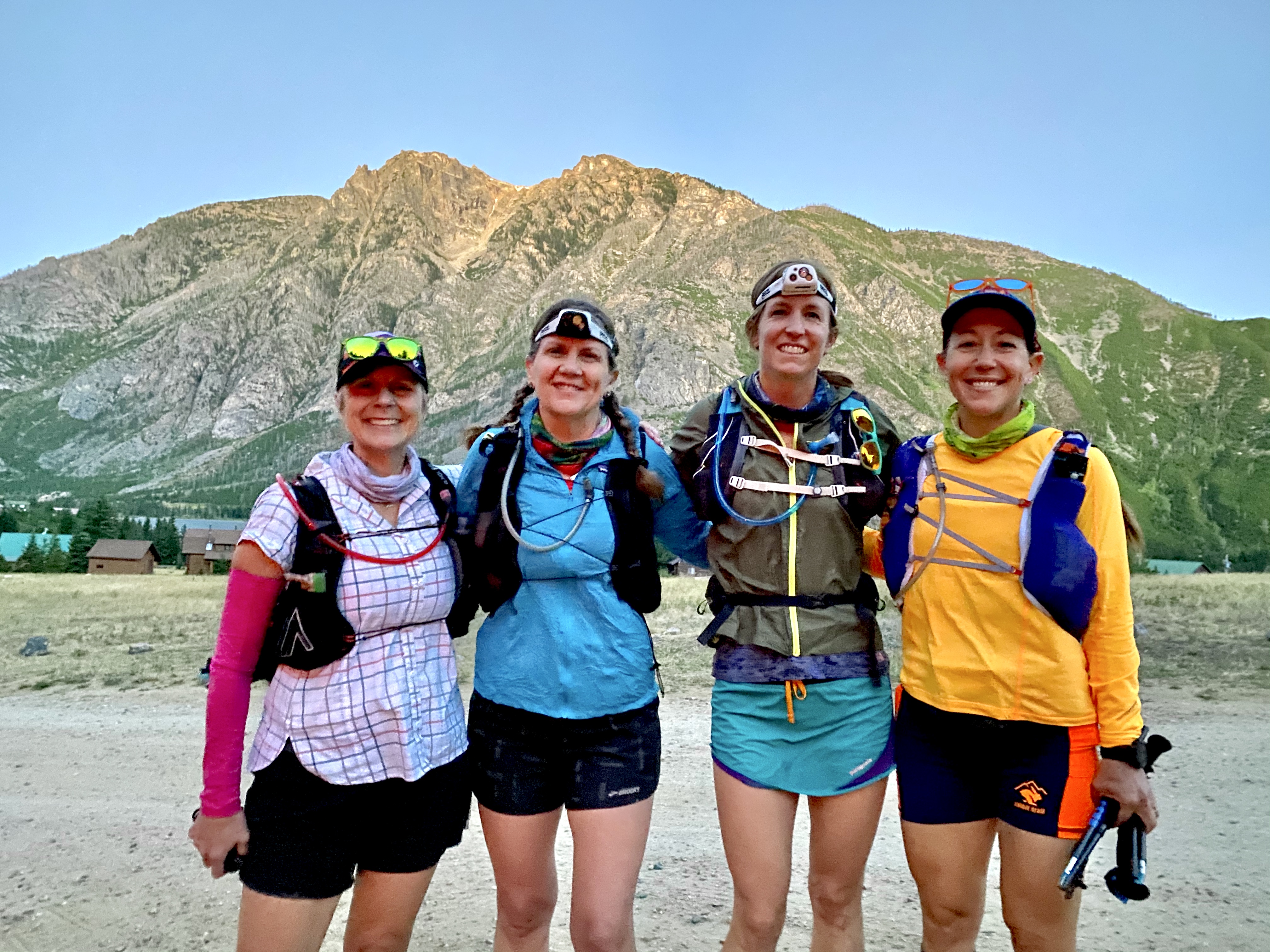
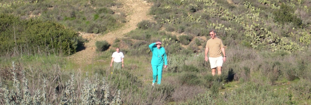
But I did run this summer. I didn’t run fast, and I didn’t try to. My running was focused on time with friends in beautiful places, and we talked and talked and talked . . . about Black Lives Matter, parenting and homeschooling, COVID and quarantine and social distancing, our work and layoffs and furloughs and uncertainty, the elections, our nation’s angst, the world’s angst, our parents’ health, we talked about it all. We learned from each other, supported each other, and somehow kept each other moving.
“While we may technically measure this race in miles (or, “yards”), I’m always reminded that we actually measure it in memories, friends, laughs, and lessons.”
Amelia Boone
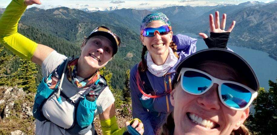
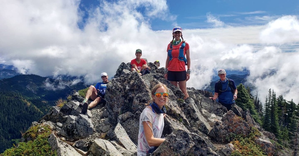
More recently, I think I’ve rediscovered how much the trail running community is a community and how much community helps with connection to the world and people around us. I first started thinking about it during Bigs Backyard Ultra.
As the race took place in locations around the world, people like me—from all over the world—were enthralled with the accomplishments of runners from Mexico, India, Belgium, Canada, and, yes, the US, as well as others. Amelia Boone, one of the American racers, said after the event, “While we may technically measure this race in miles (or, “yards”), I’m always reminded that we actually measure it in memories, friends, laughs, and lessons” [emphasis added].
Friends, laughs, lessons, memories. All the good things. The things that recharge you, connect you to the world, connect you to humanity. The things that allow me to return home, able once again to be a mom and to do my best to help the next generation be kinder, more aware, better people.
It’s made me think that maybe remembering and sharing my adventures here could offer that in some small sense to maybe even just one other person. That maybe I create a tiny bit of community for others here too. Maybe, through creating community, we inspire, aspire, and join together in this little way and do each other a bit of good.
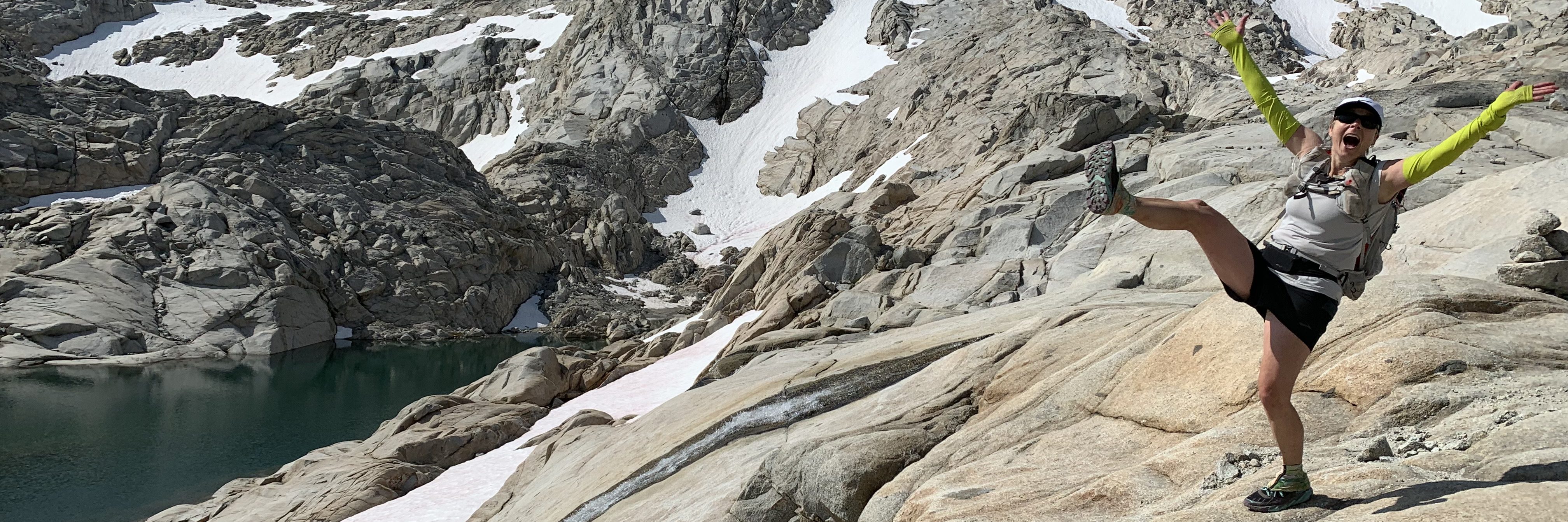
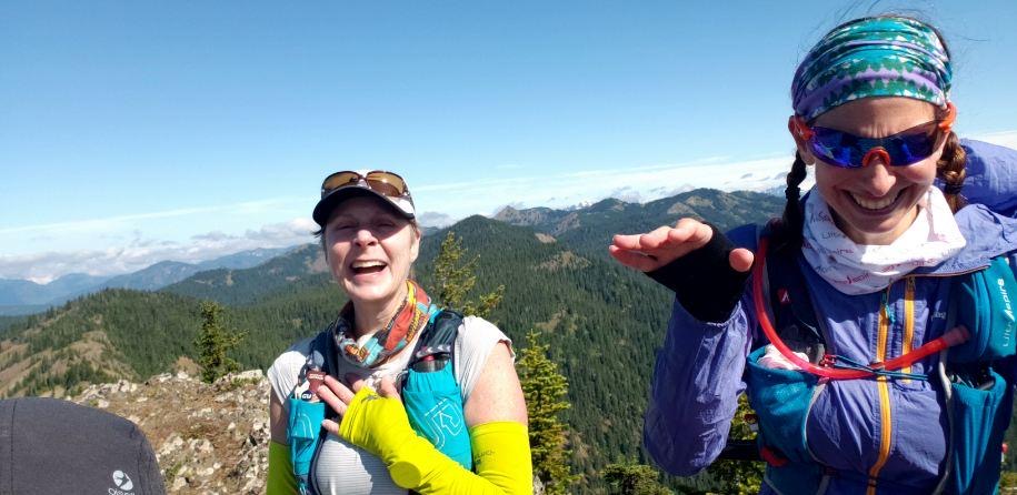
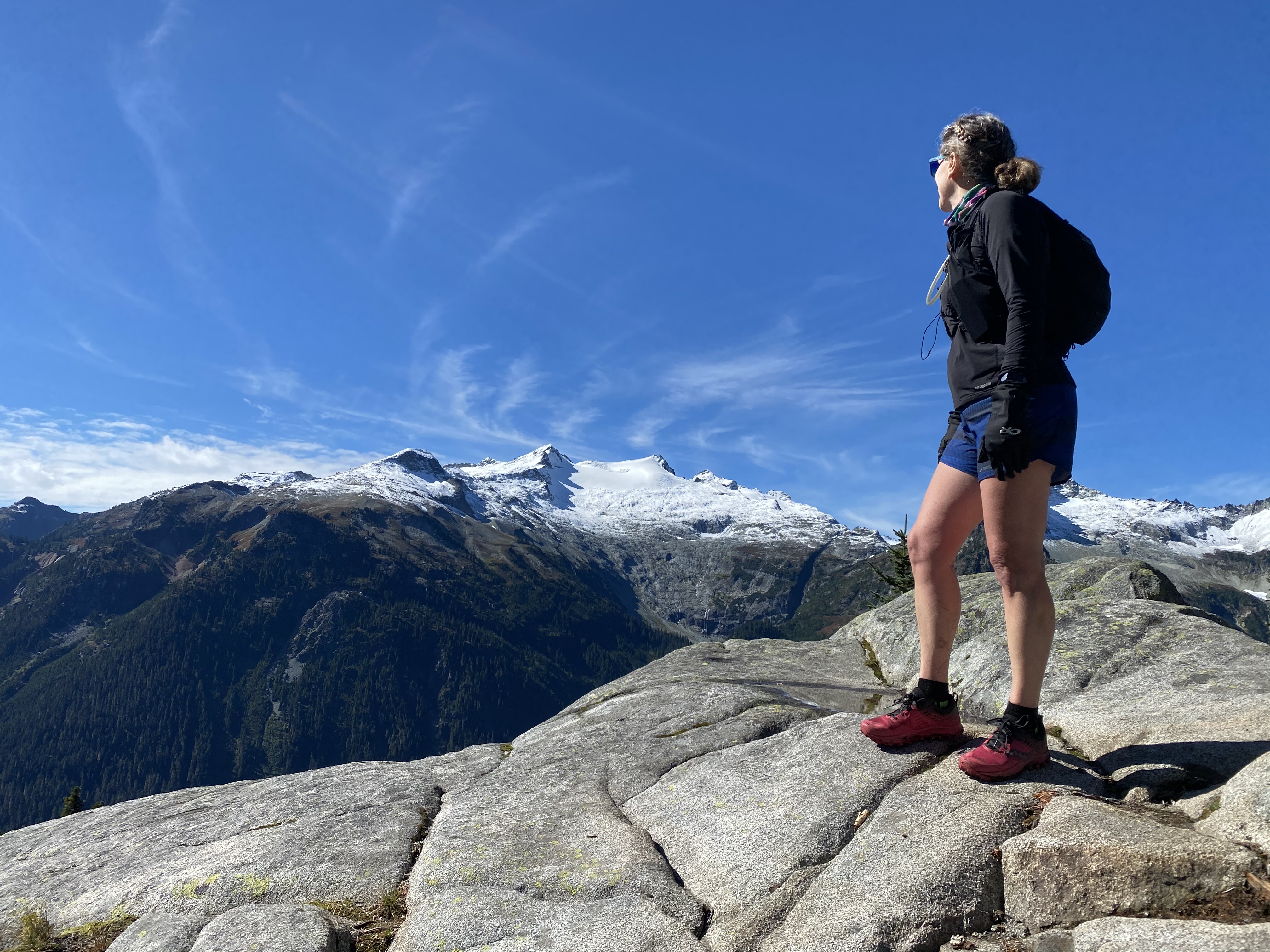
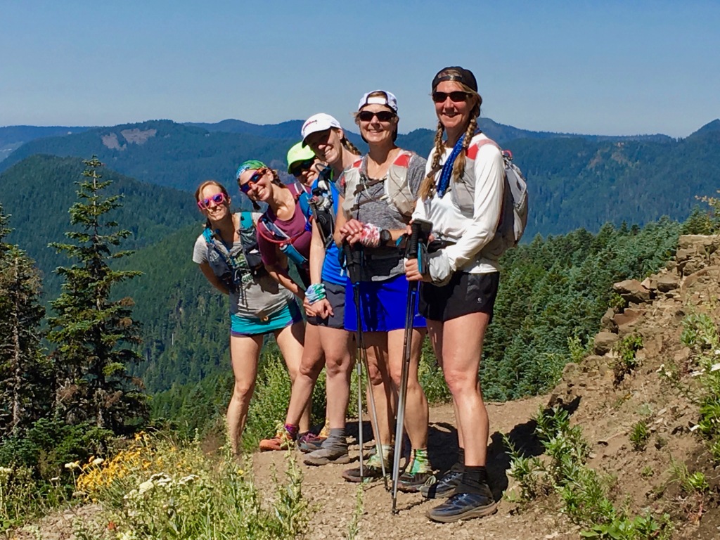
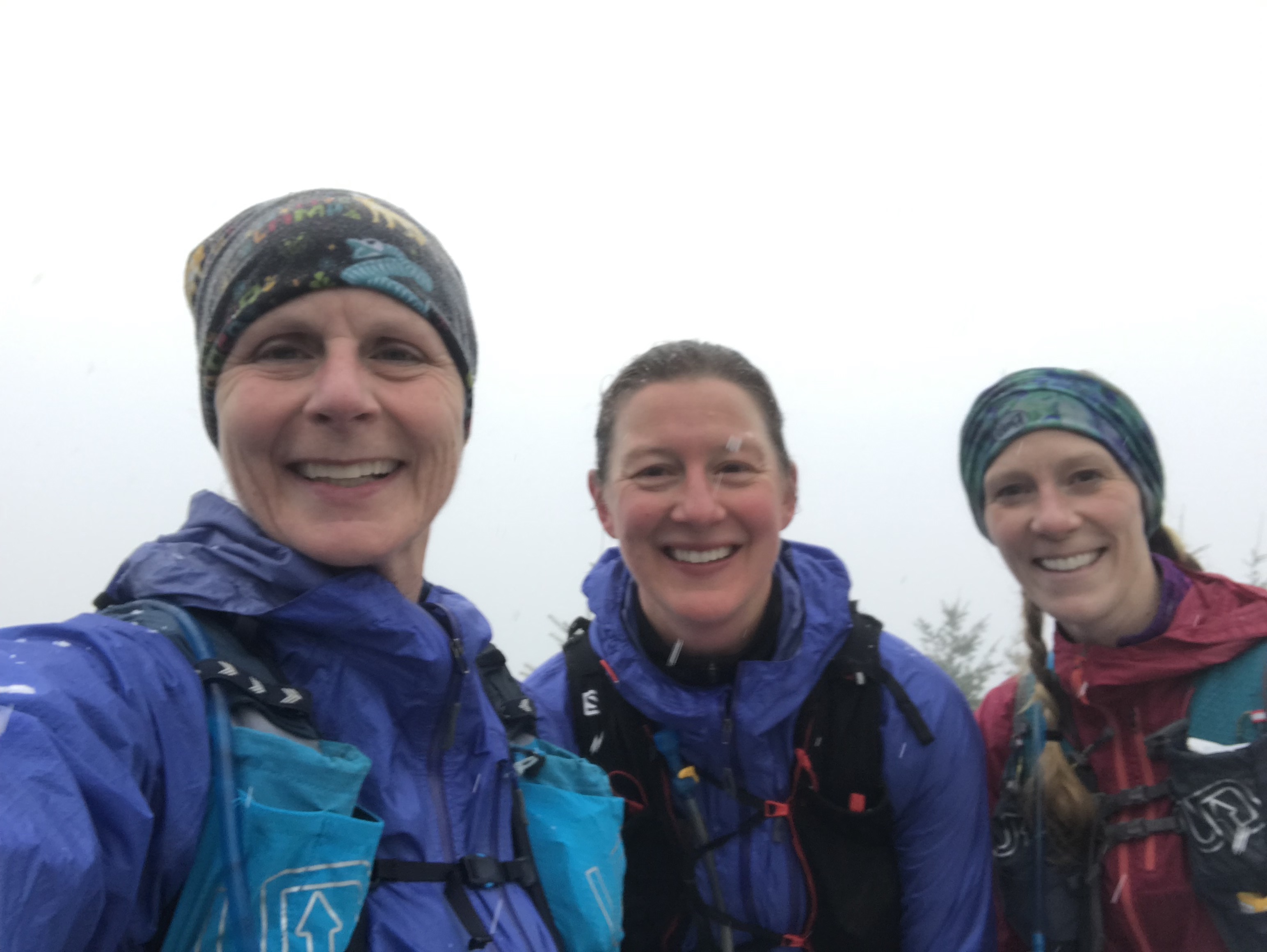
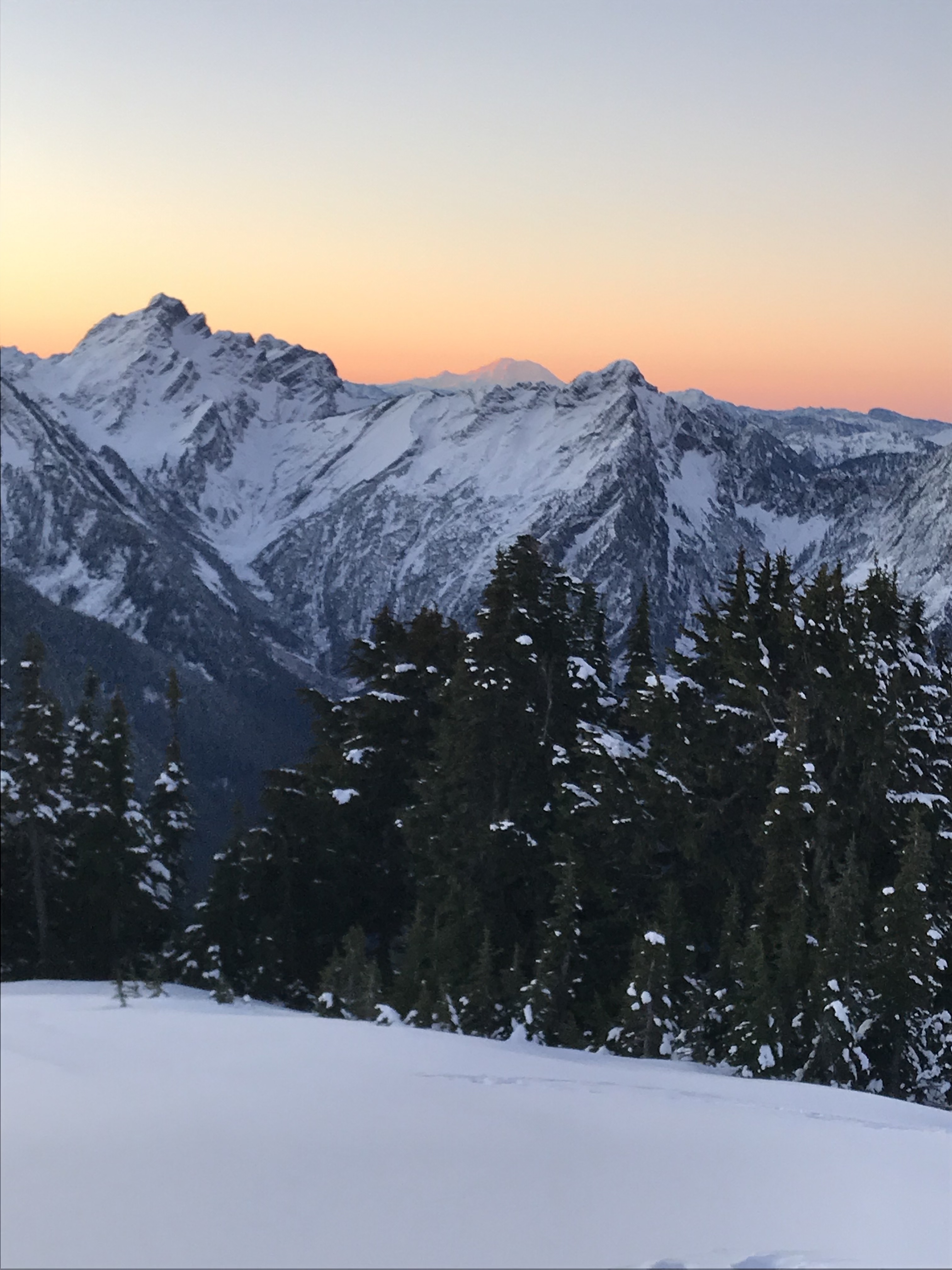
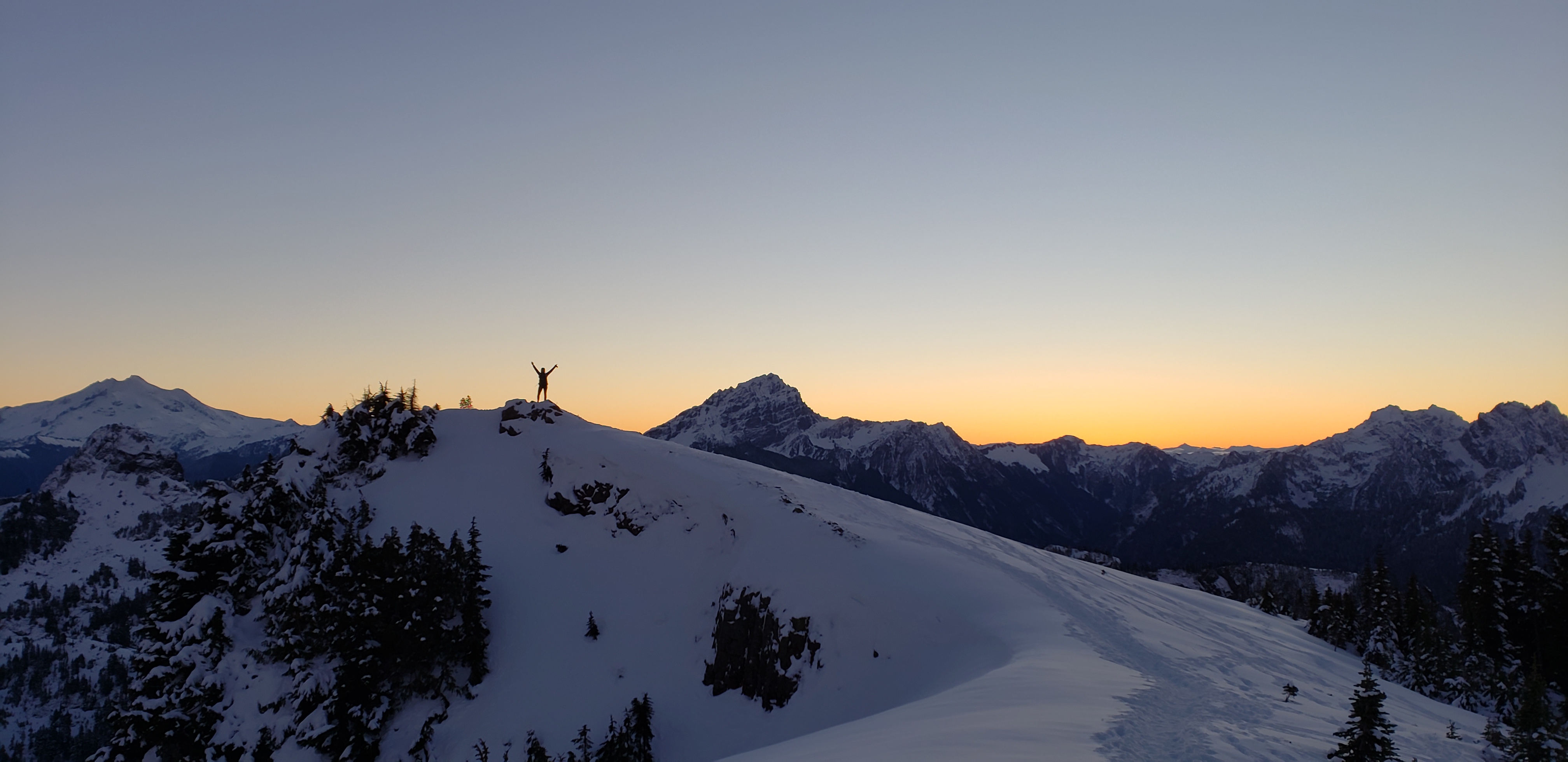
Socially distanced atop Tinkham Peak.
Ultimately, the path I’ve found to working toward making a difference seems to come in these little ways. I work to teach my children to respect all people and to be aware of the harm so many have experienced, to be aware of history and how it continues to live in our collective souls. I try to share the beauty of our planet with others.
I hope I can write adventure reports and race reports more often. Maybe they’ll be more reflective, maybe they’ll just be about beautiful places. But whether it’s a trail run, or personal growth, maybe simply a sharing of things I’m learning or wondering, it’s all a journey. And I hope you’ll take it with me when it works for you.
I will try to include acknowledgement of the Native American peoples upon whose lands I journey, using Native Land as I go. This is part of my learning journey, and I hope if I need to update my information, you’ll kindly help me so I can update my acknowledgements.
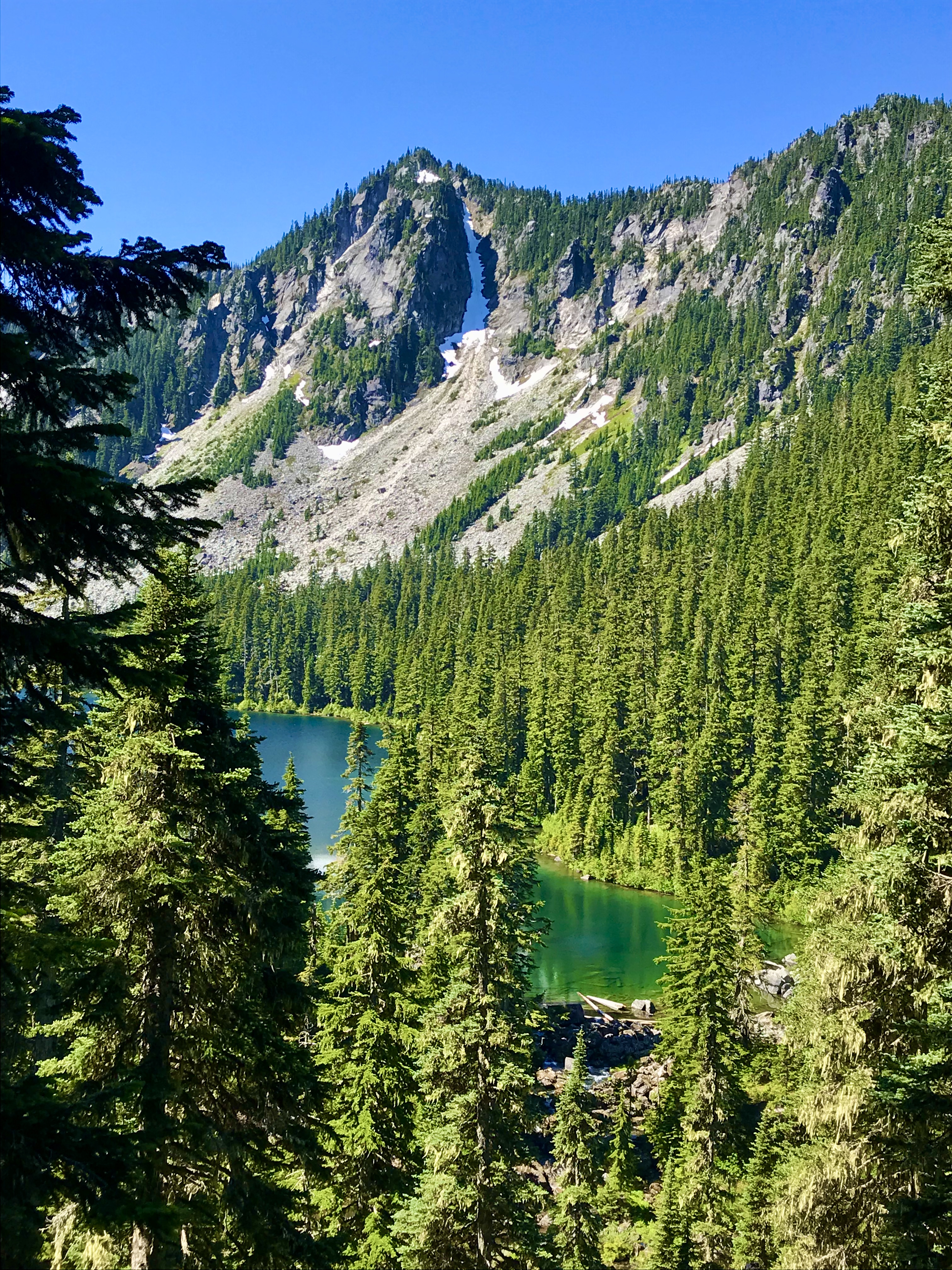
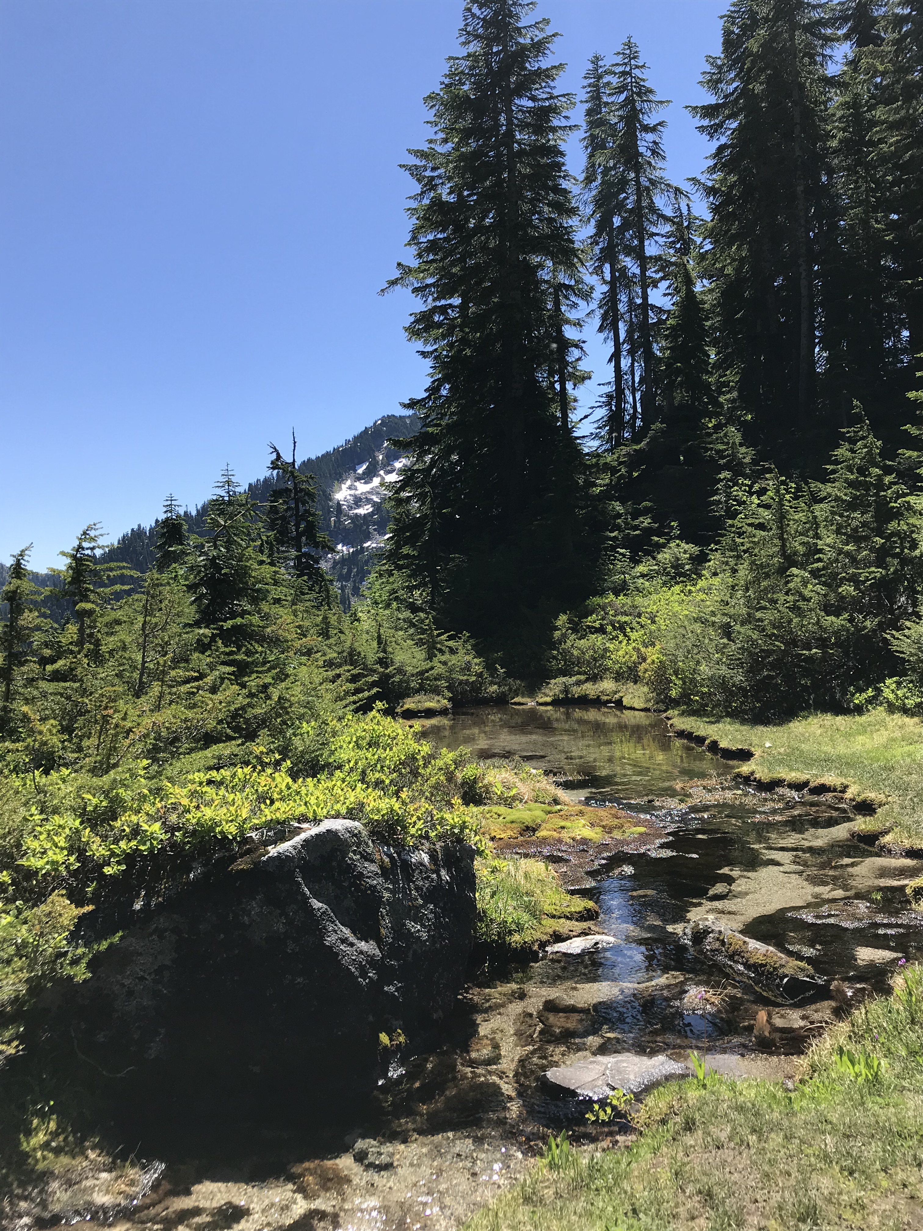
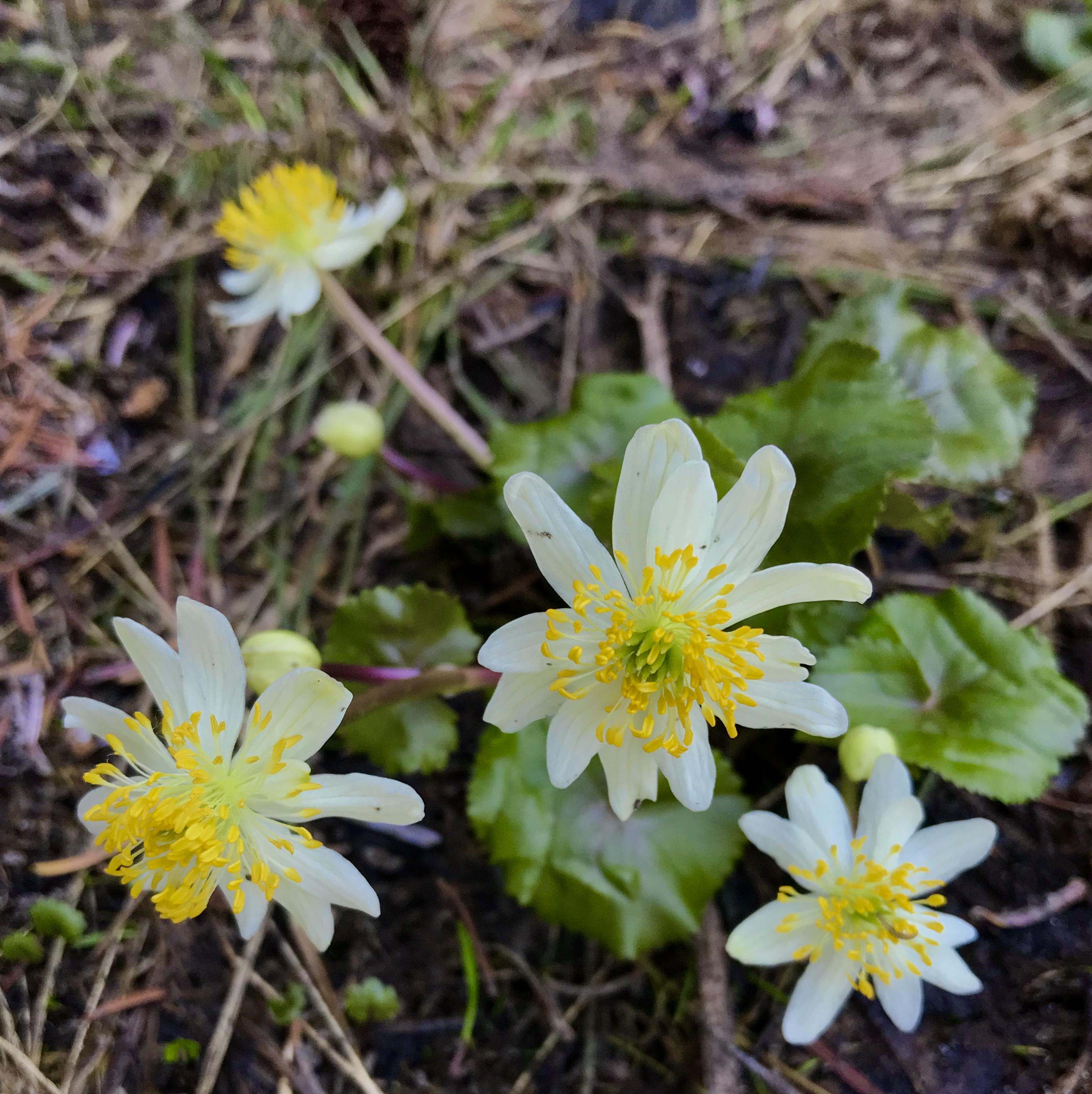
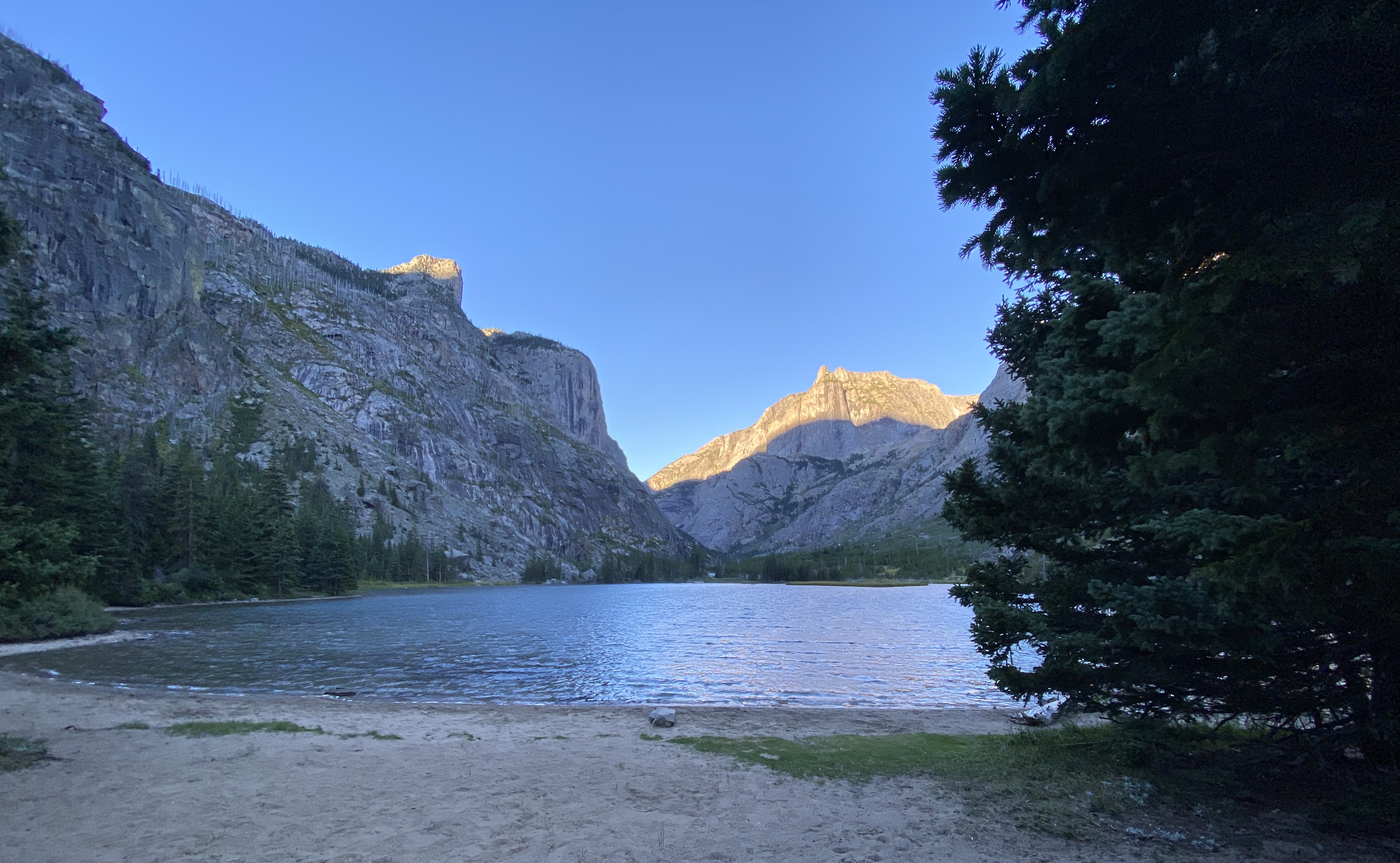
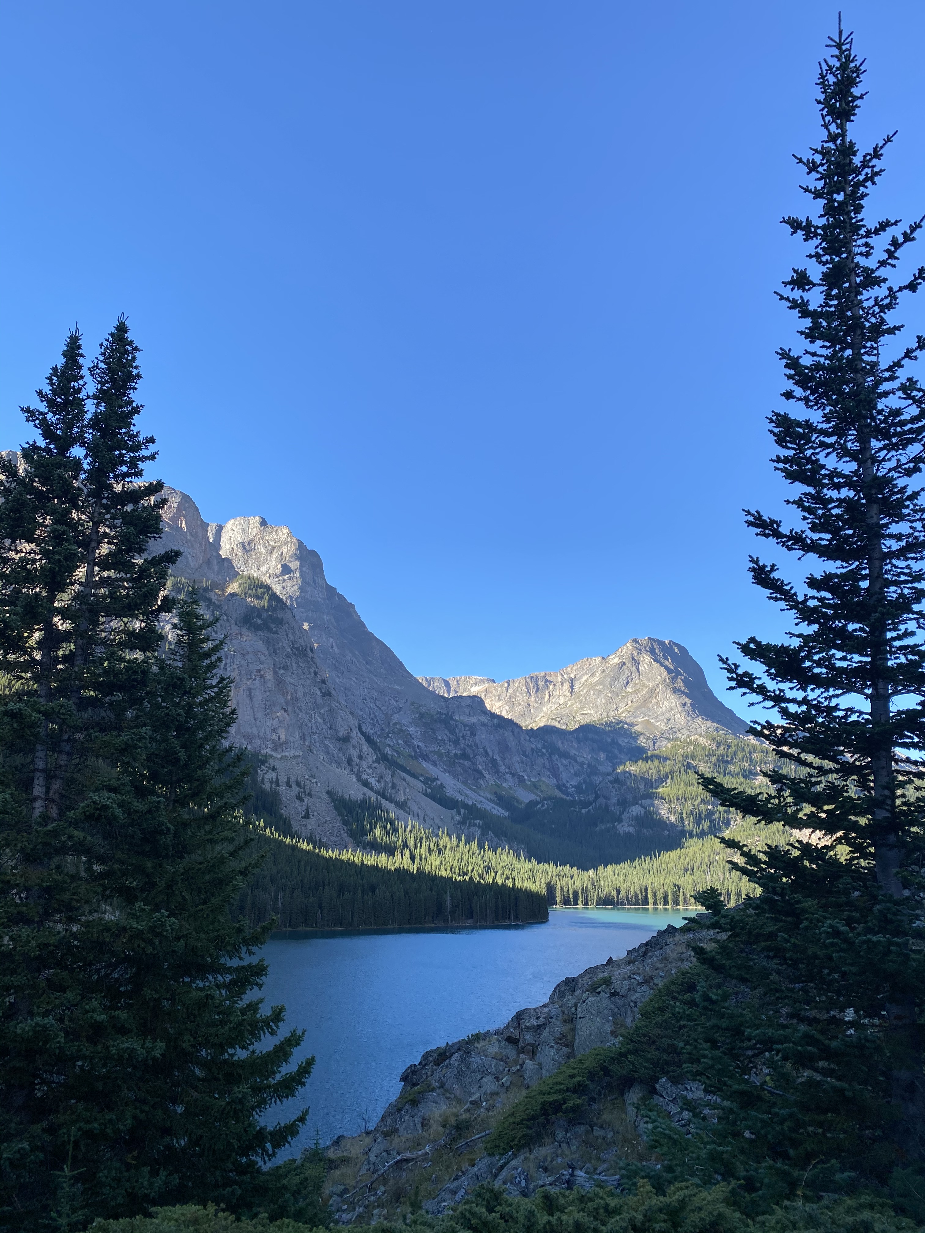
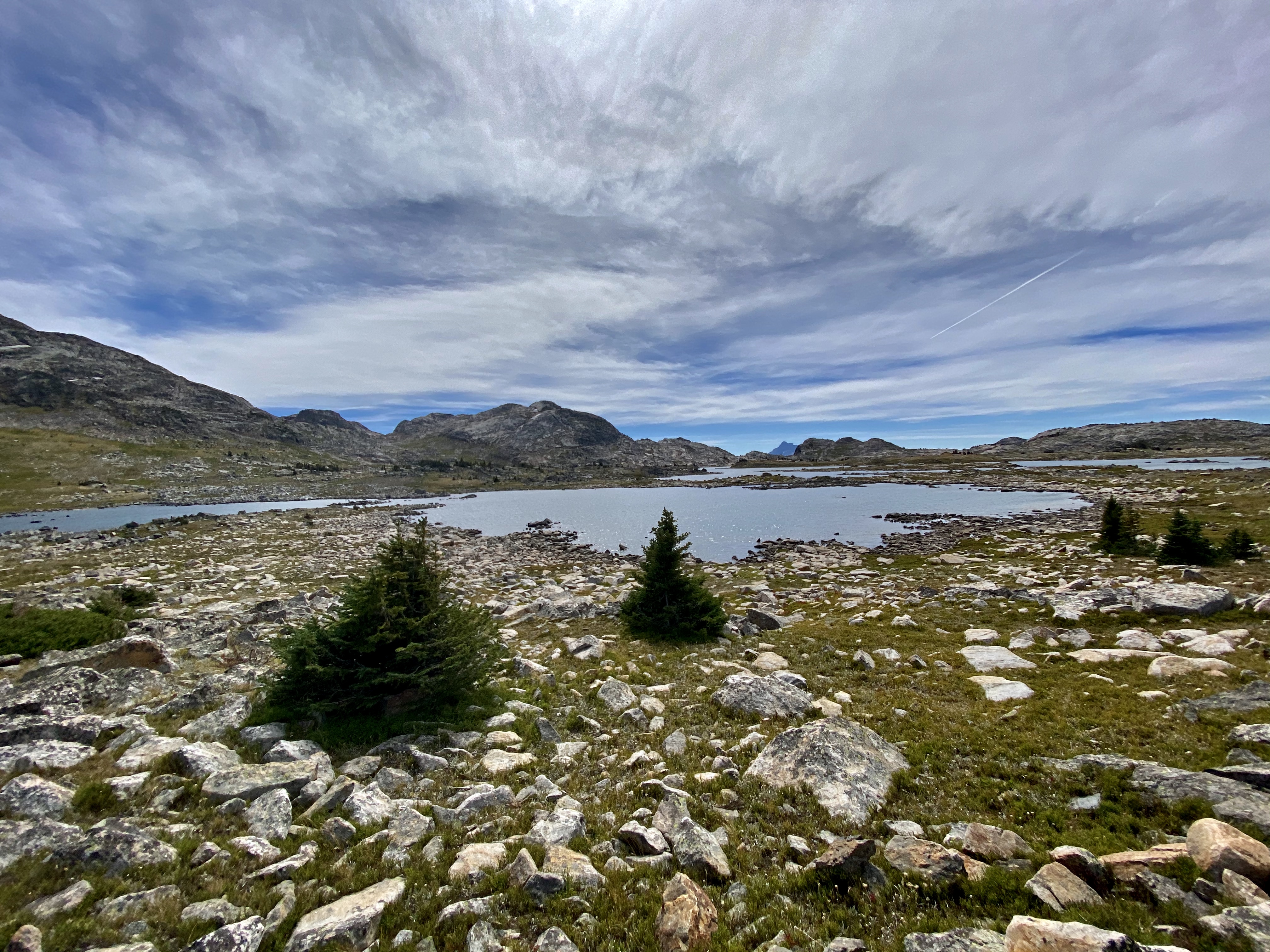
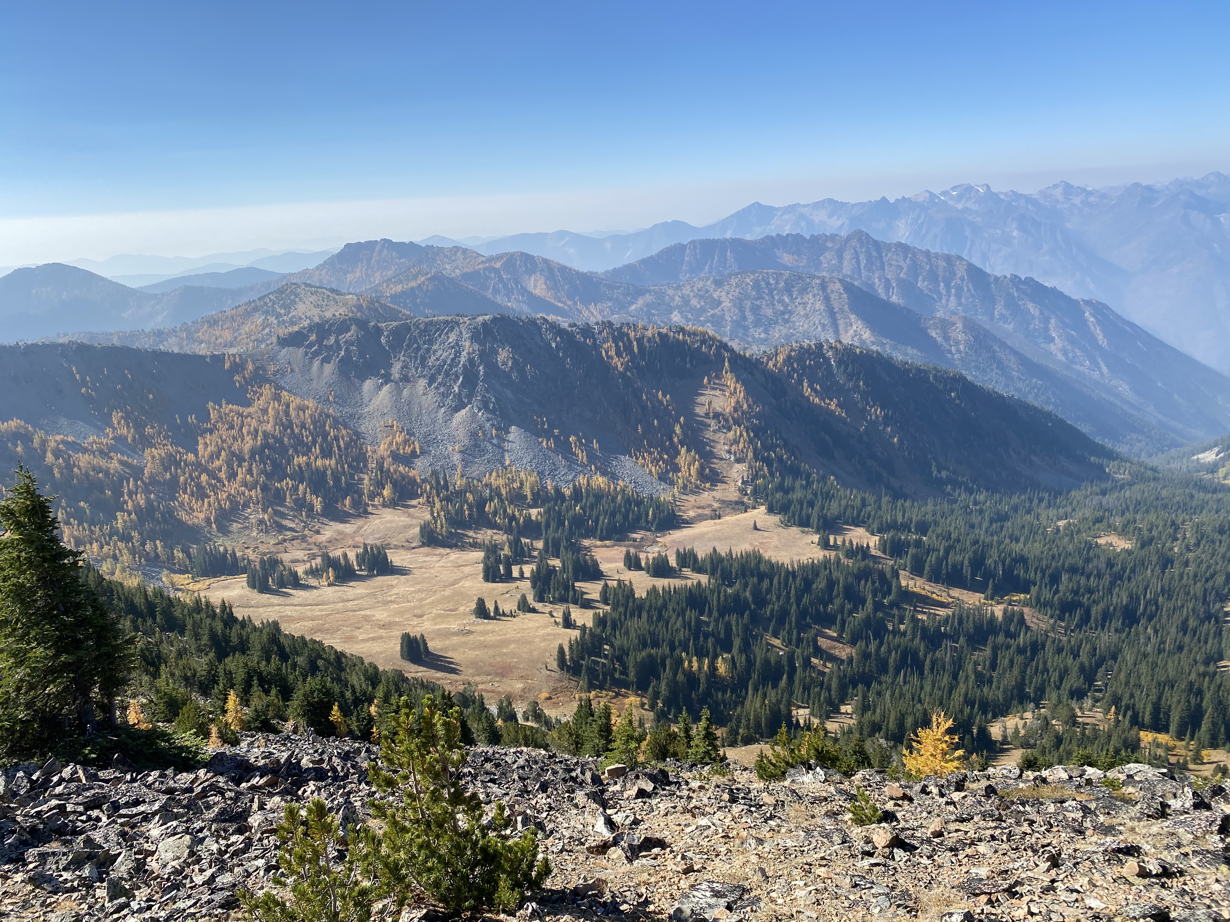
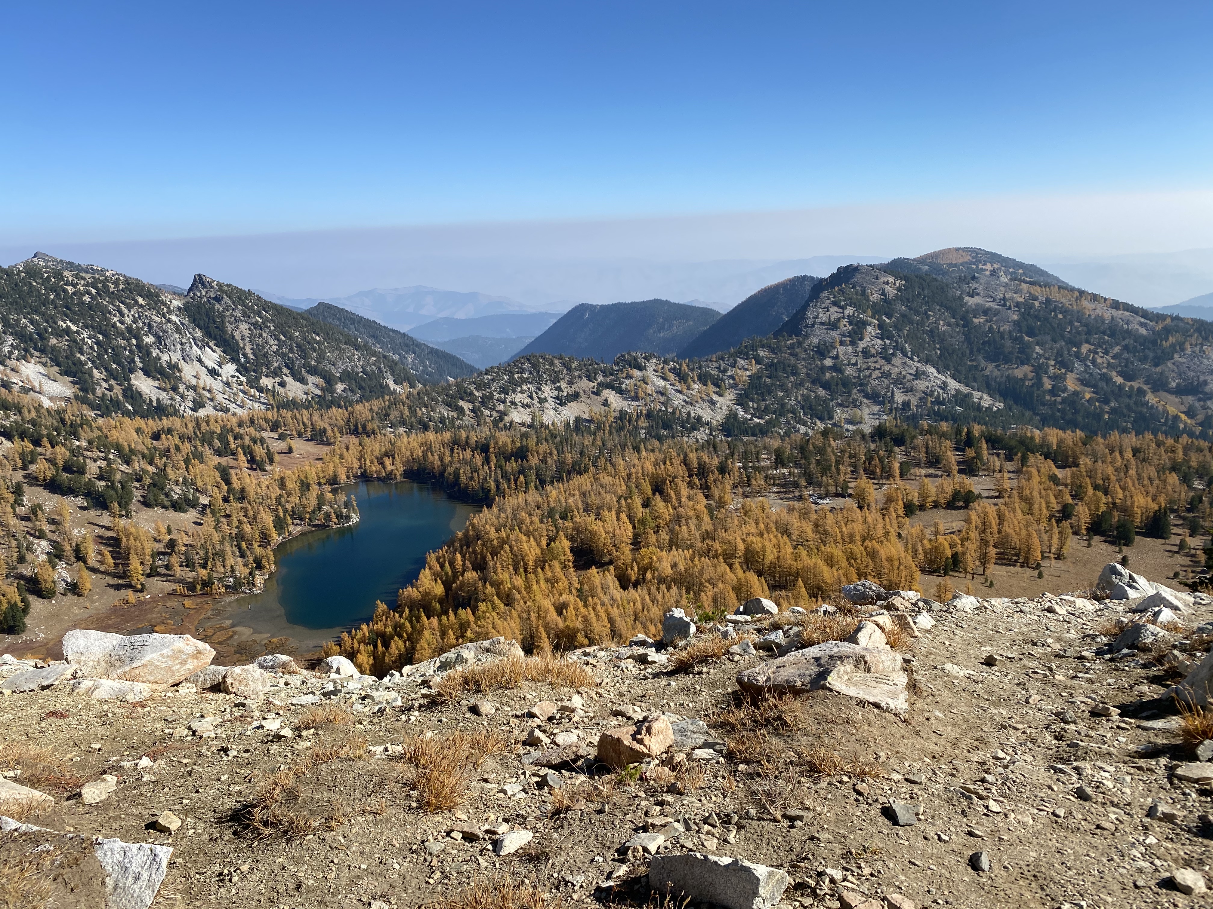
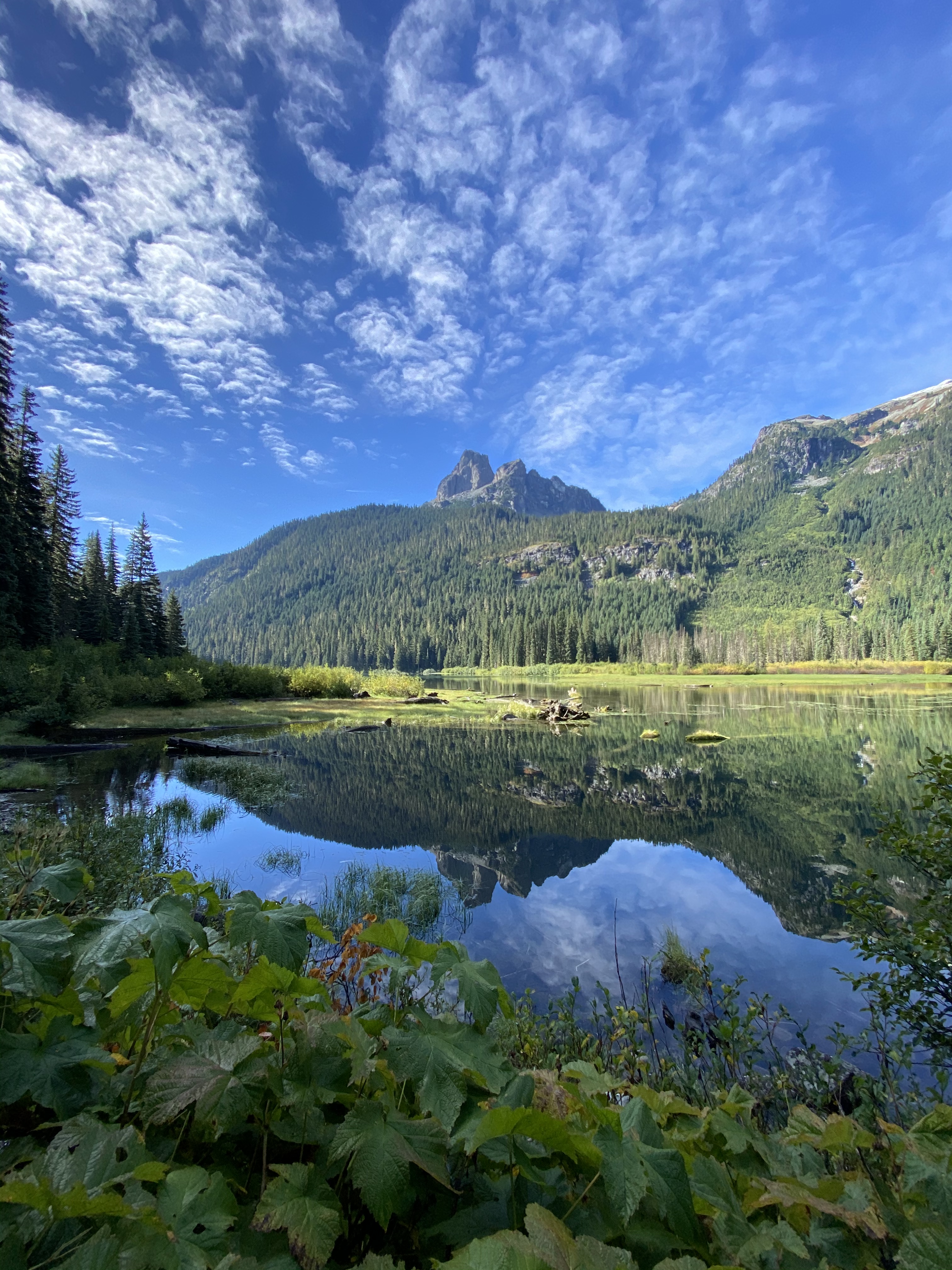
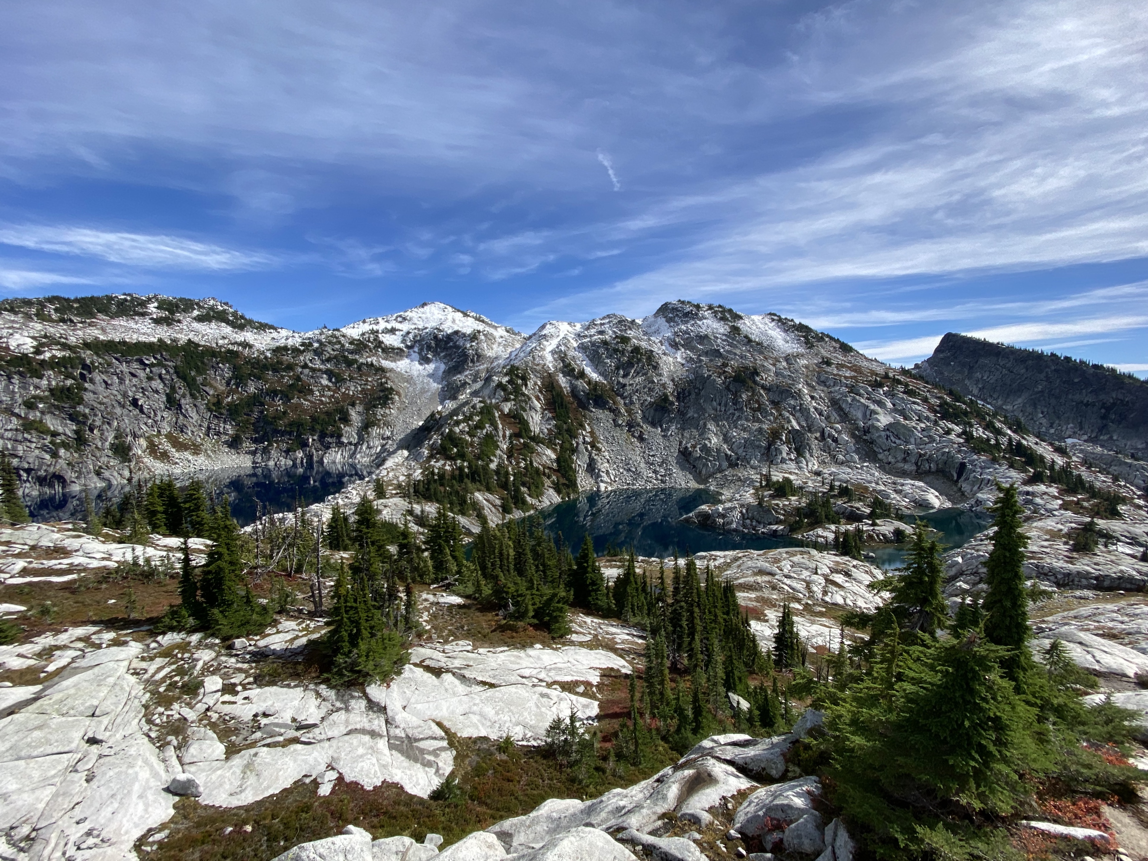
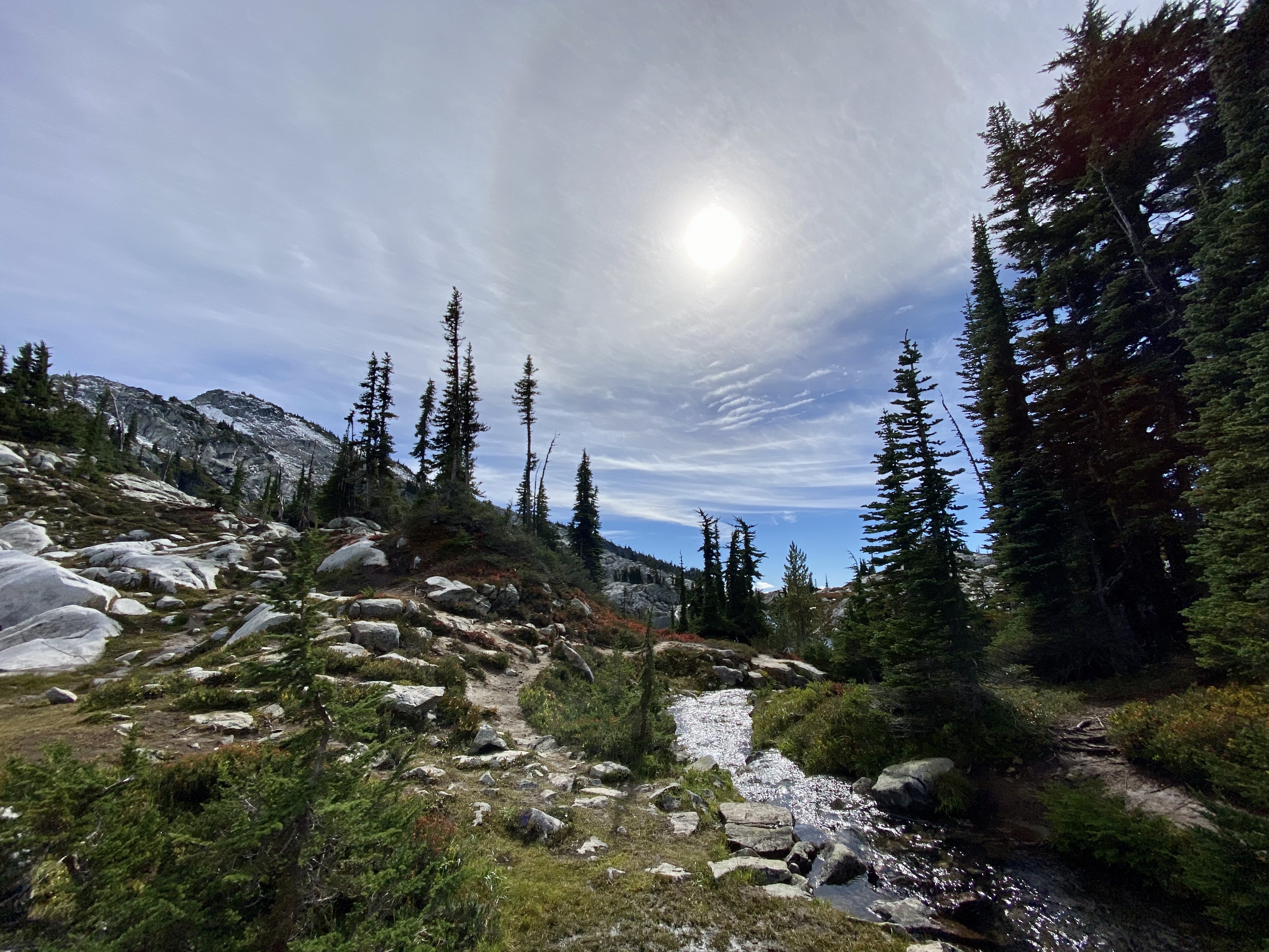
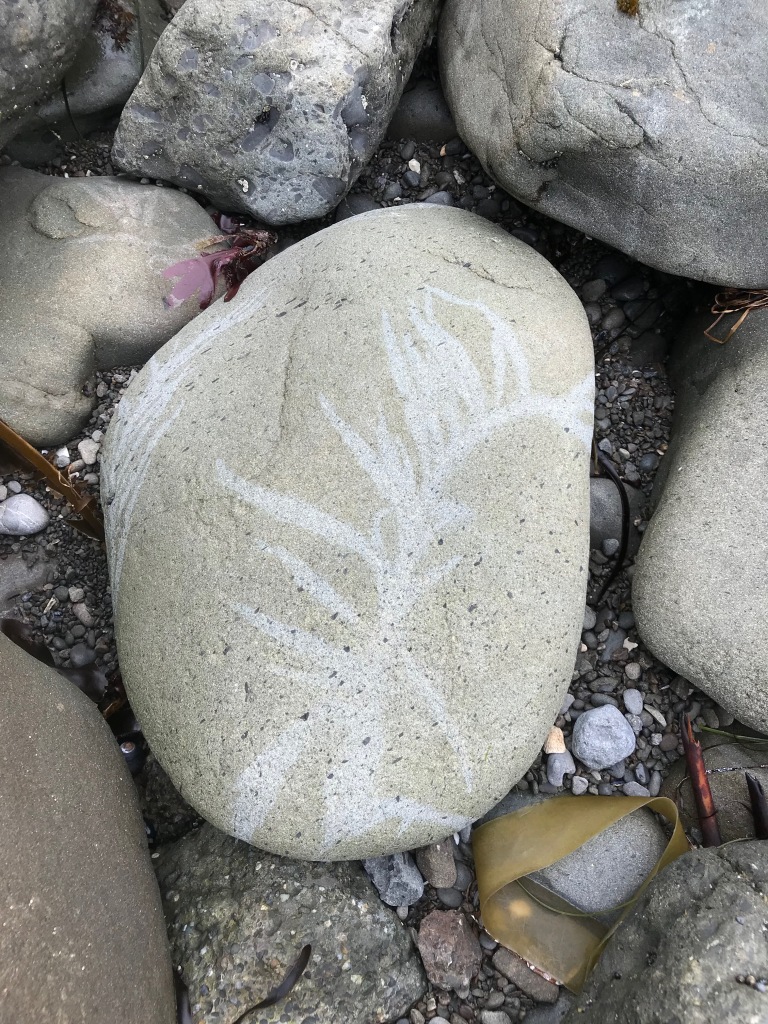
Here are a few of the beautiful places I went this summer. I hope you found beauty wherever you went too. xoxo
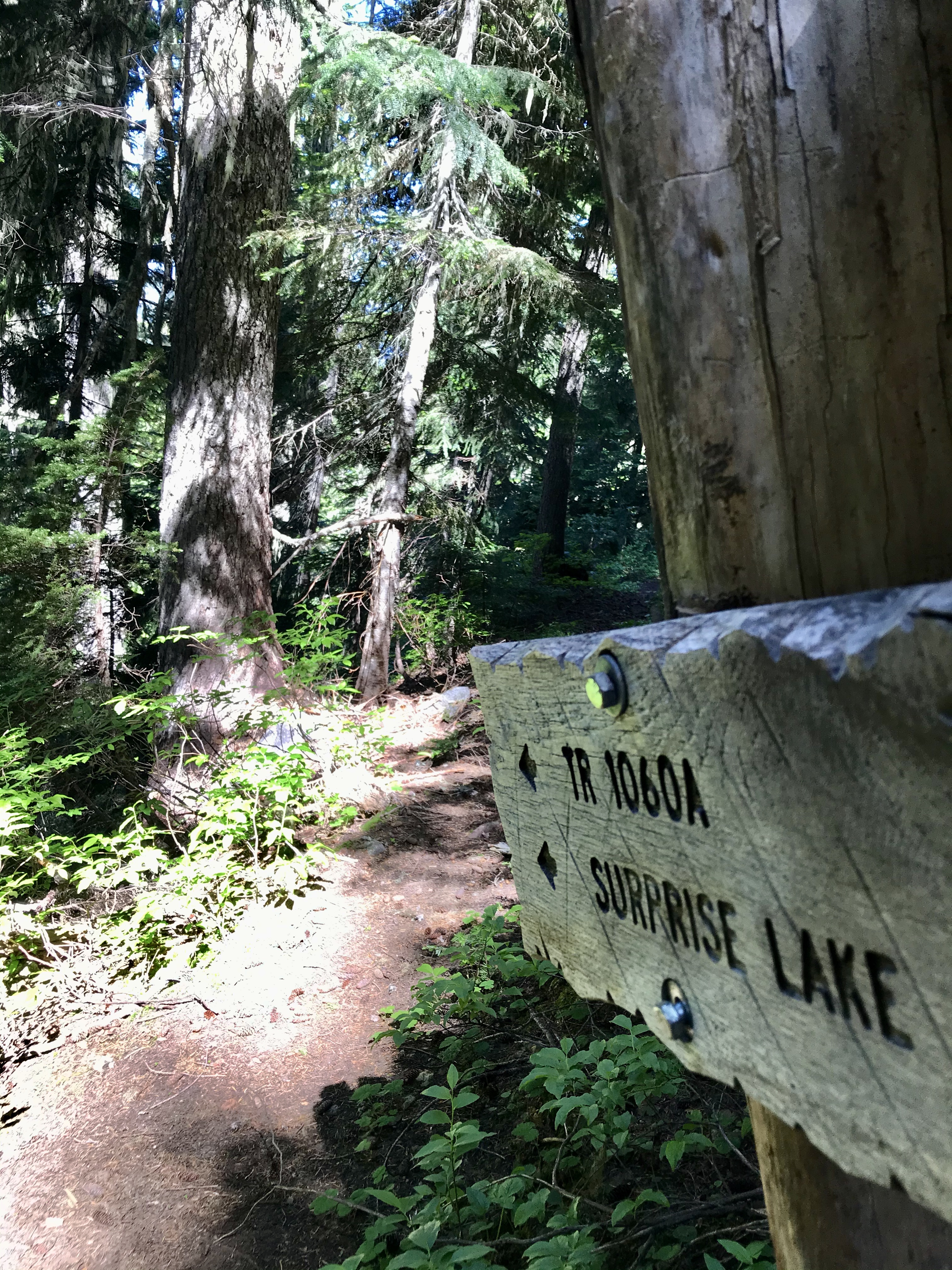
UltraPedestrian Wilderness Challenge: WAS Up Loop in the Washington Cascades
Historical lands of the Skykomish, Snoqualmie, Tulalip, and and Coast Salish people.
The Beaten Path in Montana’s Beartooth and Absaroka Wilderness
Historical lands of the Absaroka/Crow, Cheyenne, and Sioux peoples.
I wrote this in response to a writing group assignment. The assignment? [T]ake 20 minutes … to write about the following: In light of how dramatically our lives and communities have changed with the advent of this pandemic, what do you miss? Start your assignment with the words, I miss….
I miss change. Not the kind of change that’s a major life change (although the pandemic is a major life change all on its own) or getting a new hair style or trying a new exercise class. I miss the change that came with my daily routine.
As I exist essentially housebound—being with the same three people every single day—I also see the same walls. The same stain on the same carpet. The same views out the same windows. I miss seeing other views, smelling other smells, and connecting with the wide range of people who I’ve learned create value and connection in my life, whether it’s in casual interactions or through deep friendships and shared experiences.
It’s ironic that it’s this that I miss. How many times has my husband come home from work just to listen to me complain? About meetings at my kids’ school, driving to gymnastics and tae kwon do, running errands, driving the same five-mile-radius around our home over and over? About not being able to go for long runs midweek with friends because of being tied to my kids and obligations at home.
I thought I’d miss my weekend long runs with friends (I do miss those!), hugging friends and extended family (definitely miss that too!), and social nights out (yes, I miss those as well). But, today, I find myself checking the calendar several times a day because I cannot keep track of what day it is. They’re all the same, a blending of time and space that feels both infinite and confining.
That’s why I miss change.
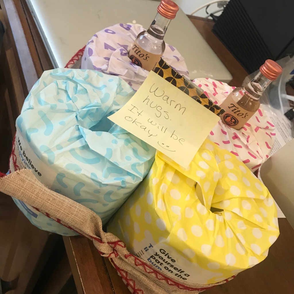
Gifts during a pandemic: TP, hot chocolate mix, and vodka!
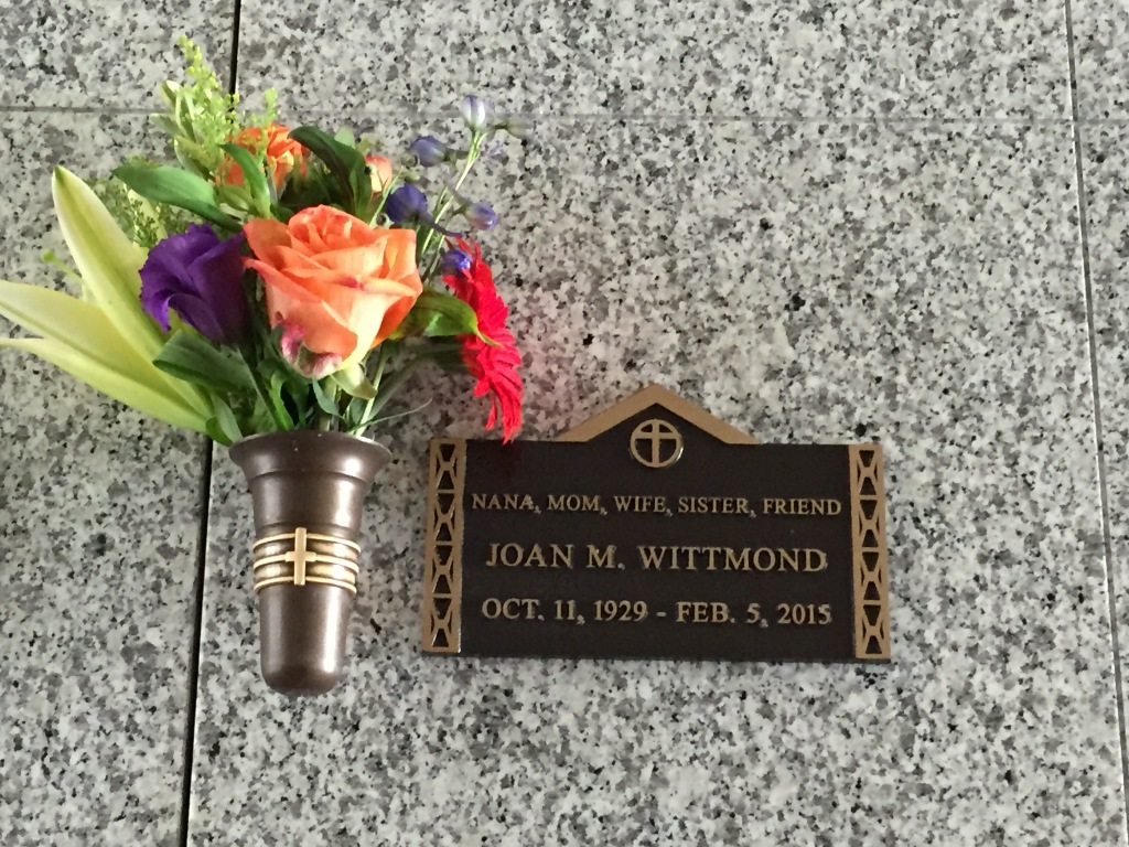
Five years ago, I was at work pulling together the first draft of a huge slide deck for our company’s annual talent review. My cell phone rang, and I saw a Thousand Oaks area code with a number I didn’t know. I immediately knew something was very, very wrong.
On the line was my Uncle Bob, who told me that my mom had been taken by ambulance to the hospital after she had been found unconscious by her sister that morning. I said, “It sounds like I need to get down there immediately,” and Uncle Bob said, “Yes, I think so.” I emailed my brother at his work, and my phone rang immediately. I told him what was happening, and then I called Mike at home and told him to get me on the first flight to Burbank that he could and that I’d be home as soon as I could to pack a bag.
She shared her love of nature with my brother and me … and somehow managed years of family camping trips with grace and aplomb. Well, except the time she was relaxing in the campsite reading a book and a bear with two cubs strolled by. No grace or aplomb that time!
I remember picking up that first draft of the slide deck and wandering the halls at work, looking for my colleague, Carol. When I found her, I said, “I’m sorry, this is a mess, but I have to go.” She took it, no questions asked, and said, “Go. Do what you need to do.” In the meantime, Rob was on his way to TO and Mom. By the time I got the airport, he was at the hospital and had spoken to the doctors and my aunt and uncle. My mom had had a massive stroke in her sleep and was brain dead. They would keep her on the breathing machine until I got there, and we could make our final decision then. In the meantime, she was given Last Rites, and she was moved from the ER to ICU.
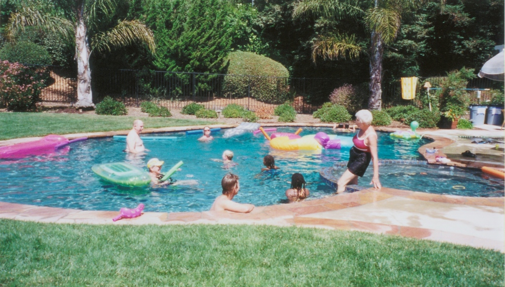
My mom loved to have people over. This is the backyard just the way she wanted it—full of people having fun.
I remember nothing of the flight down, nor of my drive from the airport to the hospital, except that I was wound up tight, numb, and didn’t cry. I guess really I was just in shock. When I got to the hospital, Rob met me at the door and showed me the way to ICU, where Aunt Nancy and Uncle Bob were with my mom. I knew immediately that she was gone.
I think we shared some Mom stories for a short time, and Aunt Nancy told me that she and my mom had a mani-pedi date that morning. When Mom didn’t show and didn’t answer the phone, Aunt Nancy got concerned and went to the house to check on her. When she didn’t answer the door, my aunt got the “hidden” key (it seems like everyone knew the key was hidden in the backyard BBQ). My mom was in bed, gasping for air. Aunt Nancy called 911, and the fire department came. As they were leaving with my mom, the paramedic told my aunt it looked like my mom had had a massive stroke. He was right.
The afternoon before, my mom had been at my aunt’s house to play bridge with their friends. Everyone remembers her laughing and what a good time they had had. That evening, my brother and she talked by phone during his commute home. It looked like she had gone to bed, fallen asleep, and the stroke had happened sometime during the night.
It was, I guess, the way we all want to go, right? Peacefully, in our sleep, just don’t wake up.
After about an hour, my brother signed the paperwork to have the breathing machine turned off. And then we sat there as she stopped breathing and held her hands as she officially passed away.
Random memories come to me today, some triggered by pictures and some coming from my heart.
In the months before this, my mom and I had some intense conversations during our phone calls on my commutes home. Today I am so grateful for those conversations, because they allowed us to clear the air over things I did as a teenager that I had always felt guilty about. (Why do we waste so much time with guilt?) These conversations allowed us to become closer both as mother and daughter and as friends.
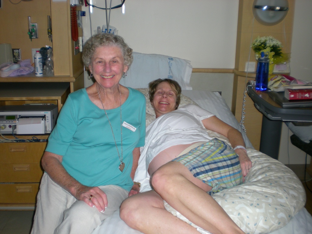
My mom moved herself and my dad to Seattle for three months when I was pregnant with the twins. I think she was convinced that I would do too much and lose the babies if she wasn’t there to take care of me. I think she was probably right. Here she is keeping me company during my 21 days of inpatient hospital bedrest.
My biggest regret is that I didn’t come down at Christmas with my family like she had asked me. I was too focused on work, too stressed out, too overwhelmed to travel at the holidays. We made plans instead to visit over the girls’ midwinter break from school. Our tickets were for 10 days after she died. Everyone told me that she was so excited that we’d be coming down and that she’d get to see her granddaughters. I’m glad she knew we were coming … but gawd, I wish I hadn’t put my job and the stress I was feeling ahead of her request to come see her at Christmas.
My mom and me when I was about 10 years old.
My mom was the coolest person! She had such a sense of adventure, a carpe diem approach to new experiences, food, places, and people. As a young woman, she traveled throughout the west with a carload of her girlfriends. She met my dad on a chairlift while skiing “single” in Colorado. And you should have heard the story about when she snuck out of the family cabin at Lake Placid (where they spent summers), swam across the lake with some friends, and met up with some boys … and then got caught by her dad!
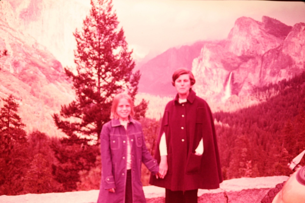
My mom (second from right), her sister Nancy (far right), and their two partners in crime on their trip to the Grand Canyon, Yellowstone, Jackson Hole, and beyond!
She loved wine, elegance, good food, playing bridge. She was a long-time member of the AAUW in Thousand Oaks, and a women’s investment group/club with some of her friends. She loved puns and bad jokes, with just a touch of naughty sometimes. She was a wonderful hostess, and even when it was “just family” over she made sure we had good food, good drink, and a great time.
She also had a crazy green thumb and had gorgeous orchids blooming constantly in her kitchen window. She traveled to Asia and Europe, and I joined her and my dad for three weeks in Spain one year and a week in Mexico another. On the trip to Spain we had a three-day layover in London, and when I—jet lagged and seriously off-kilter—got into a huge argument with some bus tour sales guy, with me yelling at him and stomping down the sidewalk and him following me, still trying to sell me the tour, she just stood there, waiting for me to rejoin her and my dad, laughing the whole time.
On a family walk in the fields behind the house in TO.
I remember how much my mom loved family too. She moved across the country with my dad when they were still relative newlyweds, and when her sister Nancy and her family moved from New York to California—and found a house just 10 minutes from us!—she was over the moon! She was so proud of her grandchildren from my brother and of all her nieces and nephews, and during our frequent phone calls I would always get updates on who was doing what from her. She was my fierce advocate when I went through an ugly divorce from my first husband, and she told me she was thrilled when I found Mike and “looked so happy.” And, when I had the girls? She told me that it gave her great joy to see me finally with a family, a nice home, and a really good guy for a husband.
Sooooooo many camping trips. Mom was with me when I delivered the girls. She told me it was the most incredible experience of her life to see those little girls come into the world.We did some great mother-daughter trips, and I think this was the first one. We had a cabin in Big Bear and she bought a small bottle of champagne to enjoy while sitting outside and breathing in the forest.My mom in a nutshell—a big smile after a ride on the Matterhorn at Disneyland. I’m in front with my cousin, Chris.
In some ways, it seems like it was just yesterday that I called her almost every day on my way home from work. In other ways, it seems an eternity since I got to speak with her. I miss her every day. I try to bear in my mind the things she helped me see are what are really important—especially being a mom to those little girls of mine (who aren’t so little but will always be my babies) and appreciating family, friends, and time outdoors. I love you, Mom!
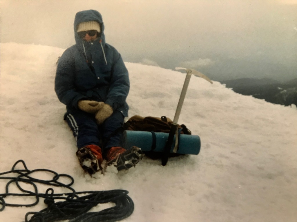
In 1986 I was attending the University of Oregon and dating my RA (I know, scandalous!). I had hiked and backpacked and car camped before meeting him, but he was a climber. Climbing had never been on my radar as something I wanted to do, but after listening to him rave about the sport, I took a rock climbing class offered in the UofO’s Outdoor Recreation program and then he and I started going to Skinner’s Butte after class a couple of times a week to climb together. As spring progressed my second year in Eugene, he asked me if I’d be interested in climbing Mt. Hood. I said “YES!!!!!” and at the end of May that year found myself climbing my first Cascade volcano.
Me on the summit of Mt. Hood in May 1984
I didn’t climb another Cascade volcano for 20+ years (but that’s another whole story about breaking up, moving back to California, and then reuniting with that same guy many years later). Yet, I’ve always held an affection for Mt. Hood and its striking profile … and perhaps some sentimental fondness for my first grand mountain adventure.
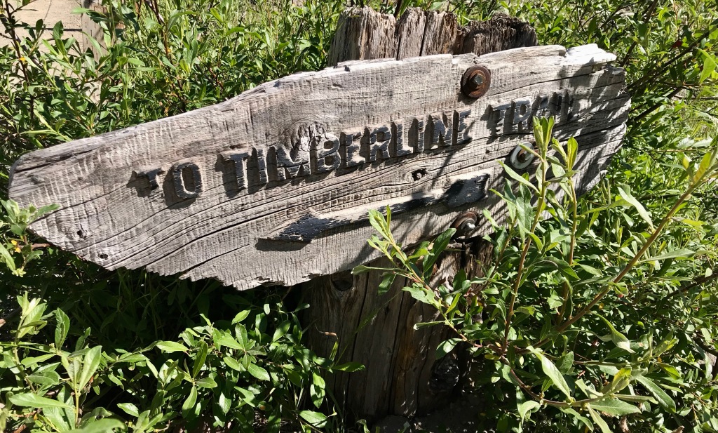
Now, with my (relatively) new obsession with long trail runs, I’ve shifted from going UP the volcanos to running AROUND them (including Mt. Rainier in 2018 and Mt. St. Helens in 2015 and 2018). In 2018 Timberline in a day was on my adventure list, but the season ended before I could fit it in, so I shifted it to the top of my list for 2019. Fortunately, it was also on the want-to-do lists of several of my friends.
In the spring we did a bunch of research and read a bunch of trip reports, and made some plans to head down in late July. Last-minute prep included finding a VRBO cabin in Government Camp with enough beds for all of us (score!), and we soon found ourselves traveling south on a Thursday afternoon for a fun Friday adventure. Even better, our friends Kelli, Mike, DeeDee, and Missy would be running the Wy’east Howl 50K/100K the same weekend we planned for our run, so we could cheer for them on Saturday.
About the trail
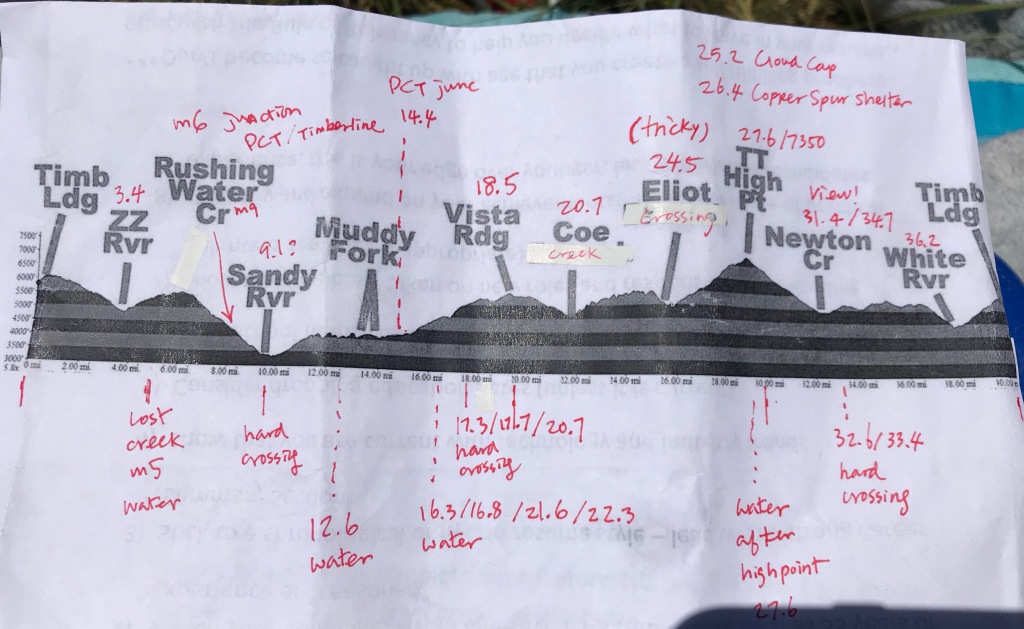
The Timberline Trail was built mostly by the Civilian Conservation Corps in the 1930s. The western portion overlaps the PCT (and we met and chatted with several thru-hikers), and the entire trail hovers right around treeline—which means we had lots of views! Distance varies based on which report you’re reading: the Forest Service says 38 miles, 40ish is the rule of thumb, and my Suunto tallied 42. Close enough.
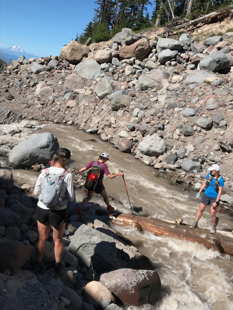
The trail climbs in and out of glacial-fed drainages throughout its length, and with all those ups and downs we ended up with a bit over 9,000 feet gross gain. Each of those “glacier-fed drainages” includes some kind of river or creek crossing, and there are no bridges so they’re all either forded or hopped over using boulders and trees. Because of this, snowmelt levels are an important consideration when planning the timing of your trip.
There’s a lot of discussion online about whether to go clockwise or counterclockwise, and from where to start. We went clockwise, starting at Timberline Lodge. This meant we hit the trail’s high point (at 7,350 feet) at mile 30 and one of the reputedly tougher river crossing toward the end. FWIW, we all later agreed that counterclockwise and starting on the PCT near Ramona Falls would be the best way to go. (Take that advice for what it’s worth: We haven’t done it that way, so what do we know?)
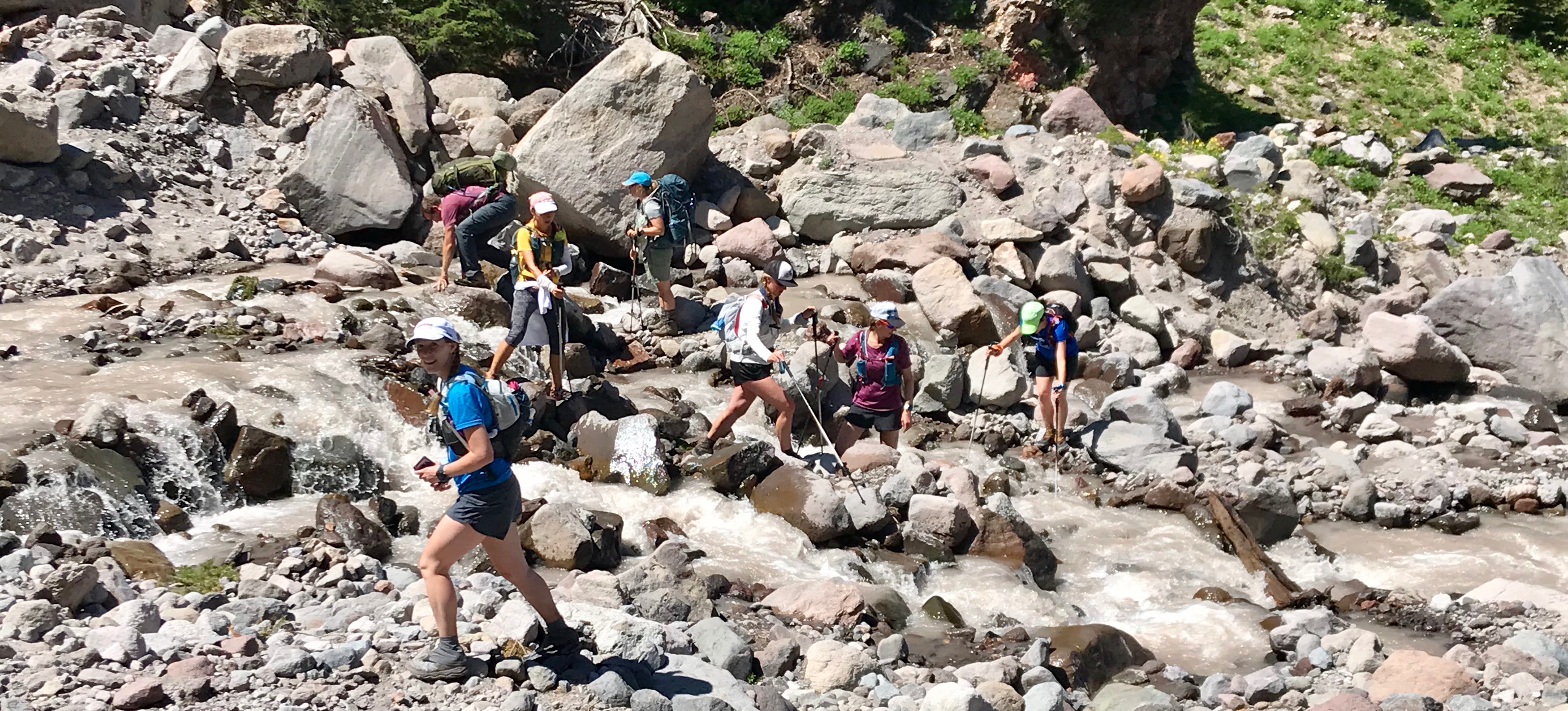
I love how nobody is going in the same direction anywhere in this photo!Vivian’s planning sheet
On the trail
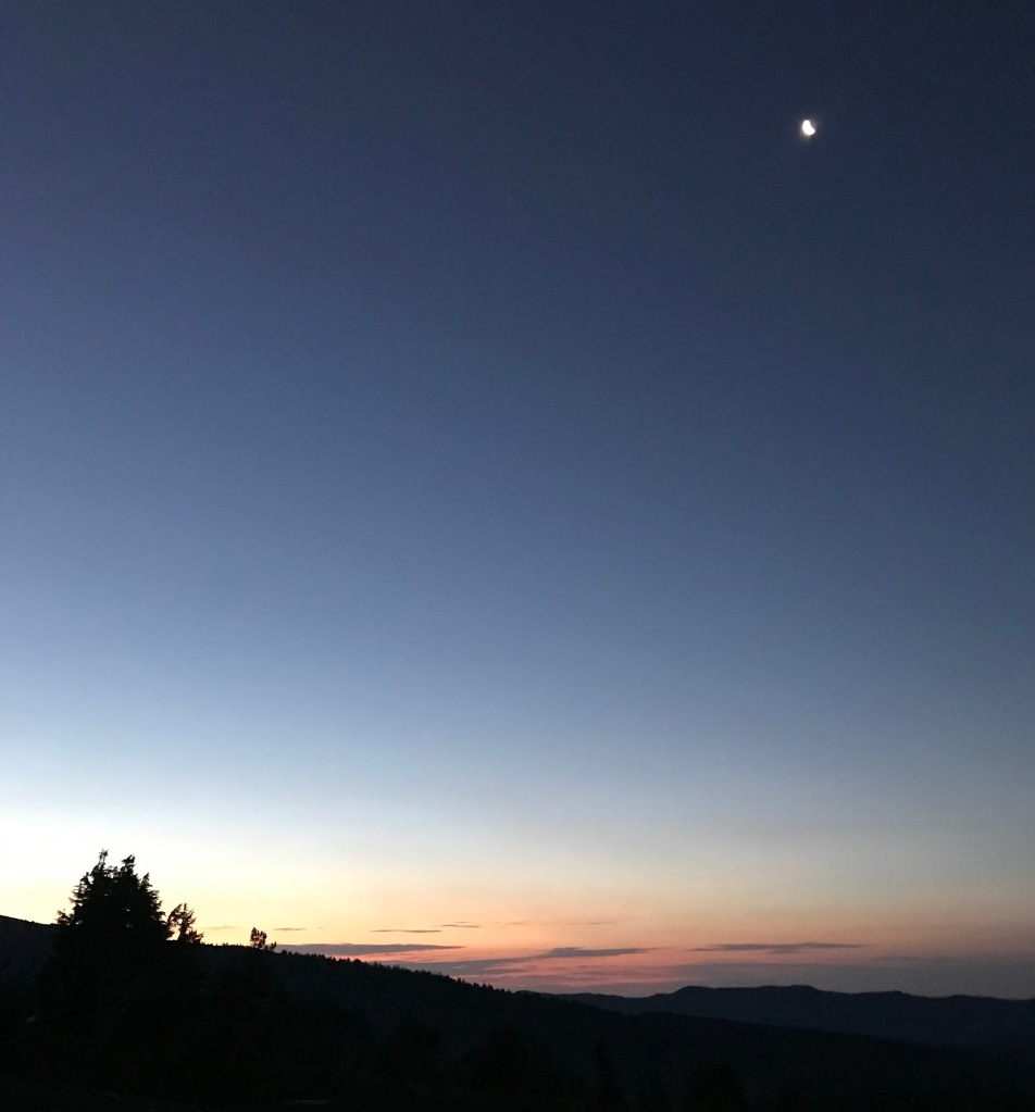
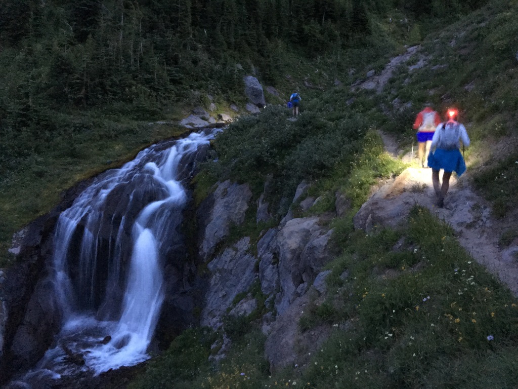
We hit the trail at 5 a.m. The sky was just starting to lighten but we still needed headlamps to see the trail.
Sunrise and the moon early on the trail
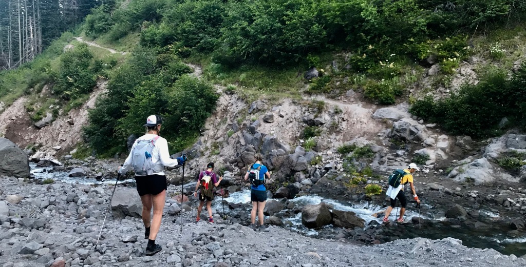
As we wound our way west and then gradually northwest, we found ourselves in a sometimes-stark landscape that for me was a bit reminiscent of Mt. St. Helens. We headed down into Zigzag Canyon and our first stream/river crossing, and then worked our way up toward the intersection with Trail 778, which leads to Paradise Park.
Early morning on the PCT/Timberline TrailL to R: Ana, Marna, Sarah, Heidi, Vivian Back row: Mt. HoodAn early creek crossing (maybe Lost Creek?)
We stayed on the PCT/Timberline Trail, skipping the detour through Paradise Park, and soon found ourselves at beautiful Ramona Falls. I don’t have our group photo, but click here for a link to more information and a photo of Ramona Falls. If you’re ever in the area and are looking for a day hike, I think it’s worth your time!
Soon after Ramona Falls, our friend, Kari, caught up to us. She wanted to join the weekend fun, but didn’t want to do the full route. It was fun to have her join us for several miles as we worked our way farther north.
Kari (far left) joined for several miles (and would be a total ray of sunshine for us two other times later in the day)
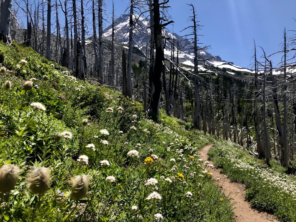
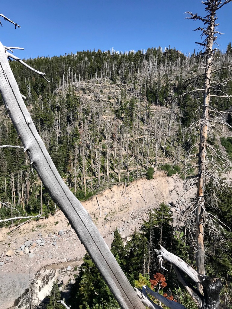
At mile 14+, we hit the far northwestern point of our route and turned east, leaving the PCT behind as we made our way around the north side of Mt. Hood. This was our favorite part of the trip: the wildflowers were insane; at several points, we had views of Mt. St. Helens, Mt. Rainier, Mt. Adams, and out to the deserts of eastern Washington and Oregon in one snapshot; and an old forest fire left acres of dead trees that somehow seemed mystical as they framed Mt. Hood. If you can only do one section of the trail, DO THIS PART!
Of course, there were more river crossings. Some required quick hops and skips to pass, and others involved a bit more planning.
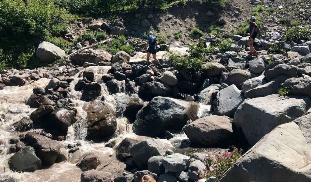
We were soon looking forward to reaching Cloud Cap, where Kari would meet up with us again. This time, she’d have a cooler full of cold Cokes and Snicker bars, both of which were sounding pretty fantastic by then. Our last “hurdle” before Cloud Cap would be to cross the Eliot. This would be one of the highest running streams we would cross on the trail, but fortunately once you get to it, there’s a nice solid tree trunk creating a natural bridge that’s accessed with an easy big step. Getting there is a bit of a slide down loose rock and sand, and a sketchy traverse along the river’s edge.
Getting down to the Eliot
As we carefully worked our way along the stream, a rock came loose beneath Marna and she was suddenly knee-deep in the water with a death grip on a boulder just above her. Sarah grabbed her arm and working together Marna was quickly out of the water. It was a very strong reminder that things can go wrong whenever you’re out in the mountains.
Marna, in front, just before she fell inCrossing the Eliot—note Mt. Adams in the background
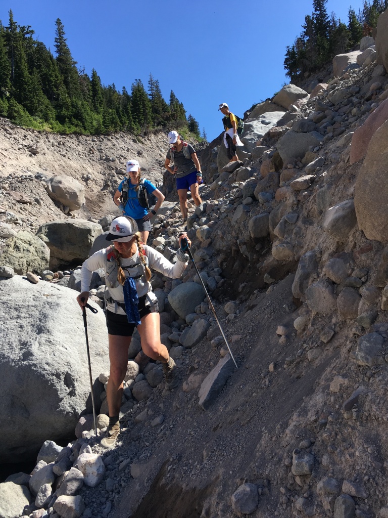
Once we were across the river, a bit of a scramble got us to a section of rebuilt trail. Look closely, and you can see a serious set of switchbacks going up the hillside.
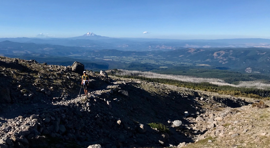
Kari had been sunning herself on the opposite bank and joined us for the climb up to Cloud Cap. Her cooler of Cokes and Snickers made for a happy “aid station” as we hit mile 25ish. At this point, however, time was slipping by and we were taking longer than we had planned, so we bid Kari farewell and started heading south along the eastern side of Mt. Hood and up toward its high point at 7,350 feet along Gnarl Ridge.
The east side of the mountain was more of a moonscape than any other part. Rocky and barren, with thinning air, it held a different kind of beauty.
Vivian, with Mt. Adams on the horizon
At the high point, we stopped to toast each other with a sip of whisky. After a long day and at a bit of altitude, it took my breath away, but added a touch of ceremony to our journey.
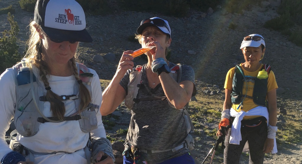
We’re starting to look a bit trashed, aren’t we?
Our focus shifted to “let’s get this thing done” and concerns about hitting our final river crossing—The White River—in the dark. As we headed down from Lamberson Spur toward Newton Creek, we encountered several long patches of snow. Ana slipped and self-arrested with a trekking pole, but otherwise the section was uneventful and we maintained our “beat feet” focus.
Ultimately we ran out of day, and our headlamps were dug out of our packs. We kept consulting maps and calculating distance remaining, but for a while it seemed that no matter how much time passed, we were continuously five to seven miles from finishing.
Finally we spied the ski lifts at Mt. Hood Meadows (where Saturday’s Wy’east Howl would start and finish) and we saw trail flagging for the race. We joked about being glad we were going to finish before the next day’s racers were starting, and then again recalculated how much farther we had to go. I think we came up with five to seven miles again, but I’m not sure how much of that was because our calculations had become a farce even to us.
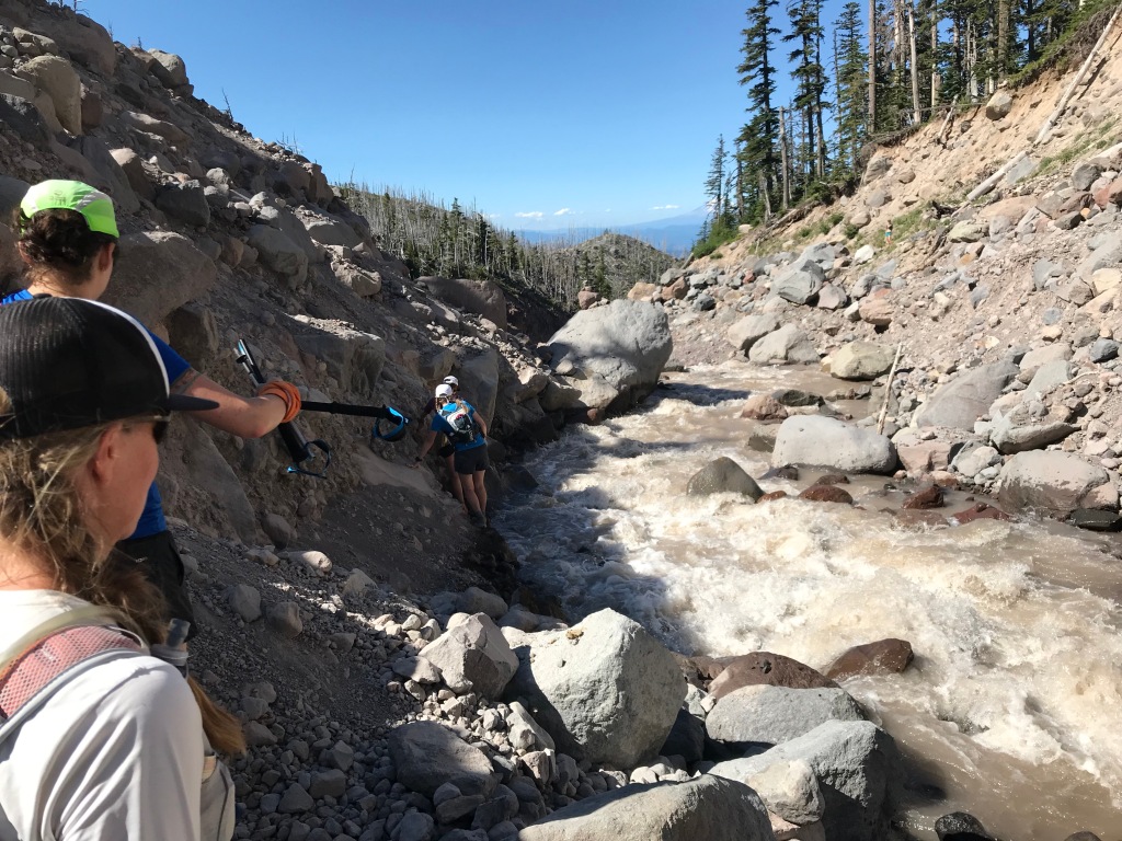
In our minds, our last hurdle would be the White River crossing, and then we’d have smooth sailing back to Timberline Lodge. The crossing itself was unnerving, as we couldn’t see much in the darkness. Vivian plowed right through it, but the rest of us felt iffy and decided to err on the side of caution by joining arms and crossing together. It ended up not being too bad, with the water up to our knees perhaps, but better safe than sorry, especially when you’re tired and not sure what you’re up against.
And then … well, and then we discovered our last two-ish miles would be on sand. Never-ending sand. And cruelly, the trail, which reconnects with the PCT just past White River, heads straight toward the lights of Timberline Lodge and then abruptly veers north, toward the mountain and away from the lodge. I had NOTHING kind to say about it until I later realized that it was noodling along the edge of a big ravine, and therefore it made sense to do what it was doing. As we finally approached the parking lot, a headlamp flashed at us and Kari called out, “Woot woot!” and once again became a very bright ray of sunshine bookending our adventure.
Done!
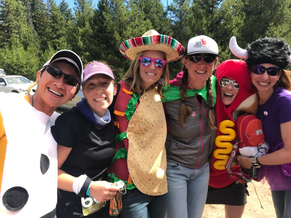
The racers
The next day we got up and drove out to the Wy’east Howl race course to cheer on our friends. Mimosas and costumes, along with a vicious game of Battleship, while lounging around in a meadow were a fine contrast to the prior day and afforded us time to digest and celebrate our friendships and to offer “Woot woot”s to Kelli and Mike, who we saw on course.
Kelli (not in costume) on the Wy’east Howl 100K course
Reflection
As I look back on the day on the Timberline Trail and subsequent day cheering racers, I think my biggest takeaway is depth. It takes a depth of training and experience to push yourself, to reach into one’s own internal depths for both physical and mental strength, in the outdoors. These experiences also deepen our friendships: as we’ve reached deep individually, we’ve all gotten to know one another—our strengths, our weaknesses, our moods, what to say when someone needs a kick in the behind—and have supported and been supported by each other. While I still enjoy a long solo day on the trails, the shared journeys hold more texture, more intensity, because of this.
The trail itself holds a special place in my heart because Mt. Hood was where Mike and I had our first big mountain adventure together. That aside, it’s simply beautiful—I can’t think of any part that I didn’t enjoy (except maybe the sand at the end).
All text copyright me. All photos belong to Sarah Brouwer, Marna Kaegele, Ana Hinz, Heidi Flora, or me.
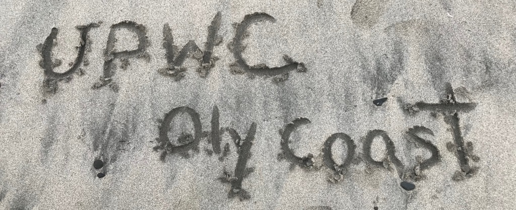
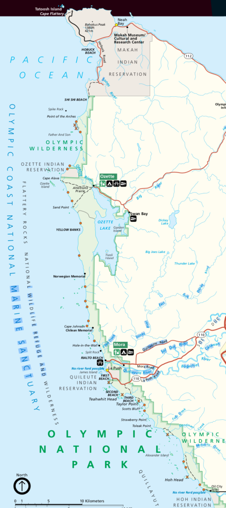
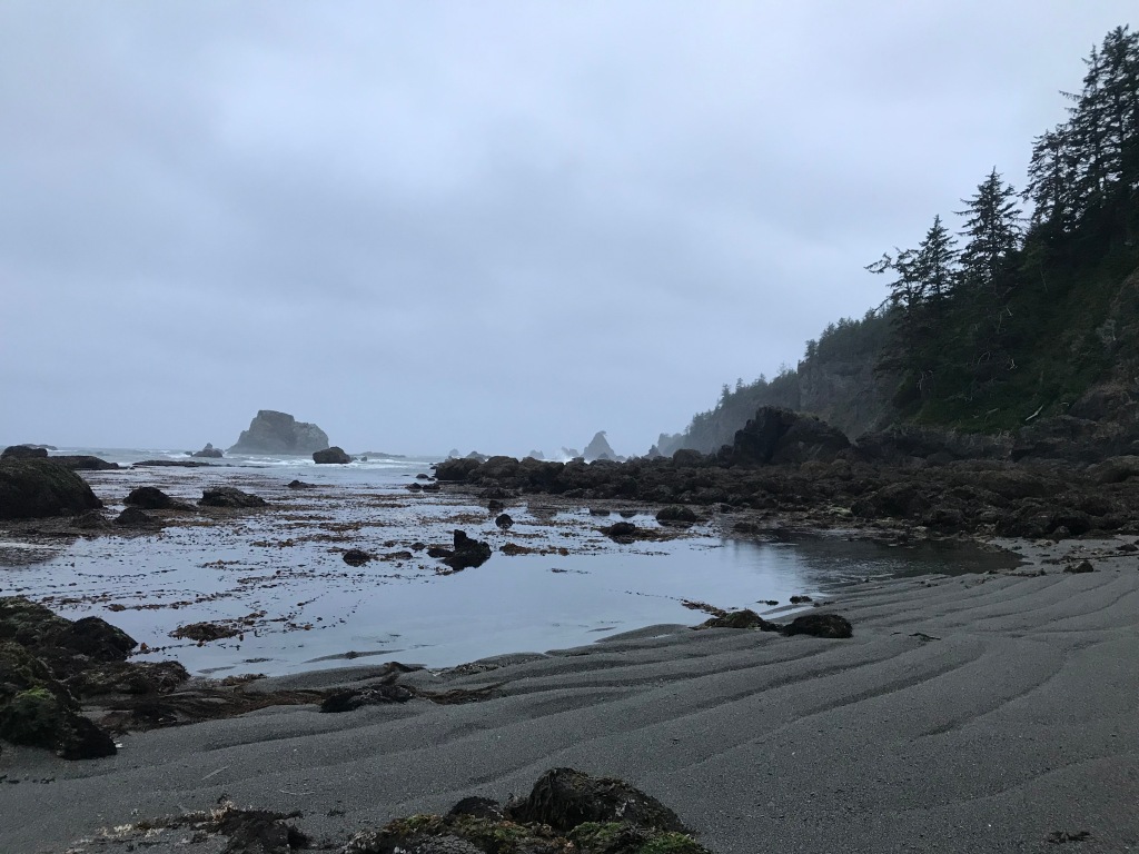
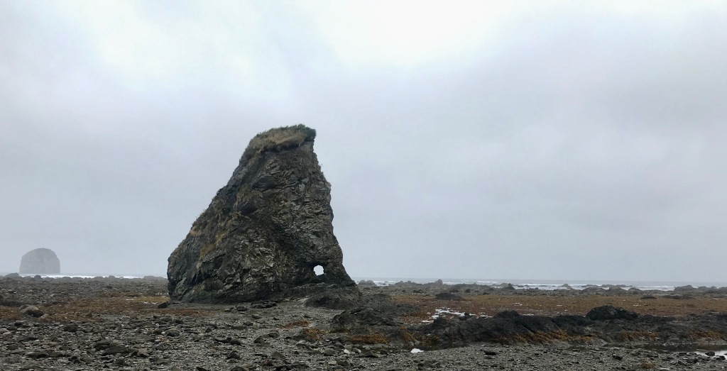
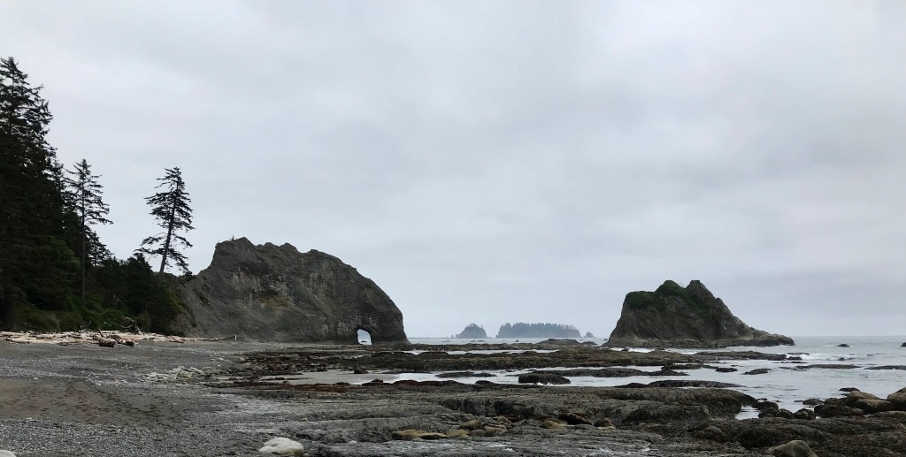
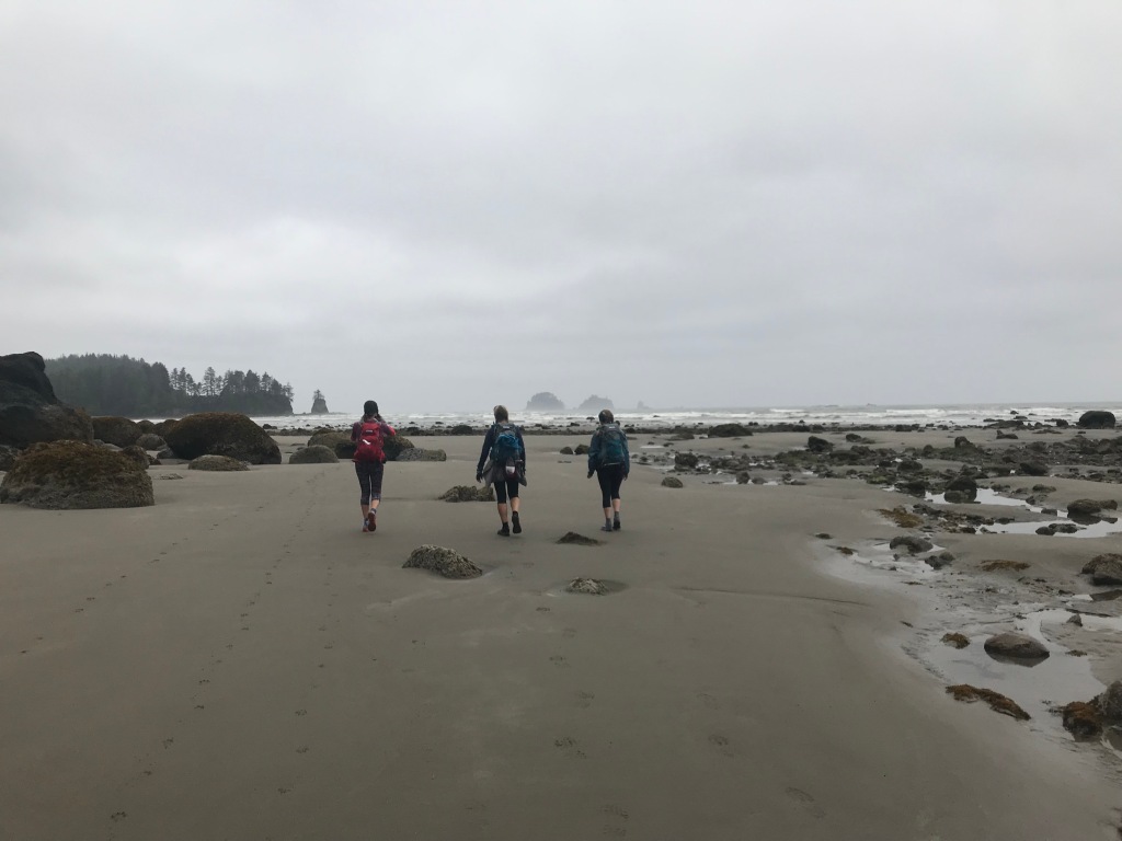
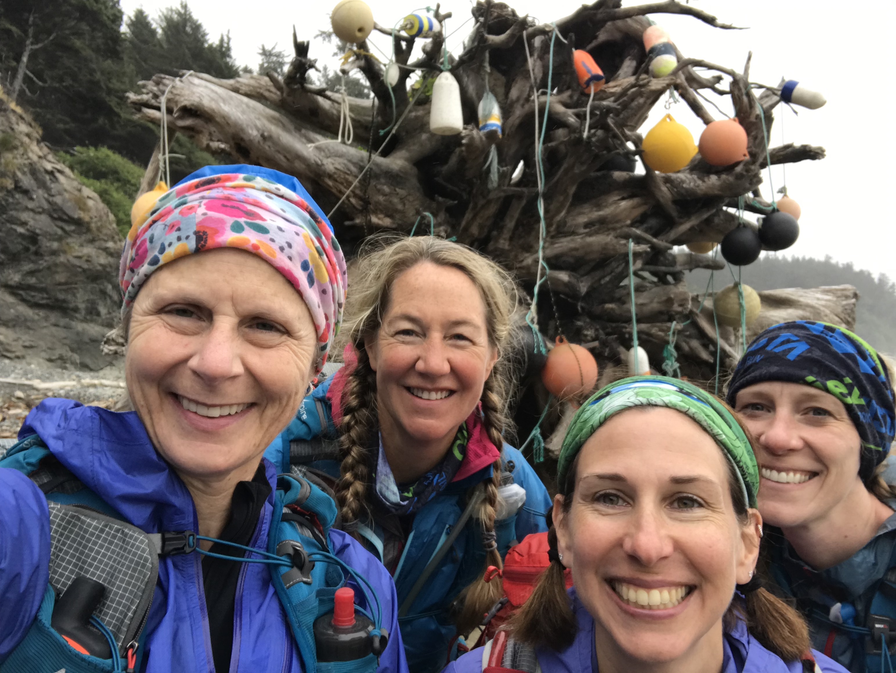
At the beginning of 2019 a bunch of my partners-in-crime got together to brainstorm adventures for the coming year. One that stuck was to do the UltraPedestrian Wilderness Challenge Olympic Coast route. As described on UltraSignup, “This [approximately 58-mile] route runs point to point between the Shi Shi Beach Trailhead in the north, and the Oil City Trailhead in the south. The Olympic Coast Route will test your logistical skills, as it involves timing tides, difficult creek and river fords, and nine miles of road to access the bridge across the unfordable Quillayute River. The Olympic Coast Route may be completed North to South, South to North, or as an out-and-back for the Epic Double.”
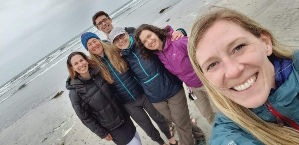
Heidi, Marna, and Sarah were committed immediately to the adventure, Ana was a maybe, and I waffled for a couple of months before formally jumping onboard a few weeks before the trip. After pouring over maps, tide charts, and other runners’ Gaia tracks, we set the date for mid-June.
The Route
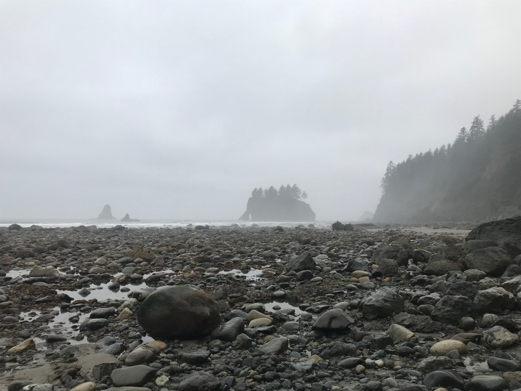
“Olympic National Park protects over 73 miles of the some of the most primitive natural coastline in the 48 contiguous United States. The views of ocean, cliffs, headlands, islands and seastacks, coupled with the dramatic changing sea, provide a unique wilderness experience. Most of the coast can only be accessed by foot.” (National Park Service)
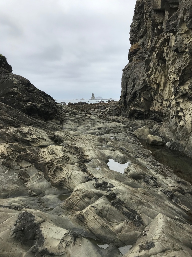
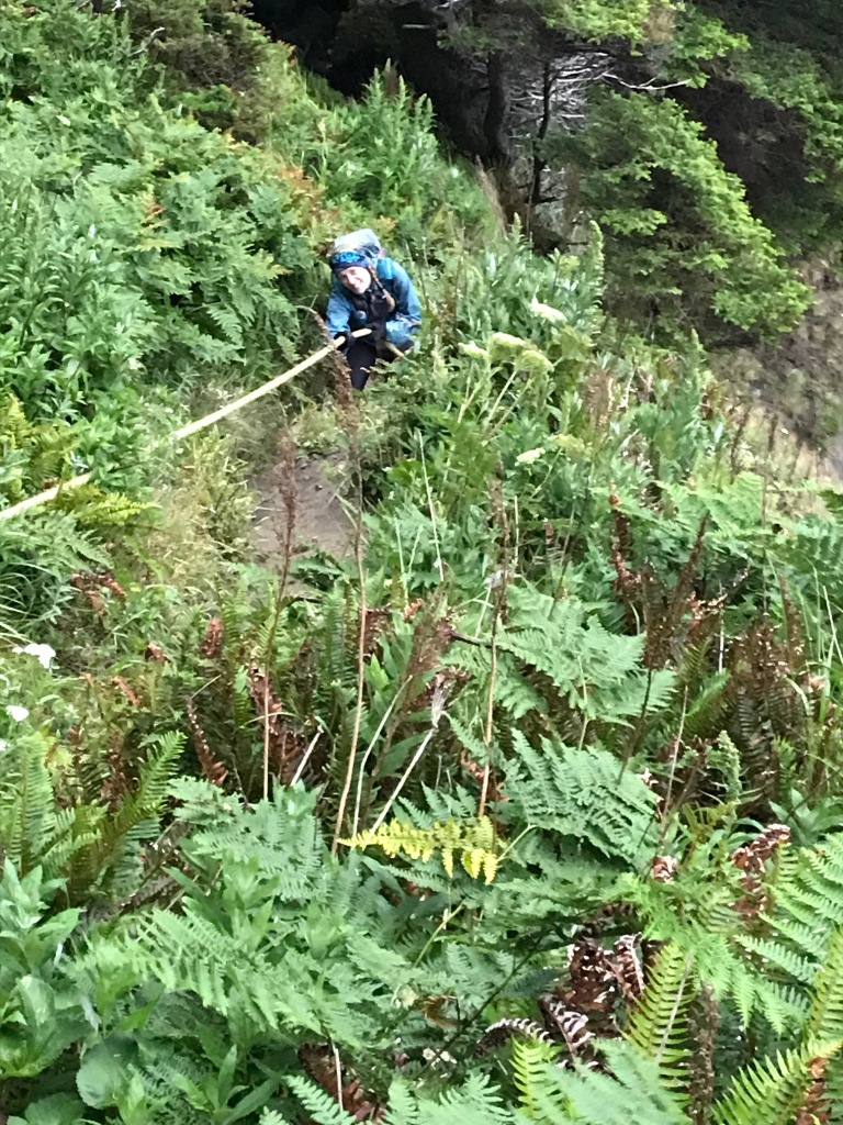
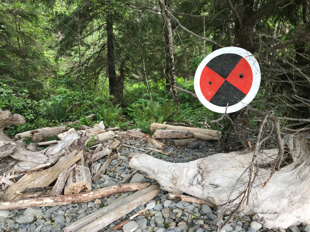
The route itself covers about 48 of those 73 miles, using the shore and, in several places, overland routes accessed by ropes and dirt scrambles. Ten additional miles are road miles that are required to get from Rialto Beach to Third Beach, which are separated by the unfordable Quillayute River. In the National Park Service map below, you can see the trail to Shi Shi Beach starting in the Makah Indian Reservation and at the bottom the Oil City trailhead, just north of the Hoh Indian Reservation. An X represents an impassable headland (where the overland routes have been built) and an orange • represents areas where a low tide is required to pass.
One challenge with a point-to-point route is the shuttle. The drive from Seattle to Shi Shi Beach, where we decided to start, is a half-day on its own. Add three hours each way on a two-lane highway to get from Shi Shi to Oil City and back, and you’ve got a REALLY long day of driving before a hard trip. In addition, there is very little parking at Shi Shi (although there is a local resident who offers parking space on her property for a minimal fee). We lucked out as friends offered to help with the shuttle: a huge shout-out to Wendy and Kari, who drove out to give us some pre-adventure cheer and support before heading to their own adventure on one of the San Juan islands, and to Ana (who ultimately decided this wouldn’t be her adventure after all) and Adam, who ended up doing tons of driving to make it all work.
PC: Sarah Brouwer
We camped the night before at Hobuck Beach Resort. They don’t take reservations but have 300 spots available. We had a wide selection to choose from! At the campground office, we were also able to purchase our permit for using the tribal lands we would be passing through at various points during the trip.
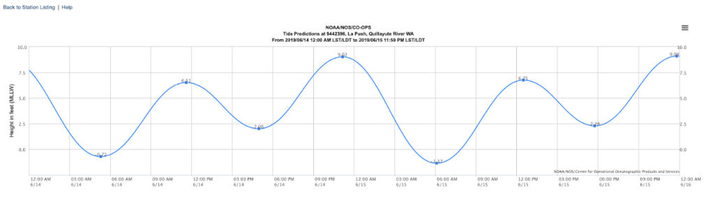
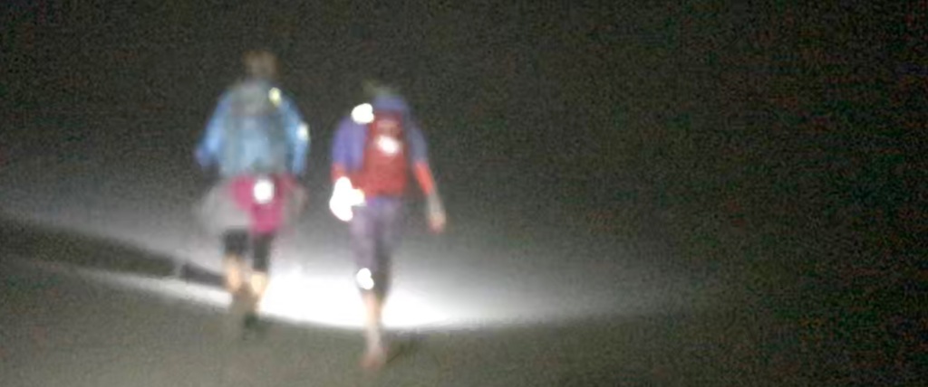
With our schedule driven by the tides, we would start at 2 a.m. at Shi Shi Beach trailhead. This gave us some buffer time wise to allow us to make it past several key points that are impassable at higher tides, and would also get us to Rialto Beach and the 10ish-mile road section in the daylight. After regaining the coast at Third Beach at mile 41, we would then have 17 miles and two tide-critical passings to traverse before reaching the Oil City trailhead.
As we have done on other crew-supported trips, we carried a Garmin InReach with us and Adam and Ana carried a second. This would enable us to call SOS if needed. In terms of logistics, having the two InReach devices allowed us to communicate with Ana and Adam via device-to-device texting—super handy for when for keeping our crew updated on our progress with no cell service available.
Also as we have for past trips, we shared a multi-tab google sheet with route details and beta, tide charts, food and gear lists, etc. For this route, our route details included landmarks and distances, tide levels required for safe passages around specific points, and clean water sources. The ongoing irony with anything ocean-related is the abundance of water and the lack of drinking water!
I’ve never had a harder time figuring out where i was
We were pretty much on time with heading out, and we covered the two miles out to the beach quickly. And I quickly found running along the sand in the dark terribly disorienting: I could hear waves, but couldn’t see them despite my headlamp, and I didn’t have any sense of where I was going, how much progress I was making, or where landmarks were.
Somewhere on Shi Shi Beach. Sarah and I saw Heidi and Marna from behind a lot early in the trip: Heidi (l) and Marna (r) are fast walkers, and periodically Sarah and I would have to jog to catch up with them!
My inability to get a sense of where I was continued even after daybreak. There were some obvious landmarks—such as fording the Ozette River and the overland sections—but everything else just seemed like a treadmill with the same scenery going by. I am certain I drove everyone else crazy with my continual questions: Where are we now? What’s our next landmark? Where did you say we’re going next? Despite having my own trip outline in hand, Gaia running on my phone, and paper maps, I just never got it. It was the weirdest thing.
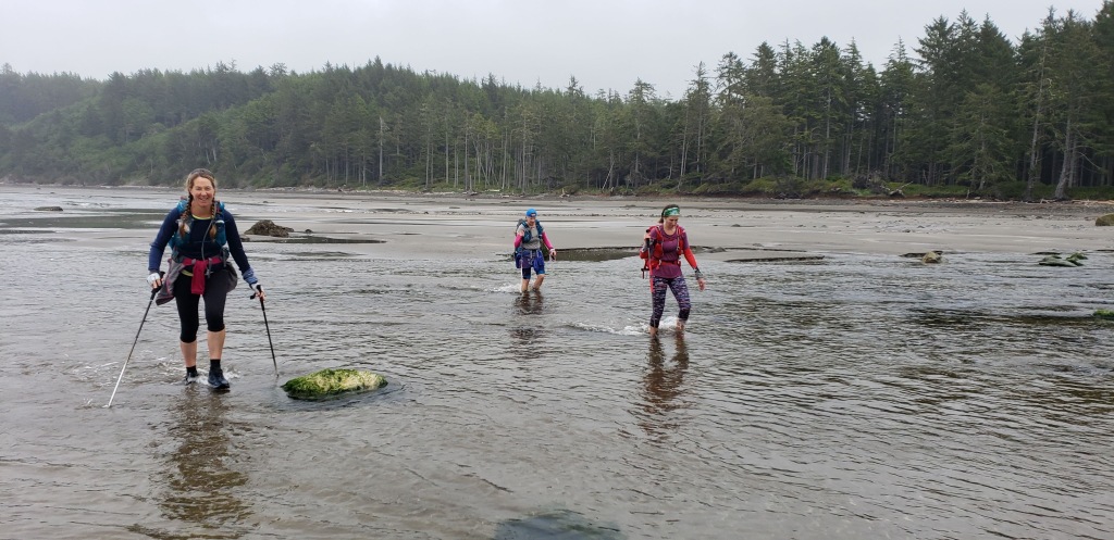
If you’re sleepy after a midnight wake-up call, just walk through a river on the Washington coast. That’ll wake you up! PC: Sarah Brouwer
A result of my lack of orientation is it’s very hard to write this trip report. I usually follow the progression of the adventure when I write, but all I have is a start, an end, and in the middle, a collection of snapshots of feelings, experiences, and views.
The middle: magic on the coast (with a dose of reality)
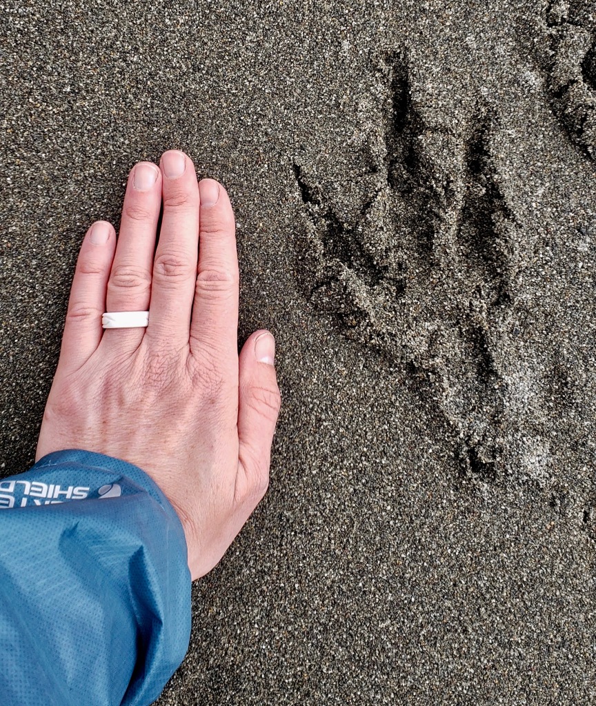
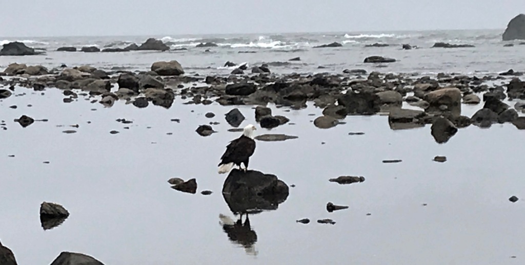
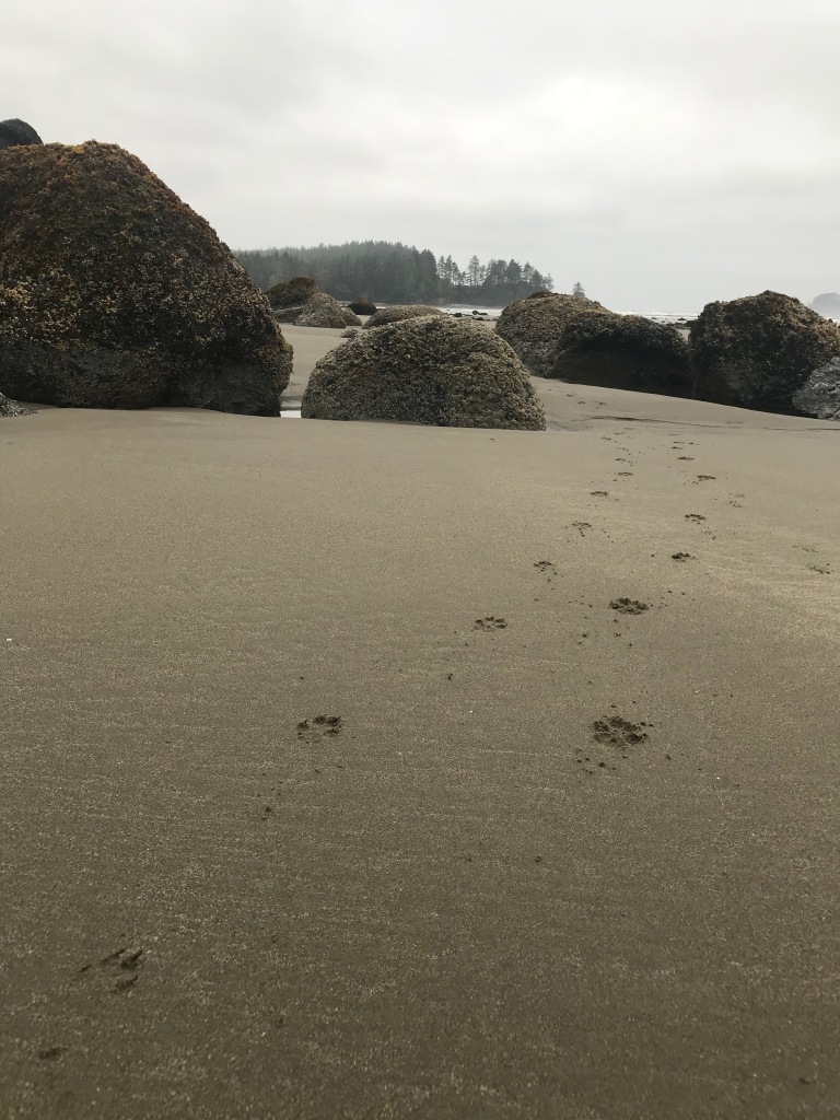
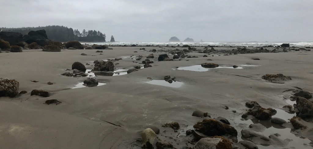
The Olympic Coast is really remote and wild—something that is hard to come by nowadays. I saw more wildlife between Shi Shi and Rialto than just about anywhere I’ve been. We watched a sea otter floating on its back and then diving and playing in shallow pools near the shore. We saw so. many. bald. eagles! plus a million other sea birds. Of course, we saw raccoons (notorious food thieves that campers must beware)—especially at night, when their eyes glowed like little heathens in the light of our headlamps. One of our favorite things was that we followed the footprints of a small animal (raccoon?) and a coyote literally for 15 miles down the beach! We never saw them, but we invented a delightful story of two friends also out on an adventure walking south along the coast together.
Talon print from a bald eagle. Sarah’s hand for scale.Eagle on a rockWe followed those prints for miles and miles
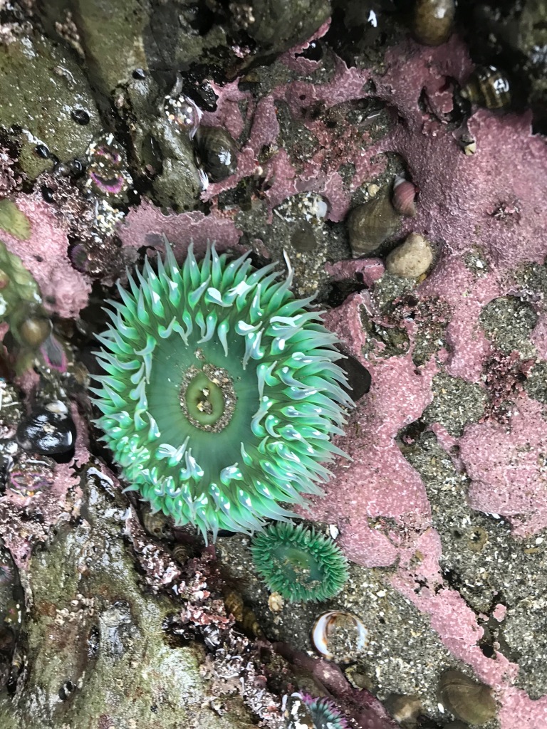
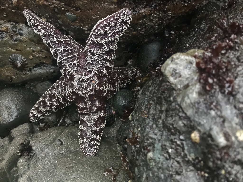
The sea life—especially in the tide pools—was crazy. So many little creatures in a grand landscape.
Anemones and other creatures
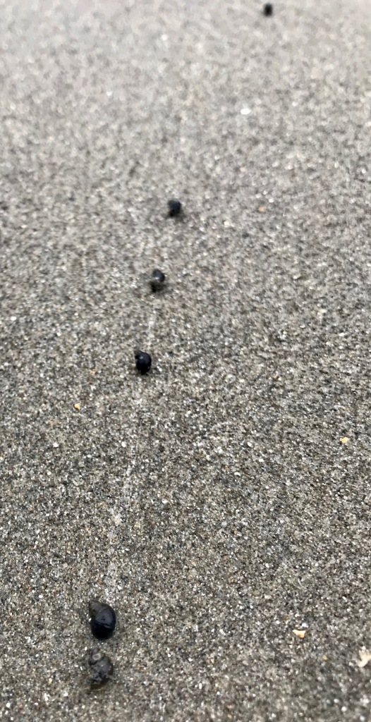
Have you ever seen a snail race?
Happy to see sea stars making a comebackScope and color
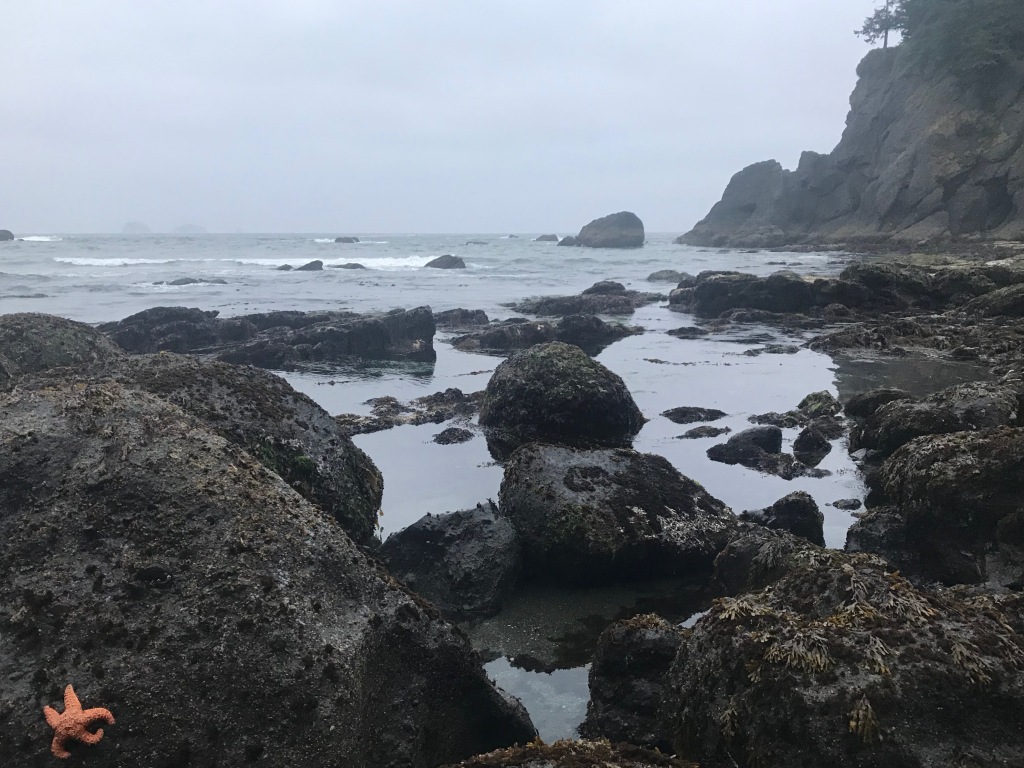
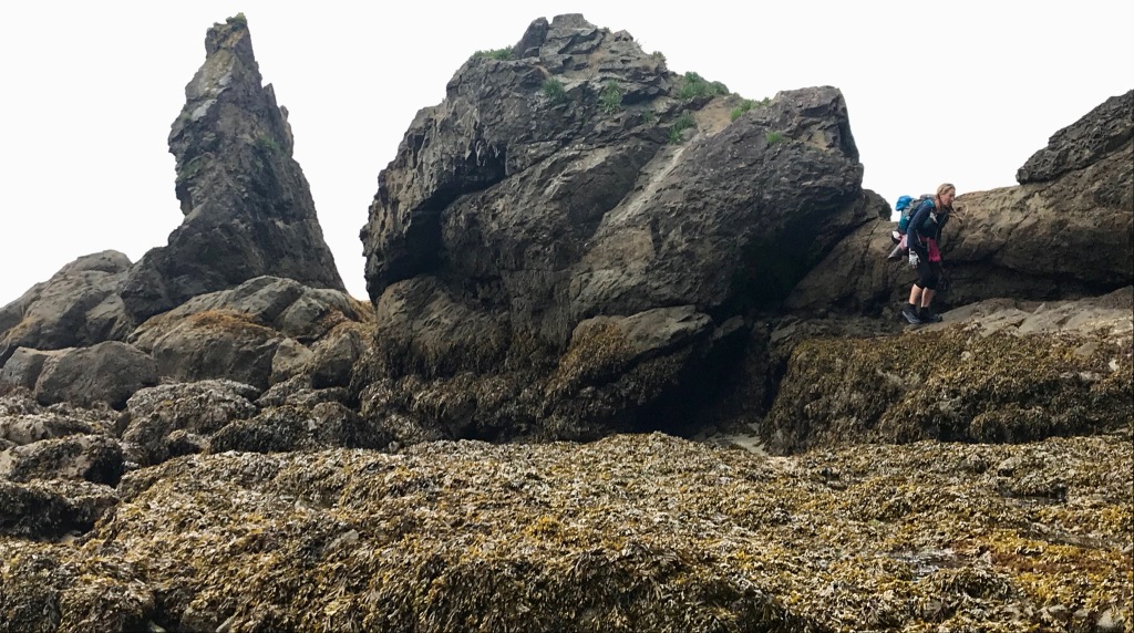
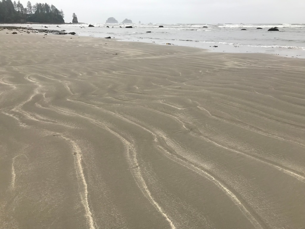
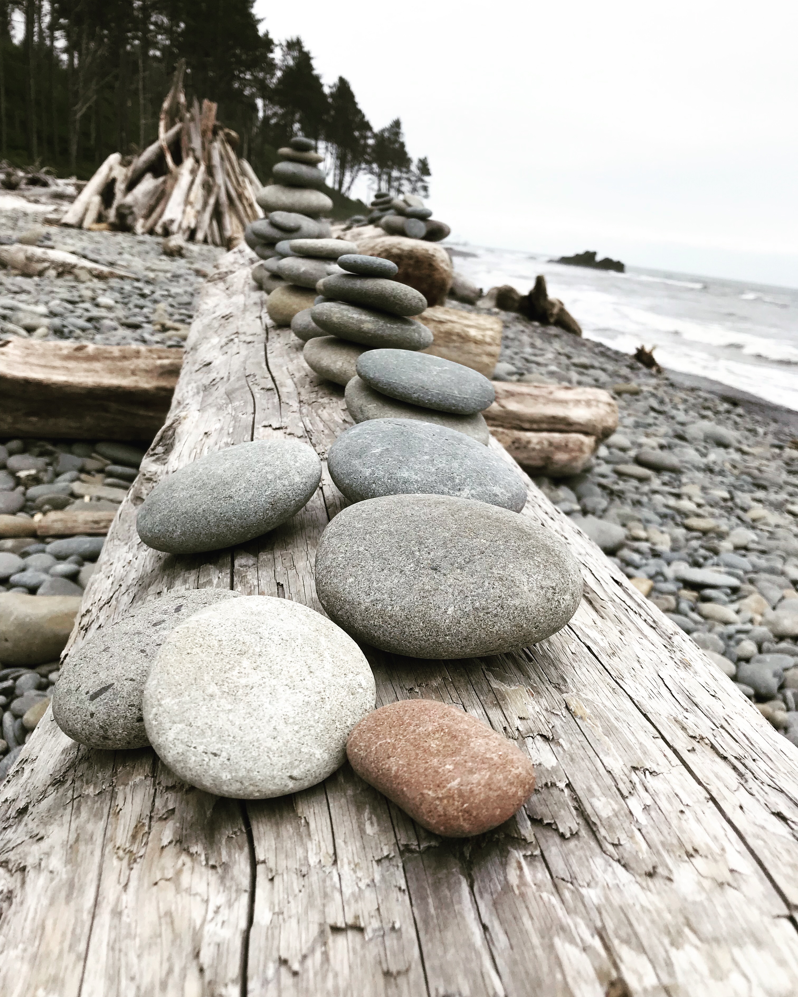
The terrain was a mix of sandy beaches, little rocks, big rocks, wet rocks, rocks covered with seaweed. It was really mentally draining, because at no point could we just walk or run. Full-time attention on where we placed our feet was imperative. We also had to scope out routes as the tide came in and find our way over/under/through different rock formations. It was much tougher and slower going than just about anything I’ve ever done.
Over rocks and seaweedWalk on big rocksOverland scramblesLook for these signs to find your overland trailWalk on roll-y rocksWalk on soft sand
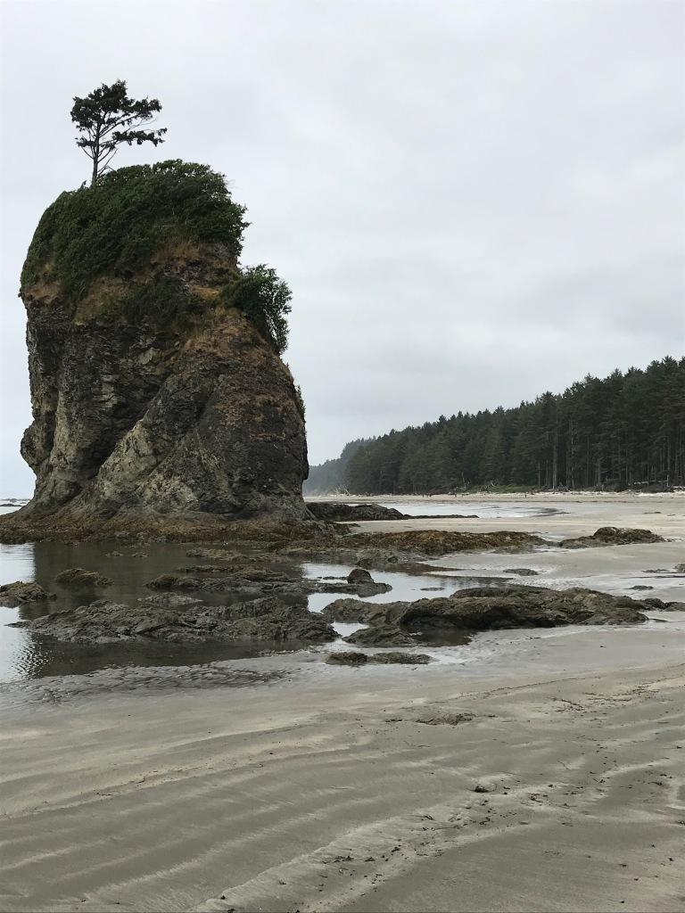
Despite the rough going, it was beautiful. Like breathtakingly beautiful. The sea stack formations, the rock carved by thousands of years of waves, the forested land coming up to the high tide line. The scope is difficult to take in.
Seaweed bas reliefPeek a booApproaching Hole in the Wall at the north end of Rialto Beach
In contrast to all this wild beauty, on many beaches we saw evidence of the human impact on our oceans. Some areas were blanketed in styrofoam, nets, floats, plastic bottles. For a time, a large shipping vessel motored its way up the coast. We could barely make it out on the horizon, but we could hear it and even feel the vibration of its engines throughout our bodies for a long time: it gave us a little window of insight into the impact “our noise” must have on sea animals, especially those who use sound to navigate, communicate, and hunt.
The end
When Marna took this picture of me, I’d already made up my mind to bail at Rialto.
I ended up texting Ana and requesting a pick up at Rialto (mile 34ish), while Heidi, Marna, and Sarah continued on and in true warrior fashion, finished the damn route.
There are a multitude of reasons, all of which are my fault/rest on me. I think they mostly stem from my waffling about whether to go: I don’t think I was emotionally fully committed to the journey, so things I could have overcome instead became huge barriers to my continuing. In addition, my planning wasn’t as complete so I (1) hadn’t internalized the route and felt overwhelmed by what was yet to come on an ongoing basis and (2) made critical packing errors. Some are lessons learned (maybe all of them?), so I’ll share them here:
Sarah kept saying it would be cold on the coast, but the forecast was for a nice weekend. In the end, it was misty and chilly the whole weekend, and I was underdressed. Bring the right layers!
The challenges related to clothes were amplified by my body alternating between being overheated when we were scrambling over rocks or headlands and being cold when we were on sand. Bring the right layers!
By the time I got to Rialto, I was dehydrated. I didn’t appreciate how hard it’d be to get clean water, and I couldn’t get myself to drink marsh-stained water even after filtering it. It smelled like a peat bog, it looked like tea, and that messed with me. We also wasted a lot of time following streams inland, looking for clearer water, when it simply wasn’t going to happen. Plan hydration better!
My feet! Once my feet were wet, they stayed wet, and then they gradually got sandy too. I ended up very close to a serious case of trench foot, which I found really painful. Bring more socks! I had a spare pair, but in reality, I’m not sure what I could have done about this. I suspect I needed to suck it up and be stronger mentally.
Group pacing. I am comfortable with scrambling on rocks, and there are sections of the route where you are jumping rock to rock or climbing up and down or over and under boulders for long periods. I would clamber along, and then spend time sitting, waiting for the others. Conversely, there were times where the others were waiting for me as they trotted along sandy beaches and I huffed and puffed and whined about my feet.
Food. No, seriously, this was a duh! moment. I forgot one of my two food bags in the car when we headed out. I got really worried about having enough food for the length of time we’d be out there.
Reflection
I remain humbled by this place where I get to live, by the challenges and opportunities I am given in the outdoors, and by the friendships I share with some really amazing, giving, and strong people. I am in awe of Heidi, Marna, and Sarah for completing the journey, but also just in general because they’re amazing accomplished people who are incredibly strong physically and mentally. I’m glad I shared a large portion of the journey, and—they’ll get this—while I am sad I didn’t complete the full journey, I’m still not sorry I was sitting in a Mexican restaurant stuffing my face with chips and salsa while they continued on. For me on that day, it was the right decision.
Yesterday, my friend Ana—of Will Run for Whisky fame—pointed out that winter is a great time to catch up on the past season’s race and trip reports. My kids and work have filled all of my nonrunning time, and I’ve missed the chance to reflect on my adventures so I’m giving it a try. I actually started this race report right after the race (um … yes, that was last April) and here was my lead:
“Running is stupid! I’m never running again!”
Ha! Well, that sounds like a typical ultra, doesn’t it?
It certainly wasn’t the mantra I had intended to have looping through my mind on this race, but it’s the one that stuck. That loop occasionally was replaced with a checklist of all the things I was going to unregister for when I was done. I think I ended up doing everything I had planned, so NEVER listen to yourself seriously when you’re struggling during an ultra!
The Badger Mountain Challenge—which offers 100- and 50-mile and 50K and 15K courses—is one of those small community races that is growing but still holding on to its roots. It has a great community feel, where you can tell many of the volunteers live locally, know each other, and come back every year to support the race and the runners.
It’s in the Tri-Cities area of south-central/eastern Washington, where Kennewick, Richland, and Pasco are all closely collocated at the confluence of the Yakima, Snake, and Columbia Rivers in the Columbia Basin. I was kind of geeking out, because I’m a total fan of the Mercy Thompson stories by Patricia Briggs. A few years ago, after running Beacon Rock 50K, I went home the long way so I could visit the “Stonehenge” memorial on the Columbia River just because there was a pivotal scene set there in one of the Mercy Thompson books. In the series, Mercy and all her buddies and enemies live in the Tri-Cities. So, gah, geekdom struck! I was hoping to see a fae or two, but no such luck. Then again, since they’re usually pretty scary in the books, maybe that’s just as well.
The course starts at the base of Badger Mountain at 7 a.m. After a brief section of double track, the trail narrows to single track and heads uphill. Aside from a small section early on, this trail is PLUSH! It’s smooth and very well maintained! We climbed our way to the top of Badger, and then headed down—this section was FAST. I didn’t have to worry about where my feet were going and I could just let go. Wheeee!
A quick road section connects the Badger Mountain trail system with Candy Mountain. After a quick jaunt through the parking lot there, and then through the first aid station, we found ourselves back on more pretty and well-maintained single track. This course chooses to go up everything it can, so of course we went to the top of Candy Mountain. There are grand views of the Tri-Cities and off to the next ridge line we would climb: breathtaking on the one hand, but also a little intimidating—as in, wait, I’m going up there, all the way over there?!
The descent down the far side of Candy Mountain was a loose, rocky, rutted, steep jaunt, which is my kind of trail. I spent a lot of it thinking about how much Ana, who was running the 50K the next day on the same course, would absolutely hate it. (She did.) At the bottom, we made a quick dogleg and then entered a long culvert (long enough it gets pretty dark inside) which allowed us to cross below a highway to connect with the next section of the course. I was with several guys as we exited the culvert, and they went the wrong way, so I did too. Doh! We quickly recognized our mistake, backtracked, and got back on course.
The next section is along the road for a few miles, and it was here I started struggling a bit—and hence the “I quit running” mantra I was chanting by the end. (I later found out that my problems were partially caused by a medicine I was taking that gave me horrible heartburn; this made me feel like my lungs were closing up and my whole chest was tight.) The road section scoots along a series of vineyards with both grape vines and hops—apparently Washington is a huge producer of hops, who knew?—which made it more enjoyable than the typical road run.
A right turn took us to the next section, which was a dirt road through the vineyards. Here, we began slowly ascending a bit until we hit the beginning of the jeep trails. I had heard that the couple-mile jeep trail section is deceptively tough, and it’s true. While it cuts along the side of a ridge it follows, it manages to find every steep up and down it can.
Once we finished with that section, we hit the Field Road aid station (which was the turnaround for the next day’s 50K), and then ran along another mile-or-so road section up to the McBee aid station. Here, my incredibly supportive friend, Sarah, was waiting for me to cheer me on. She had driven out from Seattle that morning (3+ hours, mind you) and would drive home that night after the race (another 3+ hours). I cannot tell you how important my friends are to me and how much I appreciate them!
Sarah had my drop bag ready for me, and I grabbed my jacket and gloves as it was just starting to rain. Then I looked up and realized what I was going to go up next. The “trail” was basically a deer track straight up the ridge. I was wishing for poles, and Sarah—whose van is a bit like Felix’s bag of tricks from the old cartoon—fished hers out of some cubbyhole. I was very grateful.
The climb up McBee Ridge wasn’t all the bad, but it was sustained and steep. The rain came down in earnest, so I just focused on my feet and the next bit of up till I was, well, up. At the top of the ridge climb, I took off for the out-and-back on jeep roads to Chandler Butte aid station and the turnaround. This jeep road was deceptive and frustrating, as it was coated in small rocks which gave it a cobblestone effect that made finding my stride tough. Once done with the out-and-back, I headed down from the ridge on a nice single track and switchbacked back down toward McBee aid station—a much gentler, albeit longer, trail than our route up.
Back at the aid station, Sarah joined me to keep me company for the final 18 or so miles. It was great to have company, and Sarah’s standard cheerfulness brought my mood up. Unfortunately, it did little for my stomach, which had been burning off and on for a few hours now. At Field Road aid station, I drank some ginger ale in hopes that it would settle things down, but just a mile later I barfed it all up. Oops.
I had regaled Sarah with stories about the jeep trails, and when she saw the ups and downs she started laughing. They really do find the steepest ups and steepest downs around! The way through the vineyards is a bit of a blur, but we finally made it back to the climb up Candy Mountain. The trail that was such a joy to bomb down earlier was now a bear to go back up, with my stomach unhappy and my legs a bit tireder. As I trudged up the trail, Sarah sang a song and told a joke, trying to make me laugh. I think I told her to shut up … or something a little less friendly. You’d have to ask her; she laughs whenever she tells the story.
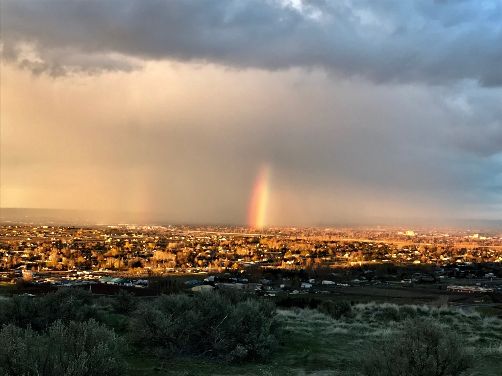
The rain had been coming and going throughout our time together, but as we crested the trail up Candy, the sun found a hole in the clouds to shine through and we were treated to a vibrant rainbow that lasted 15? 20? minutes.
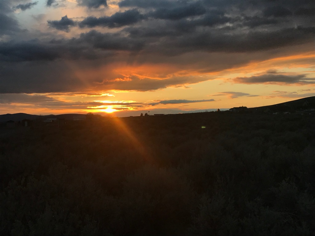
From there, we trotted down the buff single track of Candy and then headed over to Badger for our final leg. As we climbed Badger, Sarah noted that the rock types along the trail were remarkably diverse. I later learned that this is due to the Columbia Basin floods at the end of the last ice age.
As we neared the top, so did sunset. With the clouds still hanging in the sky, it was spectacular, reminding me that every run—no matter how miserable or hard, or remote or close-in to the city—always has a bit of magic. First we had the magic rainbow, and now we had a beautiful sunset.
We finished the run by headlamp, cruising down the beautiful Badger trails to the finish line. It took me a disappointing 13:30, but I finally have the 50-miler monkey off my back and some wonderful memories to carry with me.
Reflection
After what was for me a very successful 2018, this was a rough start to 2019. Why? Well, I think I was cocky—resulting in my going out too fast and not being meticulous in my planning. In retrospect, I think I find the 50 mile distance the hardest of the 50, 100K, and 100 miler ultras, simply because it seems like it should be so doable compared to the others and therefore it requires some pretty specific race planning that I didn’t attend to.
Badger was also a reminder that there’s joy in every run, even the tough, “I quit,” “Why am I here?” runs. The rainbow and sunset, Sarah’s friendship, the new scenery, even getting to geek out on the locale all made for a special experience. I’m tucking that reminder away in my bag of tricks.
The day after my race, I volunteered at the Candy Mountain aid station. I got to cheer on the 50Kers—including Ana and her husband, Adam—and many 100 milers coming back from their second jaunt through the vineyards and jeep trails and up and down McBee. The other volunteers were all from the Tri-Cities Girls on the Run, which hearkened back to my sense of this event’s connection to the community.
“I called it quits today just past the halfway mark after some 30 miles. I’ve never been more at peace with a tough decision. And I’m so proud of Marna, Heidi, and Sarah, who are out there along the coast right now, finishing the second half. I’ll welcome them back sometime tomorrow with joy!“
That was my post at 9 p.m. Friday, 30+ very slow miles and 19 hours after my friends and I started out for a single-push go at the 58-mile Olympic Coast route. (My friends finished on Saturday, 38 hours—including a few hours of rest breaks while waiting for high tide to recede 2 miles before the finish—after we started.)
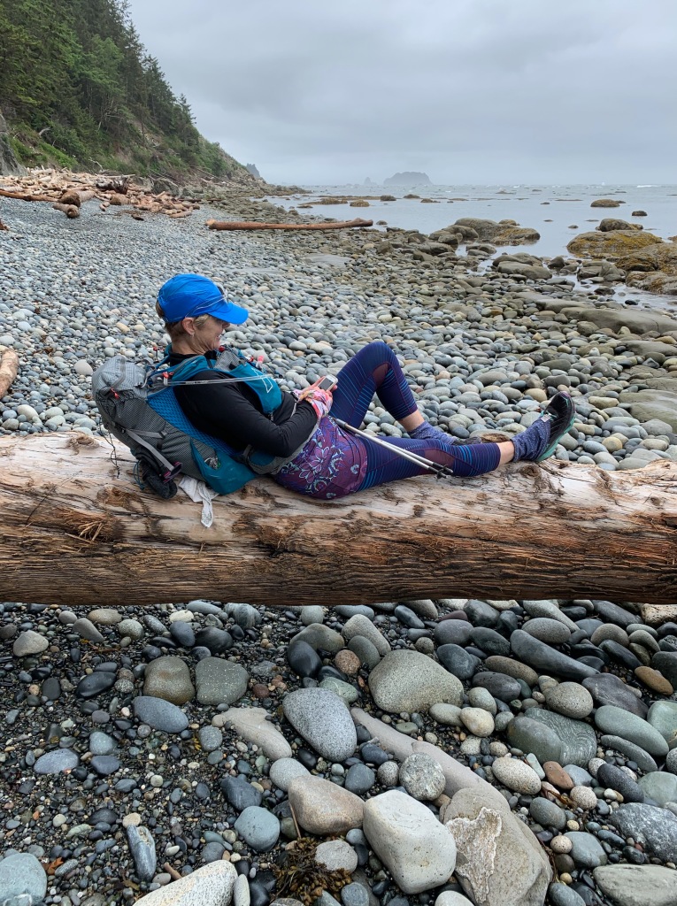
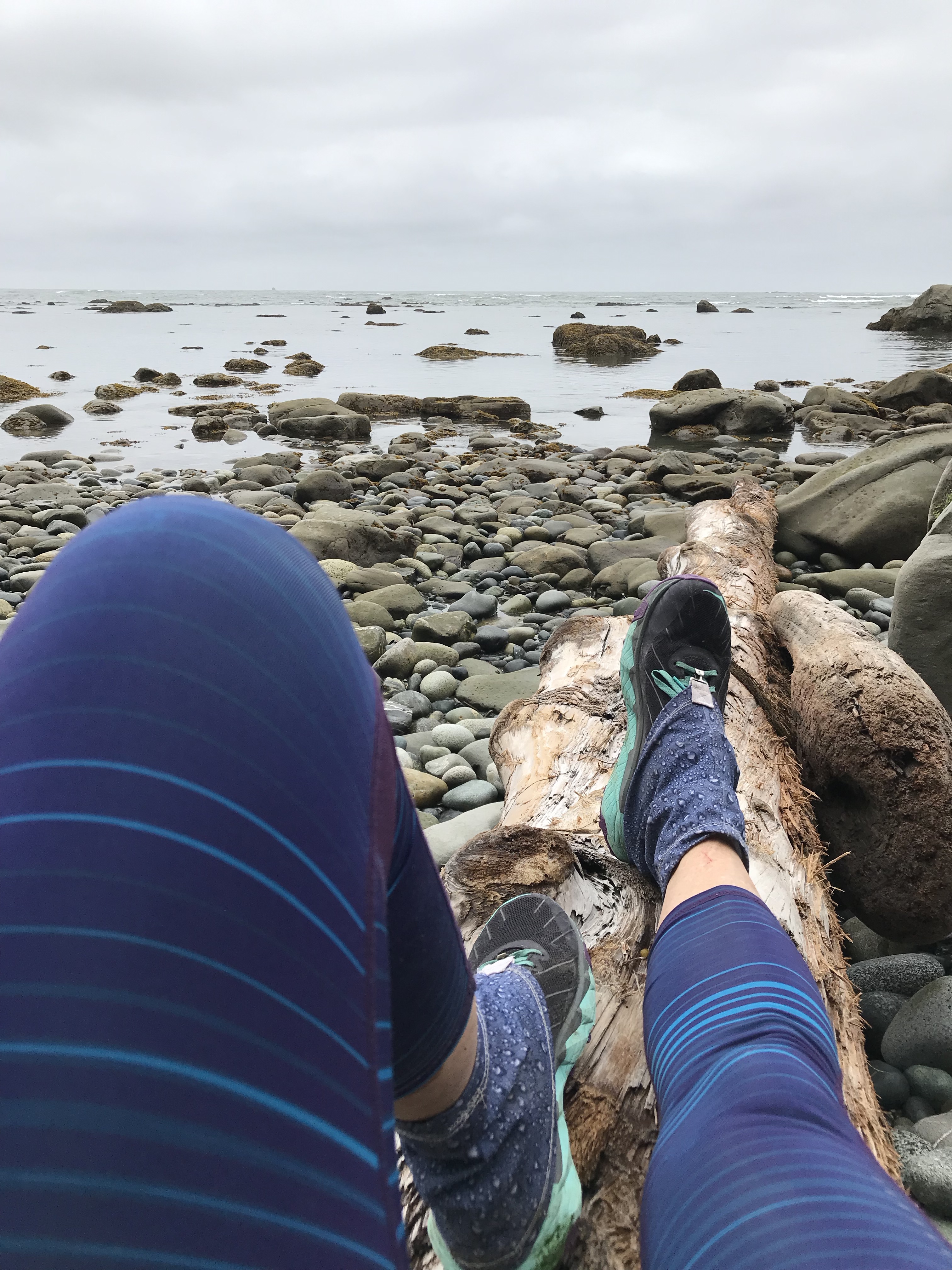
Enjoying a relaxing moment on the Olympic Coast route
Of the three events I’ve gone for this year—Badger Mountain 50 miler, Twilight Overnight, and this route—I’ve only completed Badger.
Sunset from Candy Mountain on the Badger Mountain Challenge 50 miler
It’s not clear to me what’s up, but it certainly isn’t the events or the routes or the weather conditions. At Twilight, I was too cold. But everyone was out there in the same conditions. On the Olympic Coast, I was hurting. But so were my friends, and they finished.
On the Olympic Coast, somewhere between Shi Shi and Rialto beaches
This got me thinking about what makes finishing an ultra possible. It seems like there’s an “ultra tripod” and if one of the legs is just a little shorter than the others, the damn thing just topples over.
Physical Fitness. This one seems obvious: You do have to have a certain level of physical fitness and a generally injury-free body to complete an ultra. But, when it comes to fitness, I wonder how much the actual physical aspect of training my body helps compared with the mental training of my mind to stick to a plan, to push through fatigue and soreness, to keep going.
Very few people can hop up from a couch and run/hike/walk for 12 hours or for 50 miles. However, it’s surprising what you can do without the optimal level of fitness. It will probably take longer than it would if you are fitter and it really depends on how deep you’re willing to go into the pain cave to get it done—and you can do that when you have mental fitness.
Mental Fitness. When I’ve been successful, it’s been because I’ve had a game plan and an end goal that I could visualize following and getting to. I knew my route, I had an eating plan, I knew what clothes to wear and carry. But, more than anything, I knew where I was going.
When you can stay focused on your plan, the fatigue and/or pain and/or tummy issues and/or external conditions like rain/heat/sand/rocks exist … but they’re not at the forefront of your mind. Relentless forward progress is. it’s taking you to the next milestone and the next, each one taking you to the end—to whatever finish line you’re looking for.
Desire. Many pursuits that take you to the edge of your endurance are referred to jokingly as Type 2 fun. The kind of fun that’s only fun after the pain has worn off and you’re warm and comfortable again, and you forget all the bad parts and all you remember is the adventure, the accomplishment, the journey. What gets you through Type 2 fun is desire: you gotta want to be doing what you’re doing, you gotta want that belt buckle or medal or patch or personal satisfaction.
Ultimately, if you don’t really want it, you don’t have that desire burning inside you, no level of physical and mental fitness will get you through it.
My tripod’s been tipping over too often lately.
Some of it is physical fitness. I haven’t been training as much because I’ve been focusing more and more on my girls as their activities are picking up. My favorite battle ropes class has been cancelled, so I’m not getting to the gym as much as I used to. And there’s kind of a snowball effect … I work out a little less, I eat a little bit more, and, well, you can guess where that’s headed.
Some of it is mental fitness. I’ve been stressed trying to do everything at home and still work and still parent and still train. So things have been feeling thrown together when I get out there. I don’t have plan, I haven’t mentally prepared for what I’ll be doing. So when things get tough, my mind spins. And instead of being able to see each milestone ahead of me, I get mired in the immediate: I feel the pain, I feel the fatigue, and they take over.
And some of it is desire. I’m not sure what I want or why I’m doing it. What are my priorities? Should I spend my weekends training, or should I spend them with my daughters? They’re turning 10 in a couple of months, and I feel like pretty soon they’re not going to want to spend time with me the way they do now. Should I spend more time with Mike, who’s so wonderfully supportive of my running? I miss our adventures scrambling and climbing throughout the Cascades together.
Spent a weekend in Leavenworth with my family—had only a little time for training but dang it was so fun to take the girls out on “real rock” for the first time
Here are some things I do have figured out:
I love the mountains. There are very few places I’d rather be than in the mountains with trees and towering peaks and the sense of power that lives there. In whatever form I’m there—as a runner, hiker, backpacker, mountain biker, climber—the mountains are my happy place.
Hard adventures need to be my dreams, not the dreams of others. They’re certainly better when they’re shared, but whether I do a challenging outing on my own or with a group, I have to want it for myself for it to be fun and rewarding and something where the three legs of the tripod are in balance.
I love pushing my body and mind to their limits. The feelings of personal empowerment, of strength, of confidence in myself. I like to do hard things. I like to sweat and get dirty. I don’t mind short, dirty fingernails, or getting smelly, or having funny tan lines. I don’t mind getting scrapes and bruises, as long as I earn them.
I am a person who needs some downtime. I don’t talk about it a lot but I do struggle with depression and anxiety attacks. I take medicine for it. Exercise is immensely helpful too. But when I push continuously on all fronts, the tripod falls over.
I love adventures with Mike. I love adventures with my cherished friends. I want to do it all! I can’t do it all if I don’t create time to do it right, which seems like a paradox. But I’ve figured it out before and “just” need to do that again.
The next big adventure is planned for the end of July. I still don’t know how to resolve the conflict of family vs. adventure. But, this is one I’ve wanted to do for a while. The desire is already there! This time of reflection is helping me to create the focus I need. I’ll be working on the physical and mental fitness so when I get out there, I’ll be back to embracing the “fun” in type 2 fun!
People have lots to say about running in the winter in Seattle. “Ugh! It’s always raining!” “I love running in the rain!” “It’s dark so early!” There are many online discussions about what’s the best jacket for running in the rain (hint: there isn’t one, you’re gonna get wet), best gloves for the cold and wet, best shoes, best headlamp, and so on.
While I have plenty of gear to keep me warm during a winter run, I find the other challenge with winter running is where to go. All my favorite runs are in the mountains and as the snow falls so do the chances that those trails are accessible. I can run at Cougar and Tiger just so many times before I start losing any sense of adventure.
Last year at this time I was training for Black Canyon 100K, and I did plenty of runs that didn’t have “adventure” written on them just to get my training time in. But it’s been a long and for me successful year, and with no races yet on the docket (damn that WSER lottery!) I don’t feel driven to train.
So I’ve decided to mix it up.
Yoga
A lifetime ago, I practiced Iyengar yoga fairly religiously. But Mike and I moved, and. I never found a studio I felt really good about, and after the kids were born a home practice always felt impossible.
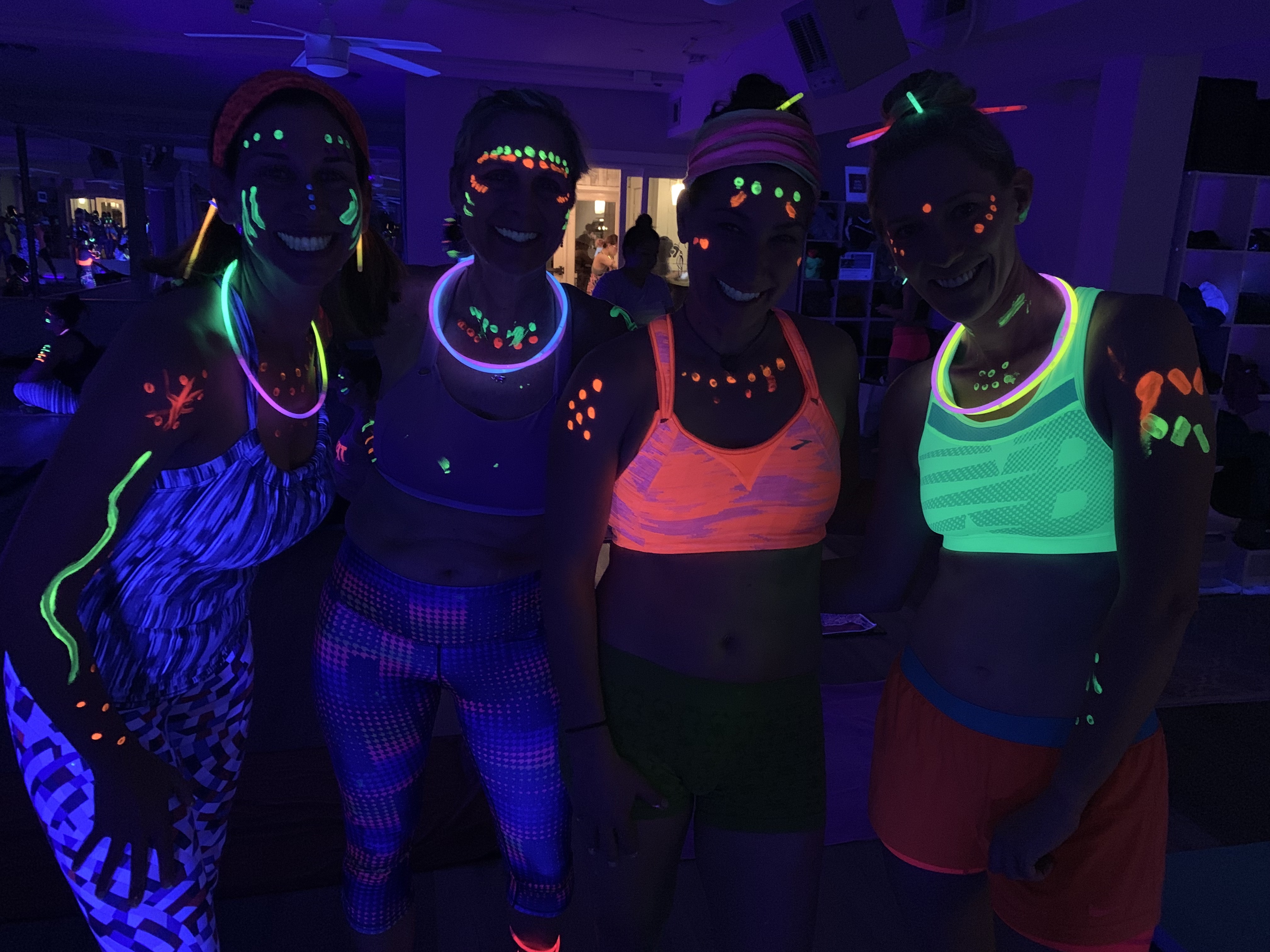
A few weeks ago, another soccer mom and I were talking and she told me about BUTI Glow yoga. As soon as I hear about it, I was in! And, of course, I talked a few other friends into joining me. BUTI yoga is a fusion of hot yoga, loud music, tribal dance, and plyometrics … and BUTI Glow yoga adds in the fun of a black light and glow-in-the-dark paint.
Marna, me, Nina, and Sarah (l to r), at our BUTI Glow class
It was challenging, sweaty, and fun. I didn’t realize slamming my hands down on my yoga mat to the beat of music while glow-in-the-dark sweat droplets fell from my face would be so … well, satisfying!
And now I have a membership for a couple of months, and I’ve been back for 90-minute sessions of hot yoga. I tried hot yoga a few years ago, and I remember walking into the studio and thinking “Oh my gawd it’s hot!” However, after a couple of months of sauna training this fall as I prepared for Javelina, the hot yoga studio doesn’t really feel that hot anymore. But it does feel awfully nice when it’s cold and raining outside, and I’m finding a new focus as I practice the structured form of hatha yoga.
Old Places, New Trails
I’ve also been trying to hit new trails at old places. Last weekend my friend Christy needed a 20-mile run, so Sarah and I joined her to keep her company. She mapped out a route that included a new trail on one of our old standard routes, and all of a sudden that old standard felt brand new. And then it started snowing big, fat flakes. And then it felt like a grand adventure!
Take time to look at the little things.Laugh when the snowflakes literally stick to your nose and eyelashes.Look to see if there’s enough snow to make a snowball!
Another local runner recently ran in the same area, and he posted some pictures of an old mine that’s in the same area. I had no idea it was there, and for my next run in that area I’m planning to go exploring and check it out. I’ll have no time goals, no distance goals … just the goal of exploring.
Hiking … in New Ways
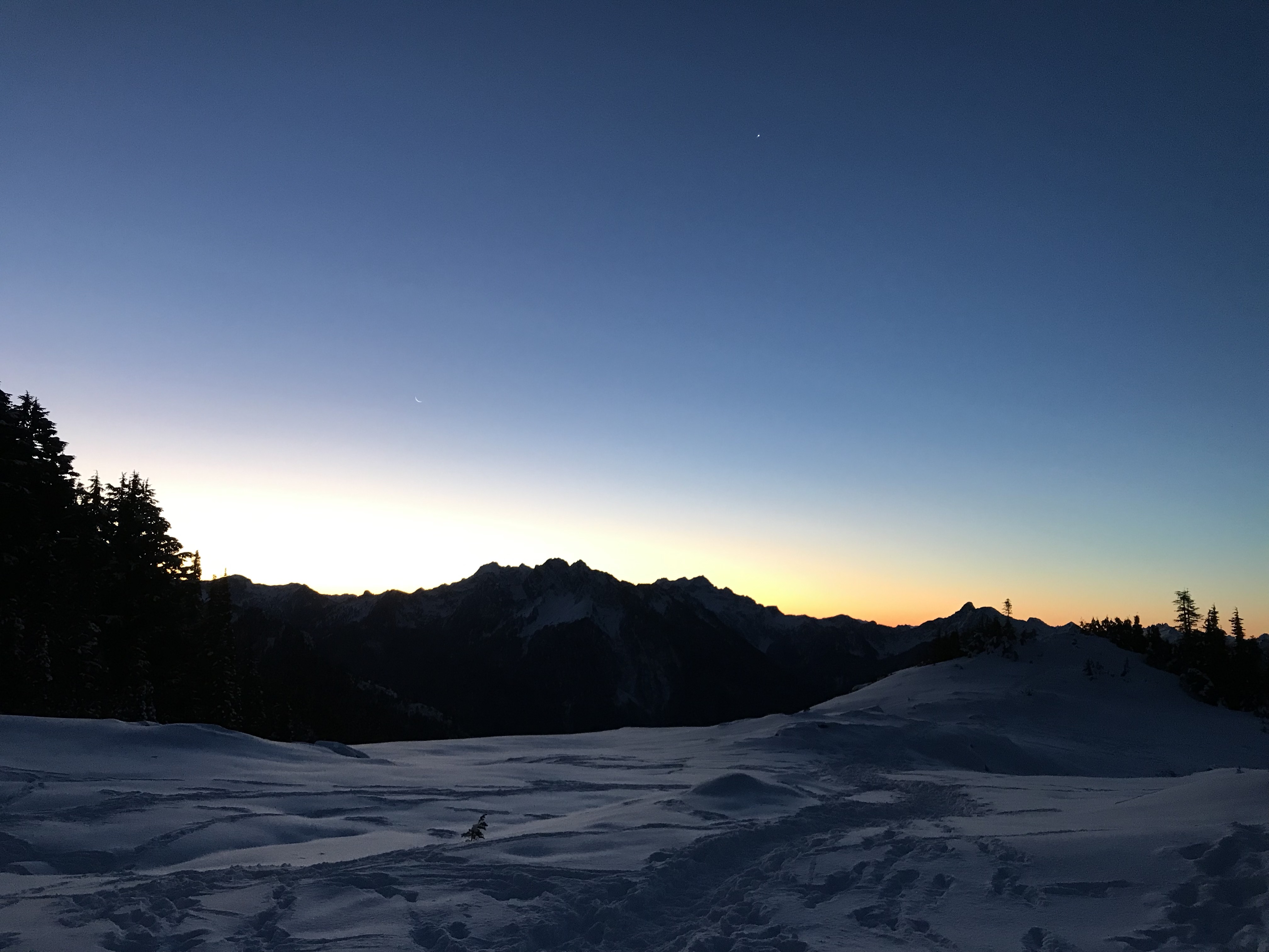
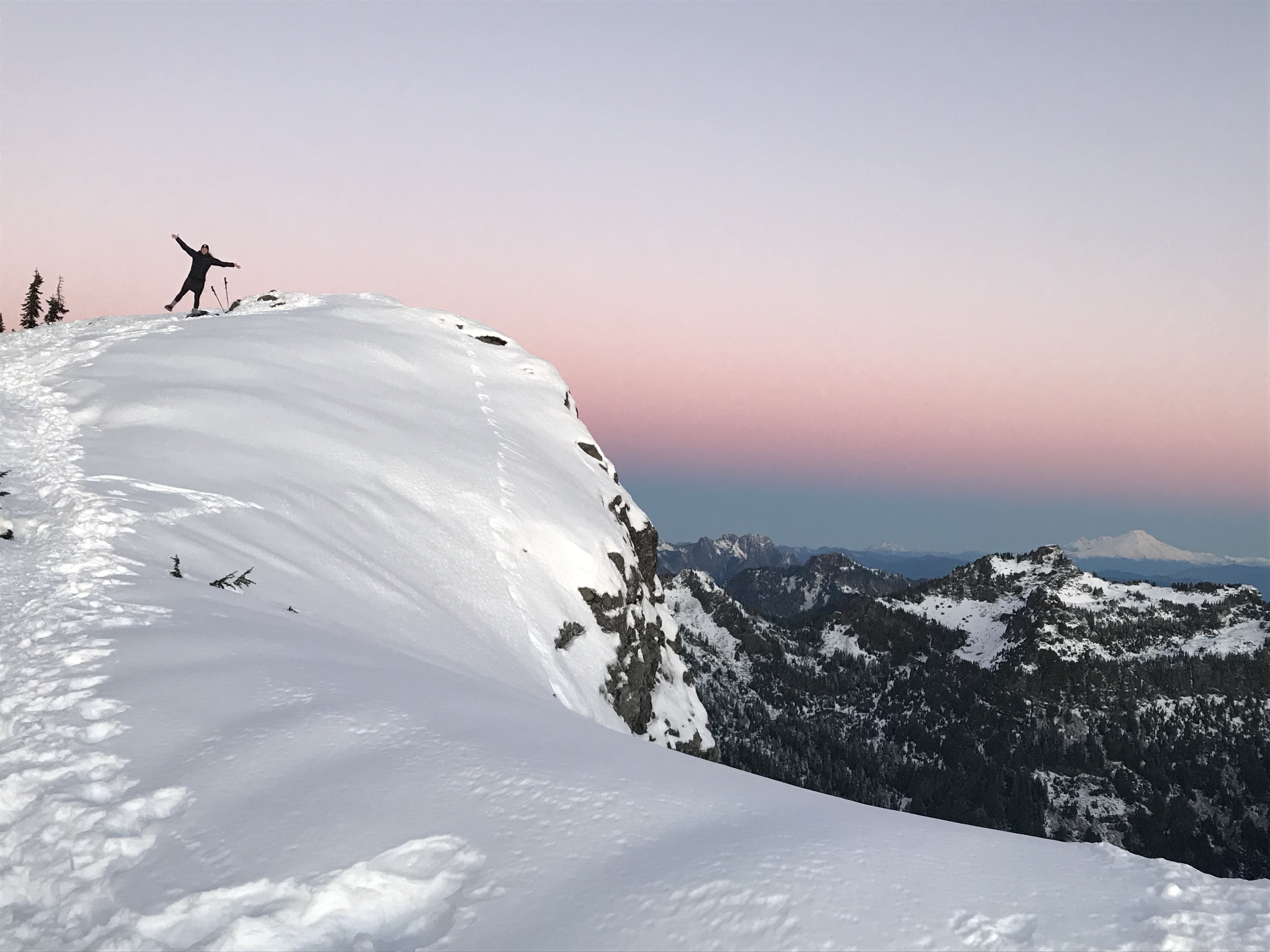
This week has been very cold but clear and sunny. On Monday Sarah and I went to yoga (see, it’s a thing all of a sudden). Afterward, as we headed to our cars, she asked me if I’d be up for a sunrise hike at Mt. Dickerman off the Mountain Loop Highway. I hiked there more than a decade ago, and I remembered that it was beautiful … but it was summertime, and I started in the daylight.
This time we hit the trail at 5 a.m. and we witnessed the forest at night, with snow and ice crystals looking like glitter in the light of our headlamps. We saw the thinnest of a sliver of the moon partnering with Venus over the dark silhouettes of the mountains.
And then the world turned salmon, and orange, and pink; the snow around us adopted the same hues as we sipped on hot chocolate and jumped up and down trying to stay warm. And we counted to thirty as the sun finally worked its way over the adjacent ridge line.
Sarah with Mt. Baker photobombing her on the distant skyline.Mt. Rainier awash in color and peeking out from behind a neighboring ridge.No filter … this was dawn’s early light.So much beauty everywhere we turned!
So What’s Next?
I don’t know! But I have a feeling that yes-itis will guide my season … I’m open to new places, or new trails in old places, and to new experiences that may or may not involve glow paint.
As a kid, both my brother and I were pretty fearless. We grew up in a part of Southern California that still had a lot of open space (we called it “the fields”) and we spent much of our childhoods running around, picking up tarantulas and lizards and snakes, building forts out of yucca stalks, stuff like that.
My big brother.
While the fields were fun, even more exciting was The Canyon. (We said it like that, with those initial caps, because in our kids’ minds it was a formal name for an awesome place.) The canyon, which is actually called La Barranca, is a couple of miles long. From our house, we’d hike down about 300 feet to a creek and then work our way upstream with a mix of trail and boulder hopping. At the far end of the canyon, there is a waterfall with a swimming hole below it, and if you continue beyond the waterfall you ended up at the far end of our neighborhood with a couple miles’ walk on streets to get back home.
As teenagers, we’d go down there and jump off the cliffs into the swimming hole. But as a younger child, it was just an adventure to hike it.
One time, about two-thirds of the way to the falls, there were three owls sitting high up in trees. We watched their heads pivot as they followed our progress on the canyon floor.
Another time, I hiked up to the falls with my friend, Rachel, and her two yellow labs, Kimmy and Max. They were great water dogs, but by the end of the hike their claws were worn down and bleeding. That was pretty traumatic, but they made it (as did we).
But this story is about the first time I went down there.
I was six years old, and I went with my big brother, who was ten, and our dog, Bootsy. It was a grand adventure, and boulder hopping across the stream was a big deal for me. There were a couple of times I was scared and hesitated, but I really wanted to see the waterfalls my brother had told me about so I sucked it up and made my way upstream.
When we got to the waterfalls, I was pretty stoked. But when it was time to start heading home, we had a dilemma. I really didn’t want to go back downstream and deal with the boulder hopping because it was kind of scary. My brother said he thought there might be a trail that’d take us past the falls and up to the streets, and I was in favor of that.
So we made our way up a slight trail to the cliff band above the waterfall and swimming hole. As we inched along the cliff, there was a place where the rock wall jutted out slightly, making the trail quite narrow. My brother and I were able to get past it, but Bootsy couldn’t do it.
This is where my version of the story and my brother’s version diverge.
Here’s what I remember: Somehow I ended up back down on the canyon floor with the dog. I thought my brother was going to proceed upstream and see if the trail went through, and then he’d come back for me. At one point, he did come back and stopped at that point where the rock pushed out into the trail along the cliff and hollered down to me. But with the sound of the falls, I couldn’t really understand what he said.
After waiting a while, I went looking for him. I scrambled back up to the cliffside trail and went back and forth several times looking for him and yelling his name. Each time I couldn’t see or hear him, and I returned to our dog.
I finally pushed my luck and went past that place where the rock jutted out once too many. I lost my balance and fell.
Here’s what I remember: I remember thinking “oh no, I’m falling!” I remember sitting cross-legged in the air and starting to tilt to one side, and I thought, “I don’t want to fall on my head,” so I tilted myself back upright. And then I remember finding myself sitting on the canyon floor on a little beach at the base of the cliff. The “beach” was at a bend in the river and was covered with small rocks and pebbles, maybe the size of ping pong balls. Next to me was a small “boulder” that was about waist height on me when I was sitting there; my left arm had landed on that boulder and was just resting on it like it was an arm rest on a chair. I remember it kind of buzzed, but it didn’t hurt.
I think I only sat there for a minute or two, and then like any smart six-year-old, I started yelling for help. I could hear some voices downstream, but apparently they couldn’t hear me. Bootsy quickly found me, though, but she hated swimming and stayed on the opposite side of the creek. I realized nobody was coming and that I needed to find help on my own, so I waded through waist- and chest-deep water until I had made my way to the dog. I again hollered for help, but again nobody responded, so I started working my way back downstream toward the voices I could hear.
Once I rounded a bend, I found a mom with two kids. I think they were fishing, but I’m not sure. I told the woman that I had fallen off the cliff and she looked at me like I was crazy. In retrospect I’m not surprised, as in subsequent years when I returned I realized I had fallen approximately 25 or 30 feet. Really!
The woman’s children were older than my brother and me, and she told them to stay put and she guided me up this totally crazy trail that scrambled up the side of the canyon. I remember telling her I thought I had broken my left arm because whenever I went to use it, it kept feeling “buzzy,” but she kept saying she didn’t think it was broken. Ultimately, and I have no idea how, we made it out of the canyon and to what is now the North American Science Center.
(At the time, the Science Center was owned by one of the aerospace companies—Northrup? Lockheed? I don’t remember. If you check out this photo, you’ll see a white rectangle about halfway vertically and more to the left; that’s the Science Center. La Barranca is visible running more or less vertically just to the left of it. Our home was a the end of the developed area curving up and to the left of the Science Center.)
The woman brought me to the front desk and told them my story. Everyone looked very doubtful, but I do remember that they asked if I knew my phone number (I did!), and they called my mom. In the meantime, they had an onsite medical clinic and they took me there; the nurse may have checked me over, but mostly she just kept me company until my mom arrived.
What I later learned is that my brother arrived home alone, and my mom freaked out. When she asked him where I was, he said, “Isn’t she here? I told her to go back along the river the way we came.” My mom ran down the trail to the bottom of the canyon, yelling my name, and then ran all the way back up. She was preparing to call the police when our phone rang with the call from the staff at the Science Center.
It ended up that I did break my arm, and I was in a cast for six weeks. It was one of those horrible ones, where you can’t bend your elbow, and made of white plaster. Of course it didn’t really slow me down, and we had to return to the orthopedist twice to get it patched.
Me and my cast. I can see my mom’s and my dad’s signatures on it in the photo, but not my brother’s!
To the day, my brother insists we had a miscommunication. He also has confessed that he was scared to go past the spot where the rock jutted out into the trail (smart boy). I, however, didn’t let him sign my cast for a week because I was mad at him!
I guess I was lucky. Today the best part is having a story to give my brother a hard time. I really have forgiven him and don’t blame him.
The thing I think about the most is how lucky we were to grow up where we did and how we did. Sure, there was the time I ran into a jumping cholla and had needles all over my knee. Or the time I split my lip open while my brother and I were playing in the pool with PVC pipe. (I have no idea why we were doing that!) Or the time my brother and I as teenagers got caught in a rip tide at Zuma Beach, and after swimming in, collapsed on our towels exhausted … until a half hour later, when we looked at each other and said, “That was fun!”
#optoutside is a popular hashtag today, and I love it! Outside, being active, exploring, learning about our world and all the beings that inhabit it, is the healthiest place for us and for our children to be. Experience the world around us, be fearless, charge forward, go for it, live your life … but be careful around older brothers! 😉
My friend (and one of my Javelina pacers), Nina, had a birthday yesterday. So, of course, that meant that it was time to celebrate! With my schedule having me in a recovery phase after a busy period of training and adventuring, an eight-mile hike to a lake—with promises of hot chocolate and birthday hats and good friends—sounded delightful!
Kari, Nina’s Women Who Run the World business partner and dear friend, suggested a few routes and Nina chose to go to Rachel Lake, which I hadn’t been to before. It’s about a 90-minute drive from my home near Seattle, which went by quickly as I passed through patches of fog and clouds and sun, with the snow-capped mountains of the Cascades peaking through.
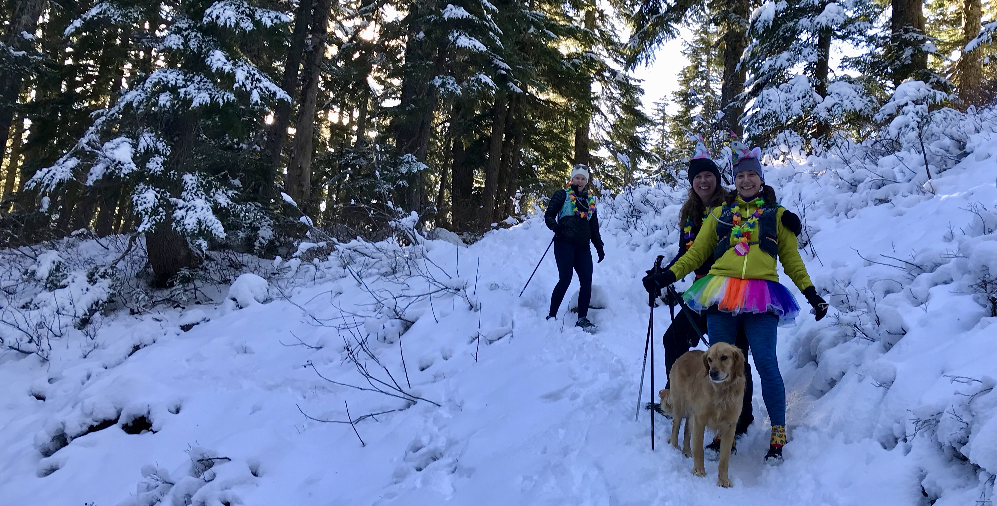
Six of us—Nina, Kari, Carol, Melissa, Melissa’s dog Maddie, and I—all met up at the trailhead, where it was just below freezing. It took a few minutes to land on exactly which layers to wear and which to bring, and then we headed out through the woods. The trail starts with a short climb, and then over the next couple of miles meanders through the woods while gently gaining elevation.
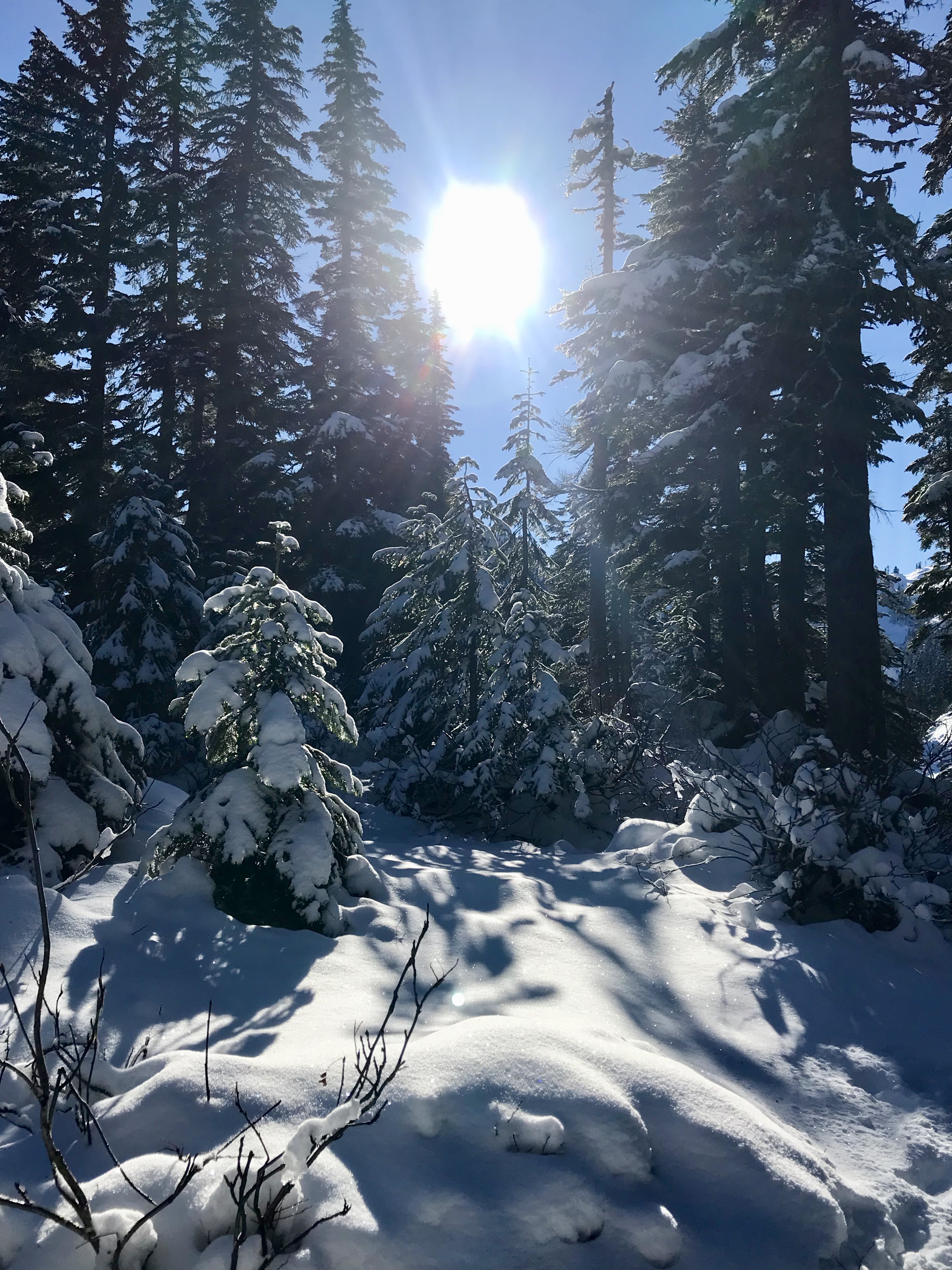
A pretty creek, green trees, and—best of all—sunshine and blue skies!
With recent rains and snowfall, there was more water on the trail than we’ve seen in a while and some somewhat sketchy creek crossings where we played “guess whether the rock is icy and slippery” as we made our ways across. We all made it through with pretty much dry toes, so we felt like life was good.
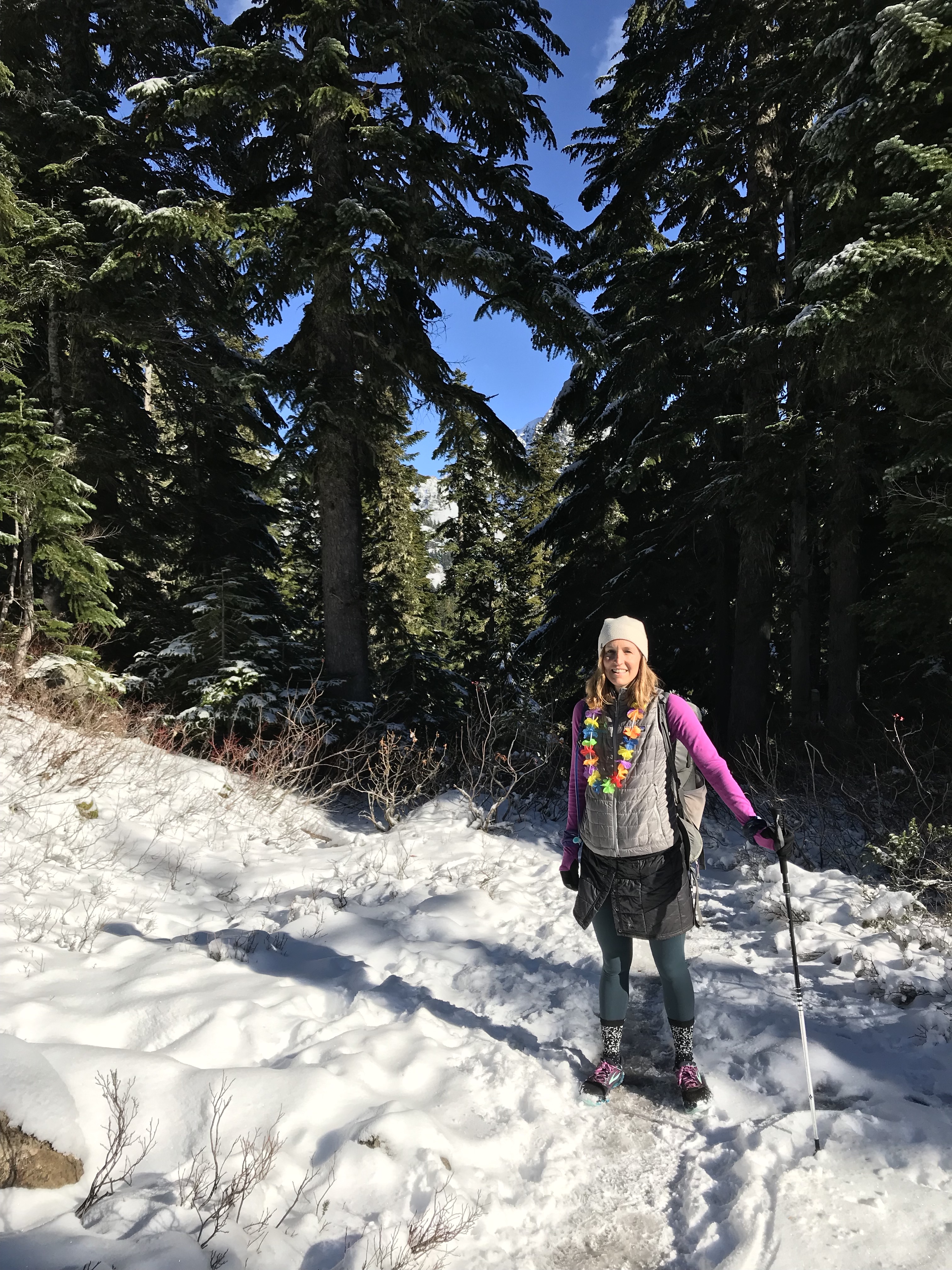
We decked the birthday girl out with a tutu, unicorn headband, and an “it’s my birthday” pin, and we all wore leis. Lots of hikers told us we were “colorful.” Here’s Nina (center front) with Maddie and Melissa just behind.
After those first two miles, the trail starts climbing, gently at first and then with great enthusiasm. In some areas, the trail is essentially a creek bed, and in others it involves some easy, short sections of pseudo-scrambling before switchbacking back to forest trail. As we gained elevation, the snow was more prevalent, and in some places there was ice under the snow that had hikers heading the opposite way slipping and sliding down the trail toward us.
Caution: May be slippery on steeper slopes.
As we gained elevation, we gained views too. Here’s Hibox Peak showing off on a neighboring ridge line.
It seemed like we climbed for quite a while—but I suspect for me it was my still-recovering-from-Javelina body saying “hey, the tank’s still not quite full!”—but soon enough we popped out at Rachel Lake.
Pretty awesome place to hang out.
We laid out coats (note: bring a small sit pad next time!), donned unicorn party hats, broke out the feast—waffles, hot chocolate, creme de menthe, salami—and sang happy birthday to Nina on kazoos.
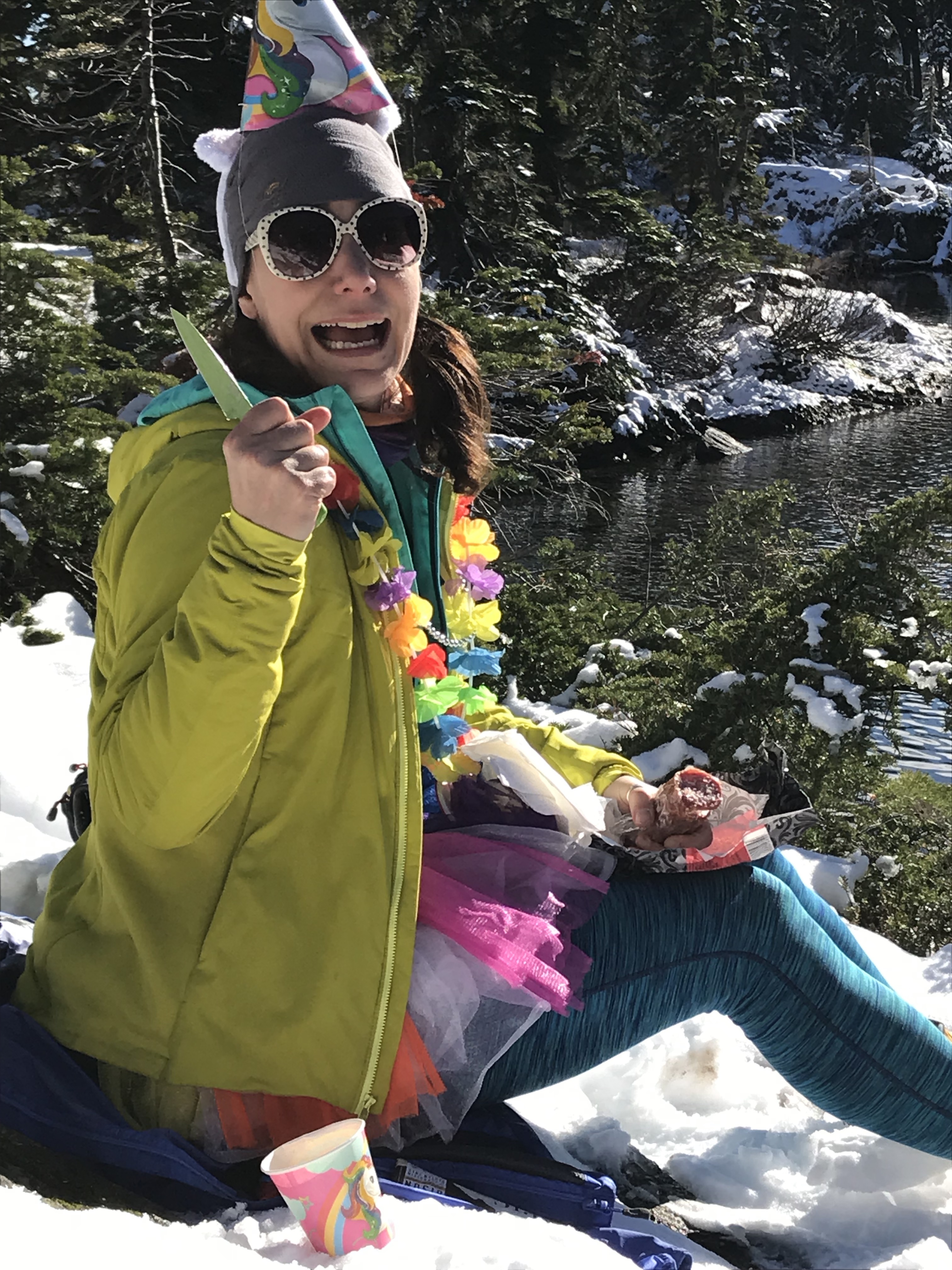
The birthday girl (and a knife?).
It was a delightful 30 minutes spent chatting and soaking up the warm sun. Then a light breeze picked up and suddenly it wasn’t so warm, so we packed back up, slipped on our micro spikes (which made for a much easier journey downhill than some of the hikers we saw earlier had had), and headed back the way we had come.
Kari in her element.
It’s not quite winter but it’s starting to look like it!
Carol, Melissa, Nina, and Maddie out front as we head back to the cars.
We topped off the celebration later with dinner at Le Coin in Fremont, where we were lost Melissa but were joined by Kelly, Heidi, Ana, Wendy, and Marna. The party continued with drinks and dancing, but the tank was empty and I headed home after dinner and quickly fell asleep while counting my blessings: great friends, great adventures, and a recovery period that allows for a relaxing day in the outdoors with those friends.
Happy birthday, Nina!
As always, all words mine. This time, all photos are mine too.